Search
News
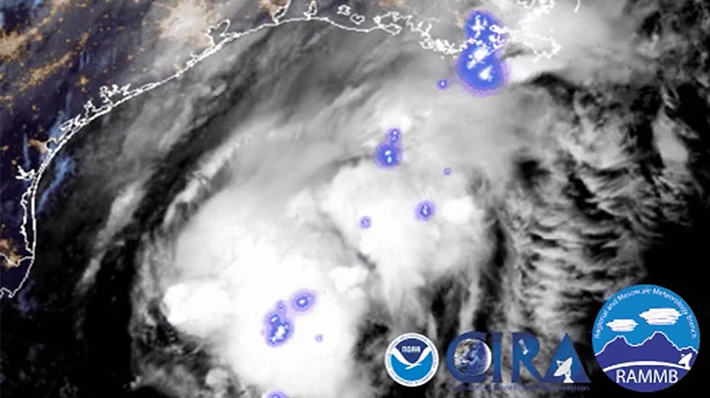
October 25, 2019, NOAA's GOES-East is keeping watch over Tropical Depression 17 in the Gulf of Mexico.
News

GOES satellites provide beautiful images of Earth. But what you see are digital representations of the data they capture.…
Page
The National Oceanic and Atmospheric Administration (NOAA) is committed to supporting emergency management in order to…
News
Earth Day celebrates its golden anniversary in 2020, NOAA too is celebrating 50 years of monitoring the Earth’s weather,…
News

Your cell phone isn't the only device that relies on the radio frequency (RF) spectrum. Buoys, satellites, weather…
News

Greenhouse gases and global sea levels both reached record highs in 2020—as the planet sweltered in a near-record warm year.
News
Did you know satellites can measure Earth’s oceans from space? The Jason-3 satellite, set to launch in January 2016, will…
News

NOAA’s Satellite and Information Service is looking back at 50 years of images from space. The 50 images we are highlighting…
News

Do you have questions about the launch of the Jason-3 satellite? Today is your chance to ask actual NOAA and NASA scientists…
News
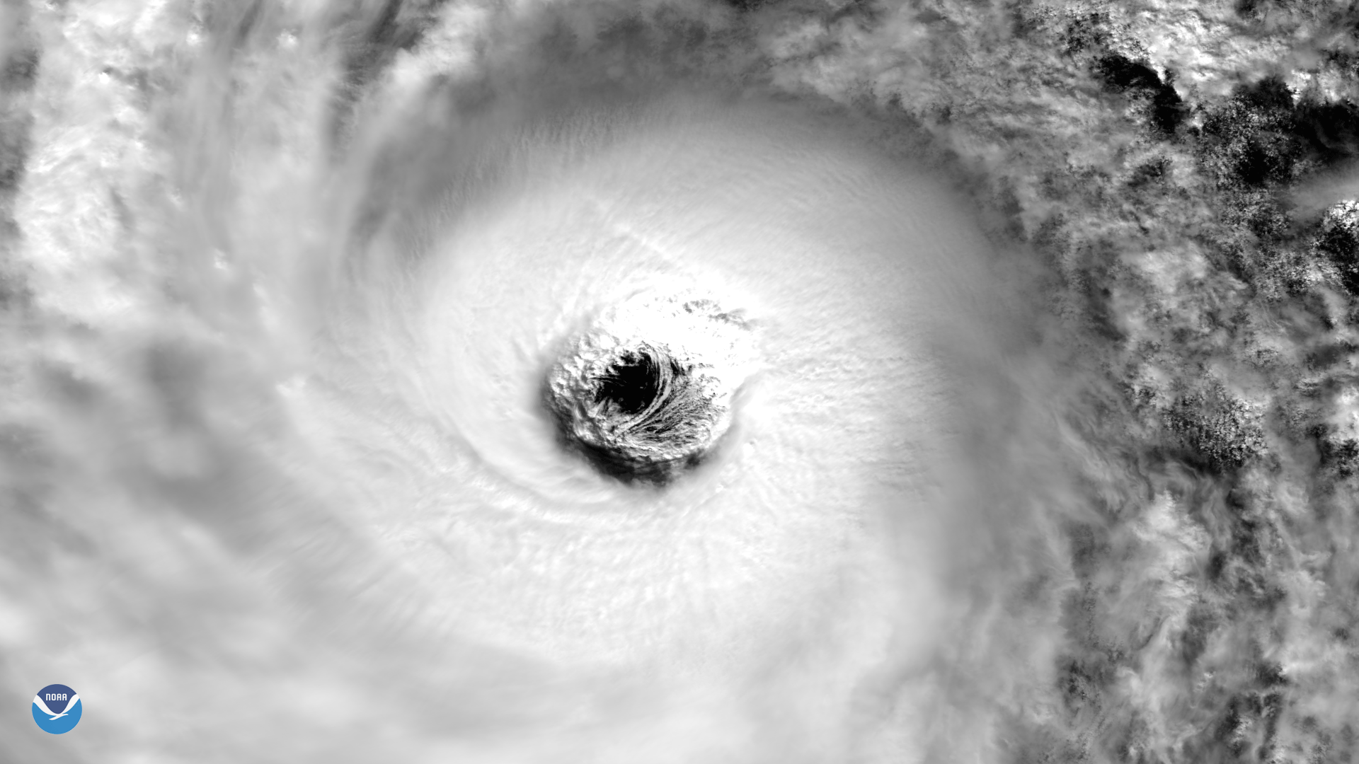
VIIRS instrument aboard NOAA/NASA Suomi NPP Satellite captured this image of Super Typhoon Lan.
News

NOAA's satellites have detected a plume of dust moving off the coast of Africa. Though quite common, this particular…
News
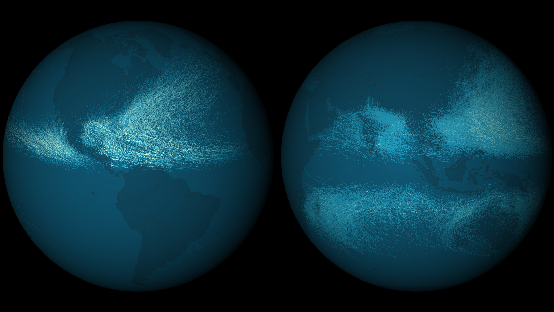
Tropical cyclones have a wide range of wind speeds that are used to classify their intensities. NOAA’s National Climatic…
News
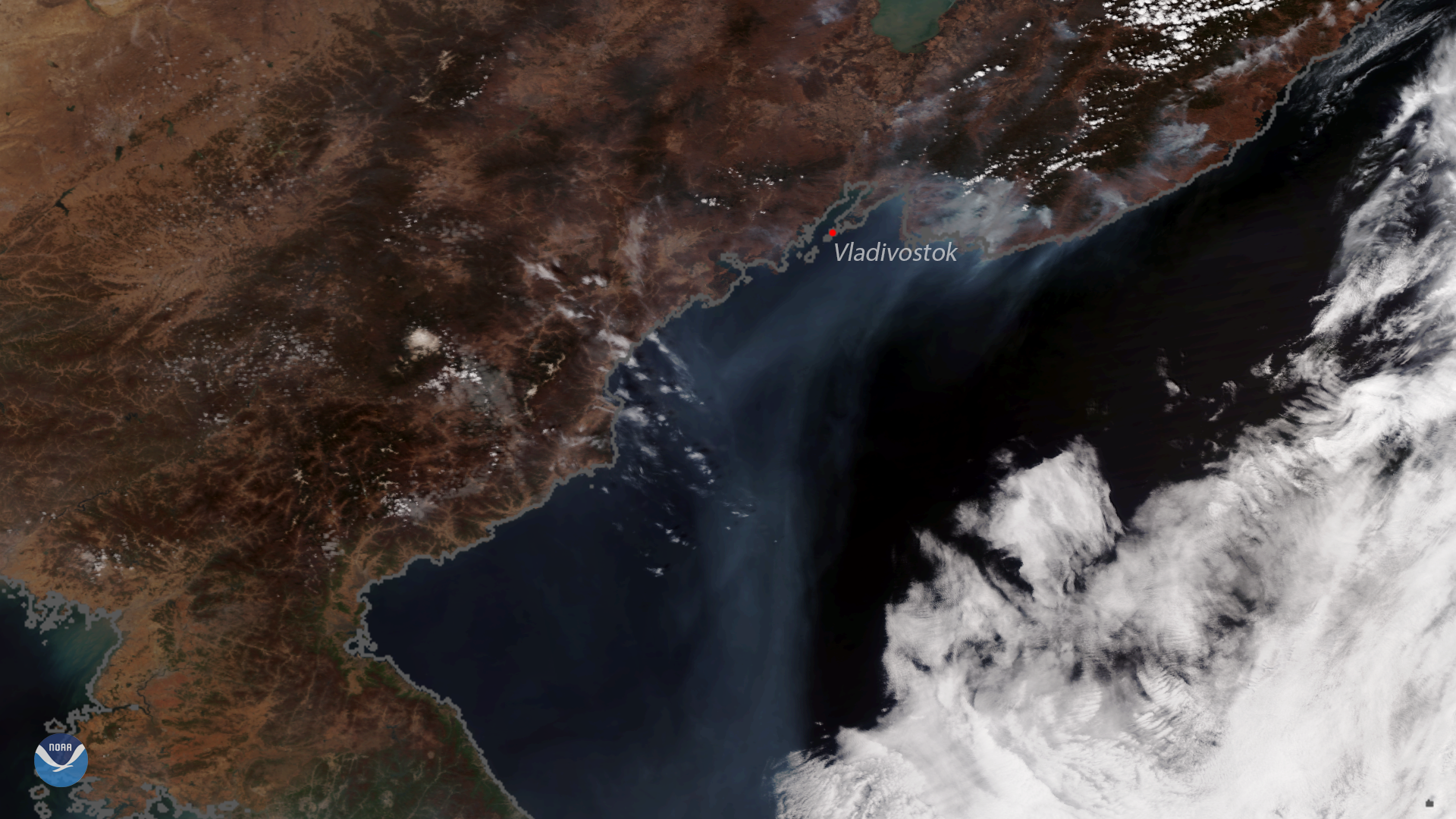
his image, captured by the NOAA-20 polar-orbiting satellite, shows several active fires burning along the coast of eastern…
Bio

Deputy Director
Systems Architecture and Engineering
Dan St. Jean brings more than 28 years of NOAA experience to our team.
News

As the Earth completes its 2017 journey around the Sun, NOAA's fleet of satellites had an amazing view along the way.…