
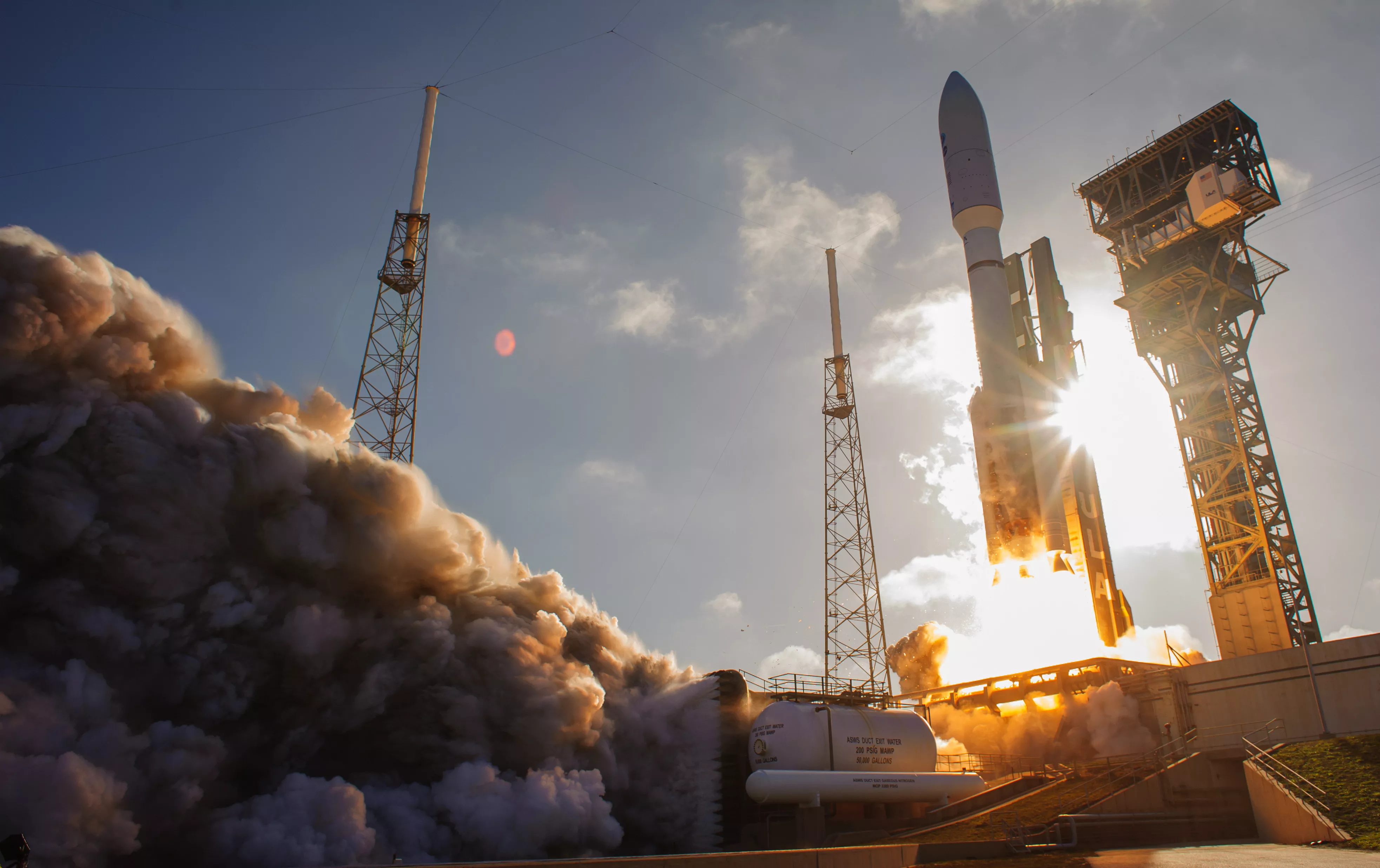
NOAA’s GOES-U is the fourth and final satellite in the Geostationary Operational Environmental Satellites (GOES) – R Series,
the Western Hemisphere’s most sophisticated weather-observing and environmental-monitoring system. The GOES-R Series provides advanced imagery and atmospheric measurements, real-time mapping of lightning activity, and monitoring of space weather.
GOES-U will be renamed GOES-19 after it reaches geostationary orbit. Following a successful on-orbit checkout of its instruments and systems, NOAA plans to put GOES-19 into operational service, replacing GOES-16 as GOES East. GOES-19 will work in tandem with GOES-18, NOAA’s GOES West satellite. Together, GOES East and GOES West watch over more than half the globe – from the west coast of Africa to New Zealand.
Monitoring Weather and Environmental Phenomena on Earth
The Advanced Baseline Imager (ABI) is the primary instrument on the GOES-R Series satellites for imaging Earth’s weather, ocean and environment. Forecasters use ABI data for a wide range of applications related to severe weather, hurricanes, aviation, natural hazards, the atmosphere, ocean and cryosphere.
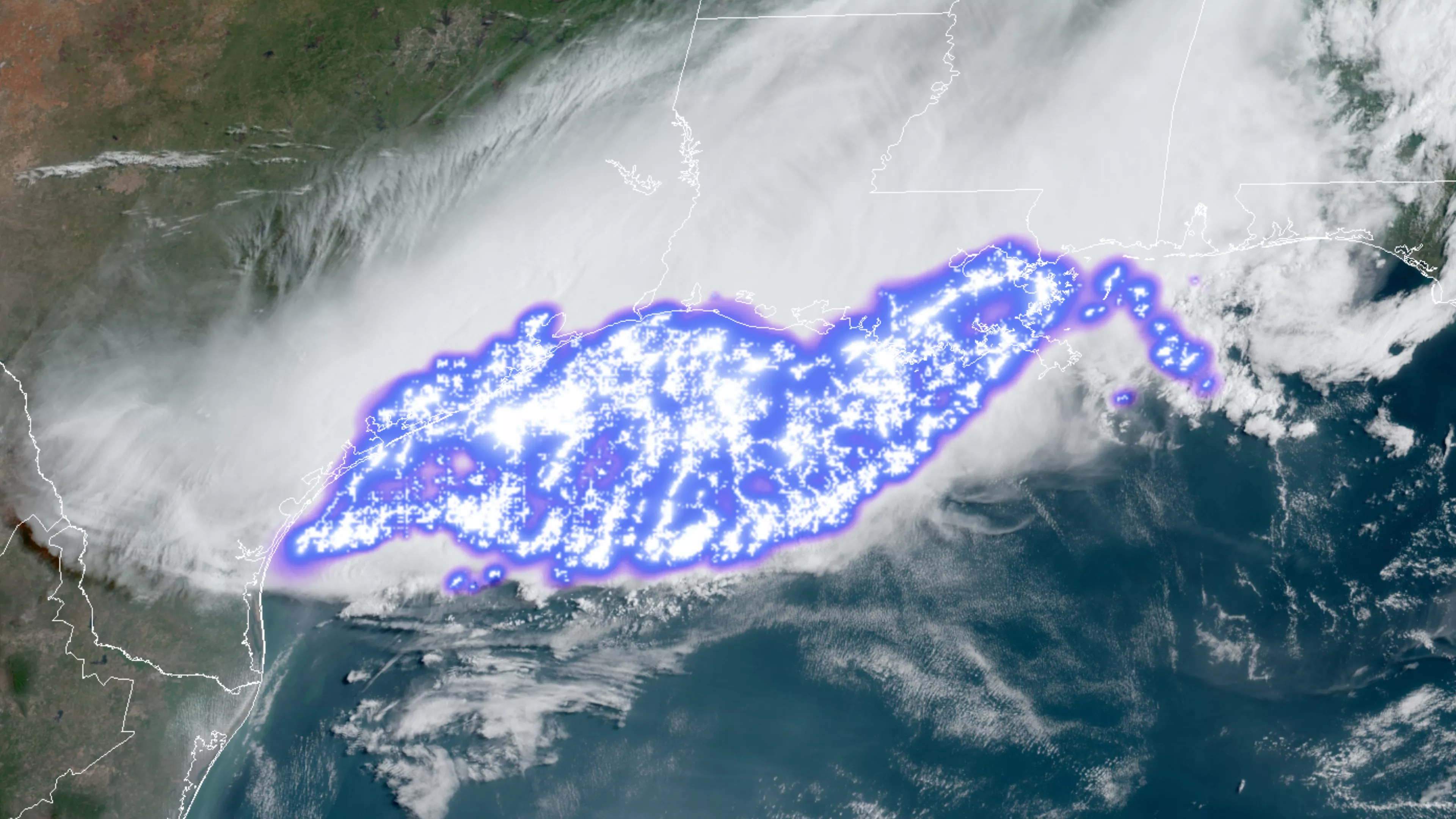
The Geostationary Lightning Mapper (GLM) is the first operational lightning mapper flown in geostationary orbit. Developing severe storms often exhibit a significant increase in lightning activity and GLM data can help forecasters focus on initial thunderstorm development and intensifying severe storms before they produce damaging winds, hail or even tornadoes.
Monitoring the Sun and Space Weather
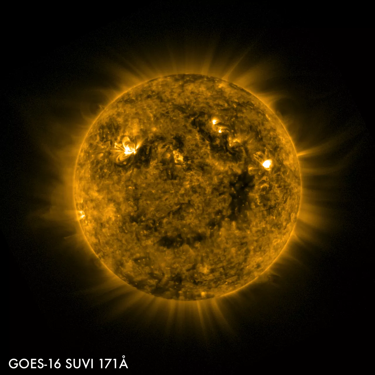
GOES-U hosts a suite of instruments that improve the detection of approaching space weather hazards. The Solar Ultraviolet Imager (SUVI) and Extreme Ultraviolet and X-ray Irradiance Sensors (EXIS) provide imaging of the sun and detection of solar flares. The Compact Coronagraph-1 (CCOR-1) images the solar corona (outer layer of the sun’s atmosphere) to detect and characterize coronal mass ejections (CMEs). CCOR-1 is a new instrument for GOES-U and is part of NOAA’s Space Weather Follow On mission.
The Space Environment In-Situ Suite (SEISS) and Magnetometer monitor, respectively, energetic particles and the magnetic field variations that are associated with space weather. Together, observations from these instruments contribute to space weather forecasts and early warning of disruptions to power utilities and communication and navigation systems as well as radiation damage to orbiting satellites.
Benefits
GOES-U will provide critical atmospheric, hydrologic, oceanic, climatic, solar and space data for advanced detection and monitoring of environmental phenomena that threaten the security and well-being of everyone in the Western Hemisphere.
- Hurricane track and intensity forecasts
- Early warning of severe storms and tornadoes
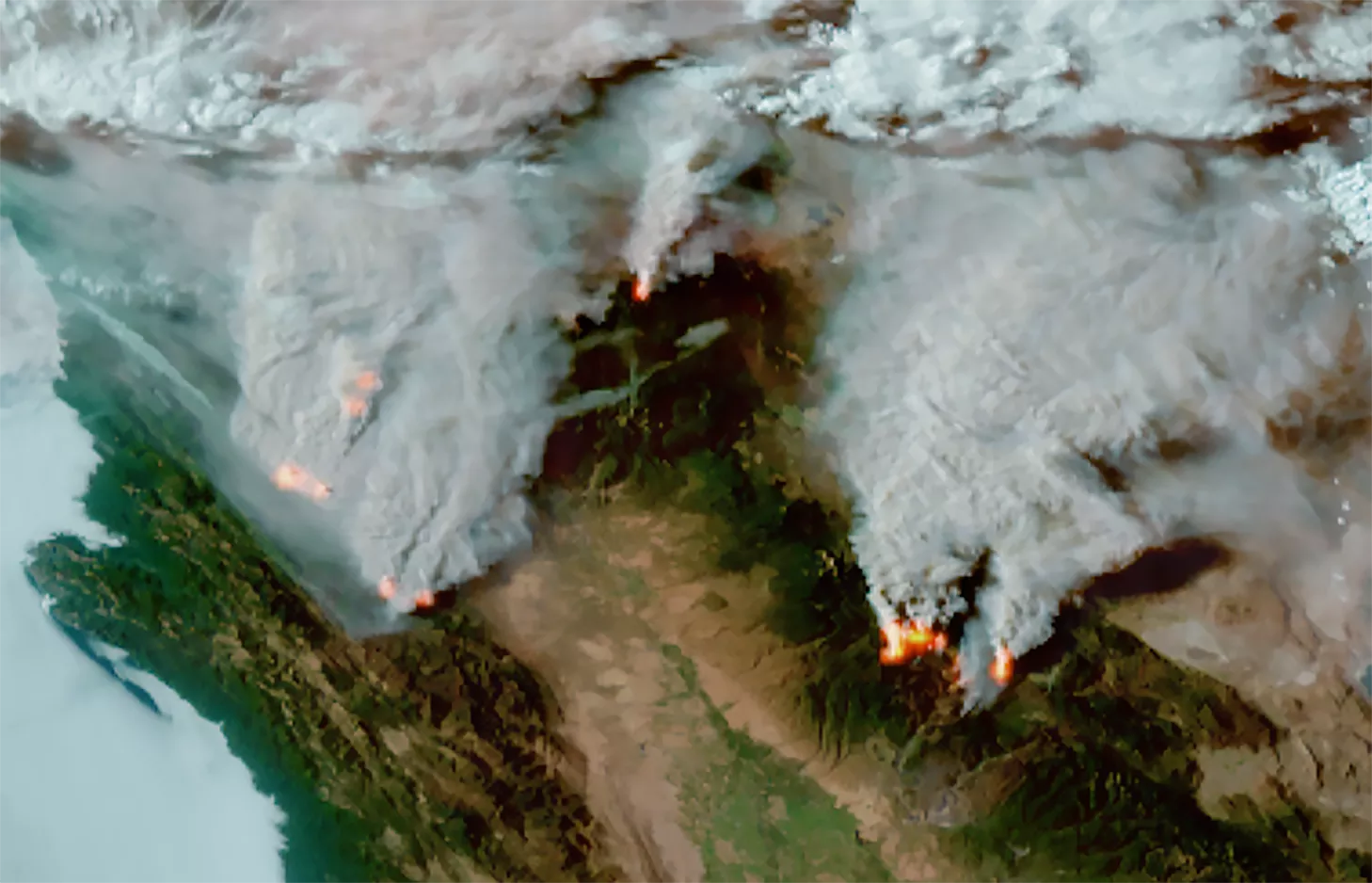
- Fire detection, monitoring, and intensity estimation
- Identification of lightning strikes most likely to ignite fires
- Detection of low clouds and fog
- Monitoring of atmospheric river events that can cause flooding and mudslides
- Monitoring of smoke, dust and aerosols
- Data for air quality warnings and alerts
- Data for aviation route planning and reducing weather-related flight delays
- Detection of volcanic eruptions and monitoring of ash and sulfur dioxide
- Detection of heavy rainfall and flash flood risks
- Sea surface temperature data for monitoring fisheries and marine life
- Monitoring of vegetative health
- Data for long-term climate variability studies
- Detection of meteors entering Earth’s atmosphere
- Detection of coronal holes, solar flares, and coronal mass ejection source regions
- Characterization of size, velocity, density and direction of coronal mass ejections
- Warning of space weather hazards responsible for communications and navigation disruptions and power blackouts
- Monitoring of energetic particles responsible for radiation hazards
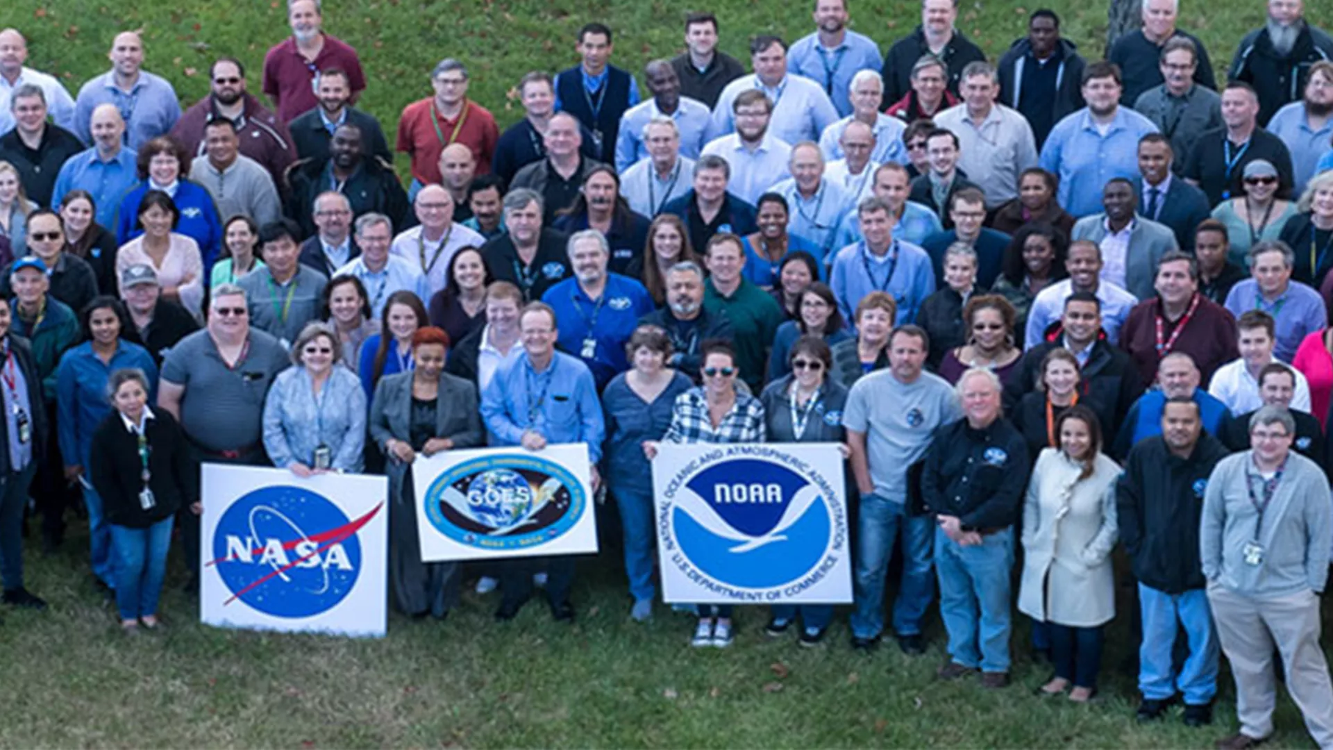
Meet the GOES Team
The GOES program team consists of top professionals in their respective fields. Discover more about the team.
Recent News
-
NOAA’s GOES-19 satellite has officially began operations as GOES East.
-
NOAA’s newest satellite, GOES-19, provided a beautiful view of Earth during the winter solstice.
-
NOAA satellites constantly monitor the ocean for tropical activity. As the 2024 Atlantic hurricane…
-
NOAA recently unveiled the first images from the Compact Coronagraph (CCOR-1) and the Solar…