
Atmospheric Weather
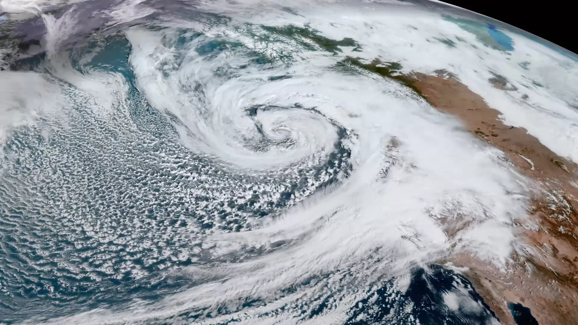
As GOES East, GOES-19 will be positioned to monitor weather systems affecting most of North America, including the continental United States and Mexico, as well as Central and South America, the Caribbean, and the Atlantic Ocean to the west coast of Africa.The satellite will alert forecasters to tropical storms forming in the Atlantic hurricane basin and track and monitor those storms in near real-time. The satellite will provide a detailed look at the storm properties of hurricanes, including cloud top cooling, convective structures, specific features of a hurricane’s eye, upper-level wind speeds, and lightning activity. This information is critical to estimating a storm’s intensity.
GOES-19 will provide early warning of severe weather. Developing severe storms often exhibit a significant increase in lightning activity and GOES-19 will help forecasters focus on initial thunderstorm development and intensifying severe storms before they produce damaging winds, hail or even tornadoes. The satellite will also detect heavy rainfall and warn of flash flood risks.
Environmental Hazard Monitoring

GOES-19 will provide critical data for identifying and tracking environmental hazards. GOES-19 will locate wildfire hot spots, detect changes in fire behavior, predict the motion of fires, estimate a fire’s intensity, and monitor smoke output and air quality effects from smoke. GOES-19 can identify the lightning strikes most likely to ignite fires and characterize pyrocumulonimbus clouds that threaten the safety of firefighters.
GOES-19 will provide high-resolution, real-time imagery of fog conditions and the satellite’s rapid scanning capabilities will also help forecasters predict when fog will clear. GOES-19 data will also be important for detecting volcanic eruptions and monitoring ash and sulfur dioxide.
Ocean Observations
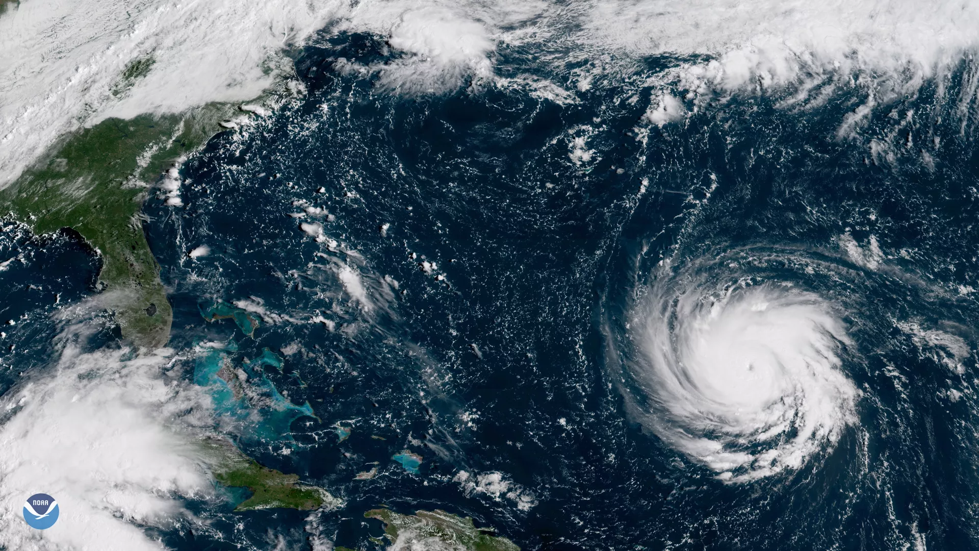
Warm sea surface temperatures are a contributing factor in the formation of tropical storms and hurricanes. Data from GOES-19 can help forecasters provide early warning that a hurricane is forming. Sea surface data from GOES-19 will also contribute to monitoring and tracking marine heatwaves, which are becoming an increasing influence on fisheries and marine life. Sea surface temperatures affect all parts of the marine food chain. Microscopic plants and animals (i.e., plankton and zooplankton) are affected, as are the fish that eat them and subsequently, the whales, birds, and other predators that eat the fish. Ocean temperatures not only influence when and where the fish go but also when and where fishermen must go to catch them.
As sea surface temperatures rise, mass coral bleaching events and coral reef infectious disease outbreaks are becoming more frequent. This alters ecosystem function, as well as the goods and services coral reef ecosystems provide to people around the globe. The loss of coral reefs also makes coastal communities more vulnerable to storm events.
Space Weather
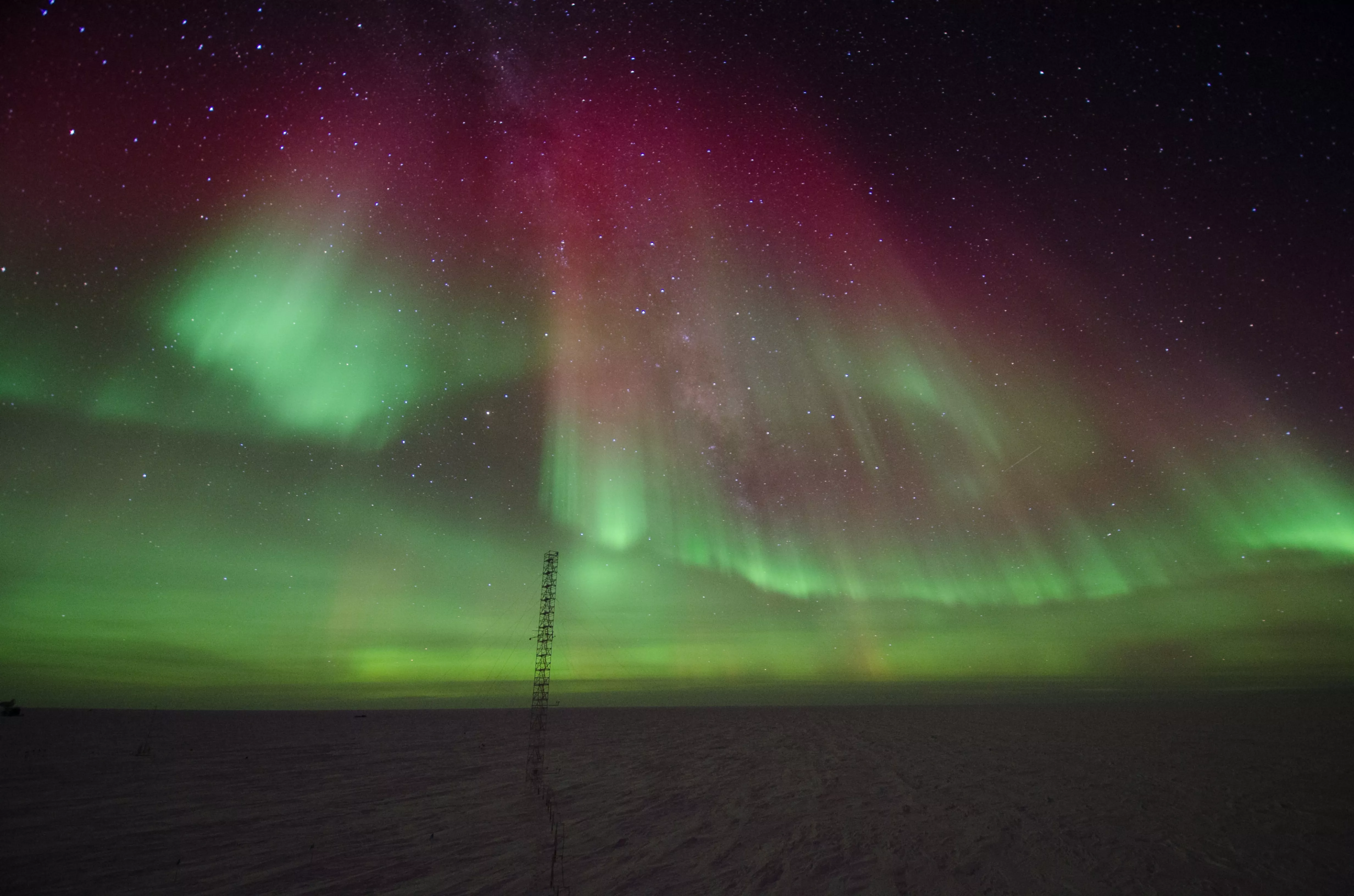
The changing environmental conditions from the sun’s atmosphere are known as space weather. Space weather is caused by electromagnetic radiation and charged particles that are released from solar storms. Changes in the magnetic field and a continuous flow of solar particles during a powerful storm headed to Earth can disrupt communications, navigation systems, and power grids as well as result in spacecraft damage and exposure to dangerous radiation. GOES-U hosts a suite of instruments that detect and monitor approaching space weather hazards.
GOES-U hosts a new instrument for NOAA’s Space Weather Follow On (SWFO) Program, the Compact Coronagraph-1, or CCOR-1. CCOR-1 will be the nation’s first operational coronagraph. CCOR-1 will observe the solar corona, or outermost layer of the sun’s atmosphere, to detect and characterize coronal mass ejections (CMEs) that can cause geomagnetic storms. Sequences of CME images help determine a storm’s size, velocity and density, serving as the primary source for information on impending geomagnetic storm conditions at least one day ahead of time.
Recent News
-
Lightning is a dangerous weather hazard that poses a significant threat to life and property. It…
-
LightningCast uses artificial intelligence (AI) to predict general locations where lightning is…
-
On June 25, 2024, GOES-U, the final satellite in NOAA’s GOES-R Series, launched from NASA’s Kennedy…
-
Since mid-May, NOAA satellites have been closely monitoring heat signatures and thick plumes of…