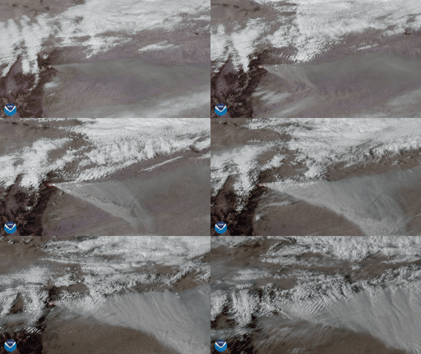
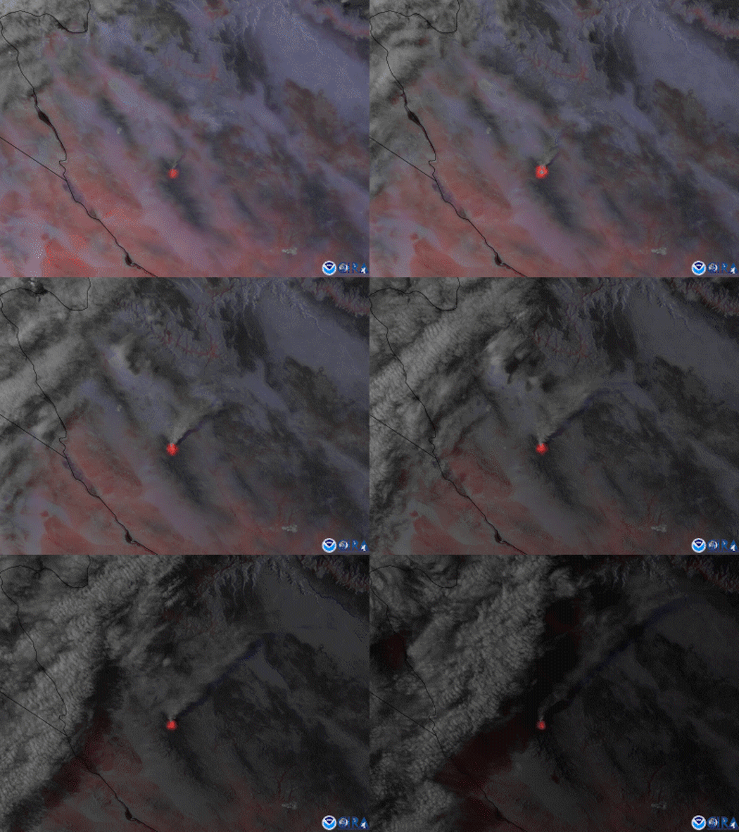
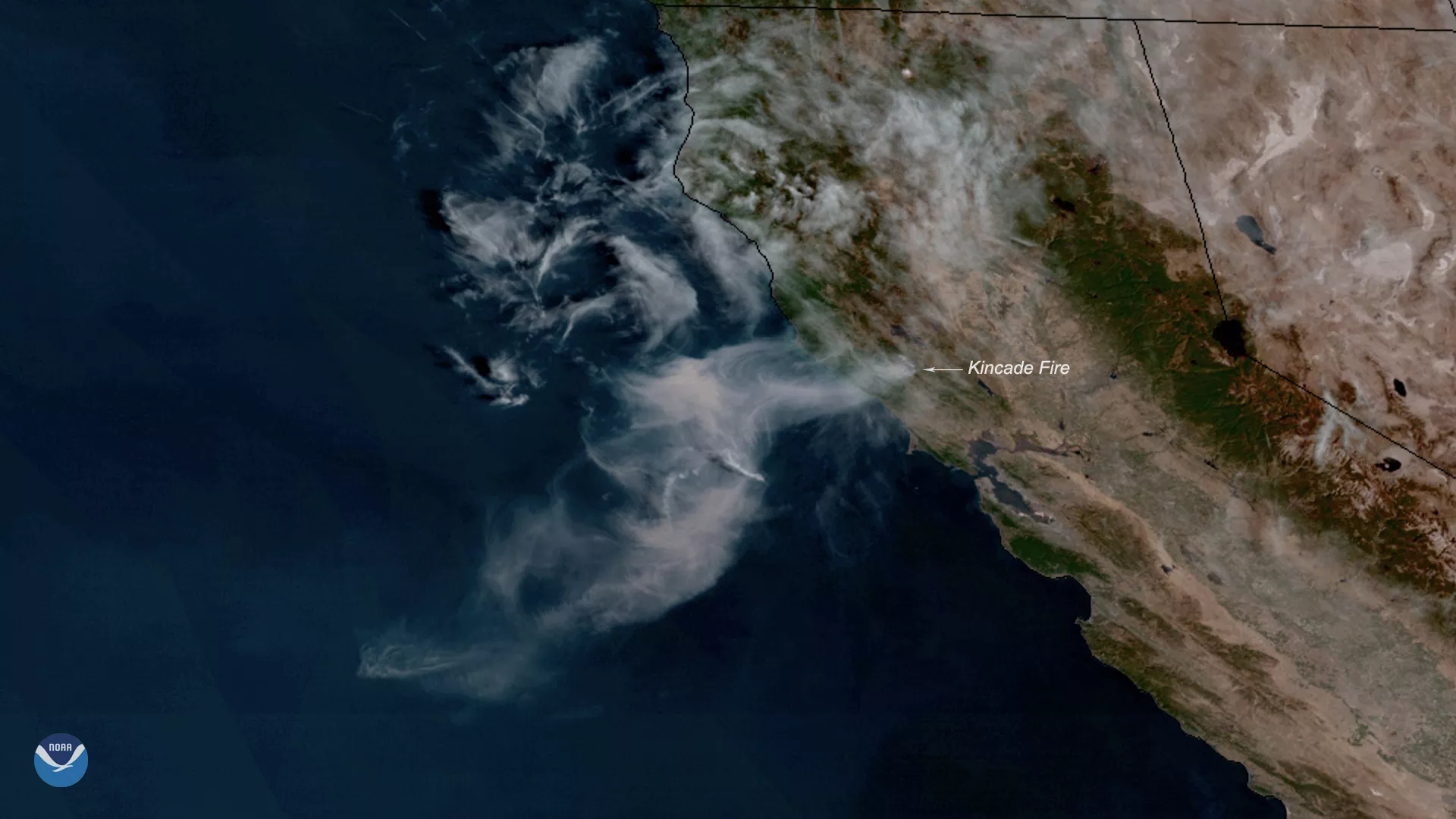
Fires, whether naturally occurring or manmade, can have far-reaching impacts on society. They can destroy homes, wildlife habitats, and valuable resources, while also consuming vast tracts of land and releasing large amounts of harmful pollutants into the atmosphere.
Monitoring wildfires from the ground is labor intensive, expensive, and limited in scope. Satellites, however, provide a broader and more efficient way to detect and track fires. They can collect valuable information about a fire’s location, size, temperature and intensity, which is difficult or impossible to gather solely from the ground.
How NOAA Satellites Monitor Fires
NOAA satellites are essential for wildfire monitoring and management, delivering critical information to support firefighting efforts and safeguard public safety. They detect heat signatures, map fire perimeters and burned areas, and track smoke and pollutants to assess air quality and health impacts. These advanced capabilities enable firefighting agencies to make informed decisions, allocate resources effectively, and predict fire behavior using enhanced prediction models.
NOAA operates two key satellite systems: geostationary and polar-orbiting.
The Geostationary Operational Environmental Satellites (GOES)–R Series, equipped with the Advanced Baseline Imager (ABI), delivers near real-time, high-resolution images that help forecasters detect and characterize fires. To do so, they can locate heat signatures, determine a fire’s size and temperature, detect changes in a fire’s behavior, and monitor smoke and air quality. The ability to monitor smoke plumes in near real-time is particularly useful for directing firefighting efforts.
NOAA is also using GOES satellite imagery in its new wildfire tool, the Next Generation Fire System (NGFS), which uses artificial intelligence to scan satellite imagery and quickly detect fires down to the neighborhood level. NGFS also tracks wildfire growth and monitors fire intensity in near real-time, helping first responders prioritize which fires need immediate attention and keep firefighters safe. The NGFS displays this information on a dashboard that provides access to satellite imagery and other critical information such as fire weather outlooks and red flag warnings, wildfire incident perimeters, governmental boundaries, agency jurisdictions, and fuels data, which are essential for decision-making during a fire.
Polar-orbiting satellites, such as those in the Joint Polar Satellite System (JPSS), feature the Visible Infrared Imaging Radiometer Suite (VIIRS), which offers detailed, continuous global fire monitoring. VIIRS excels in detecting smaller, lower-temperature fires with its 375-meter spatial resolution and Day-Night Band, which captures low-intensity visible light for enhanced nighttime fire detection.
These capabilities also make information from VIIRS especially valuable for models such as HRRR-Smoke, which forecasts wildfire smoke movement up to 24 hours in advance. The model relies on VIIRS hot spot detections for initialization while also incorporating data from GOES.
Additionally, the Hazard Mapping System (HMS) integrates satellite data into a publicly accessible platform that provides daily updates on fire locations and conditions. NOAA collaborates with partners like NASA and the U.S. Forest Service to enhance fire monitoring and share critical information.
Learn more about how NOAA supports wildfire science and response.
More Articles on Fire
-
Lightning is a dangerous weather hazard that poses a significant threat to life and property. It…
-
Since mid-May, NOAA satellites have been closely monitoring heat signatures and thick plumes of…
-
NOAA satellites have been monitoring several large wildfires in Minnesota.


