

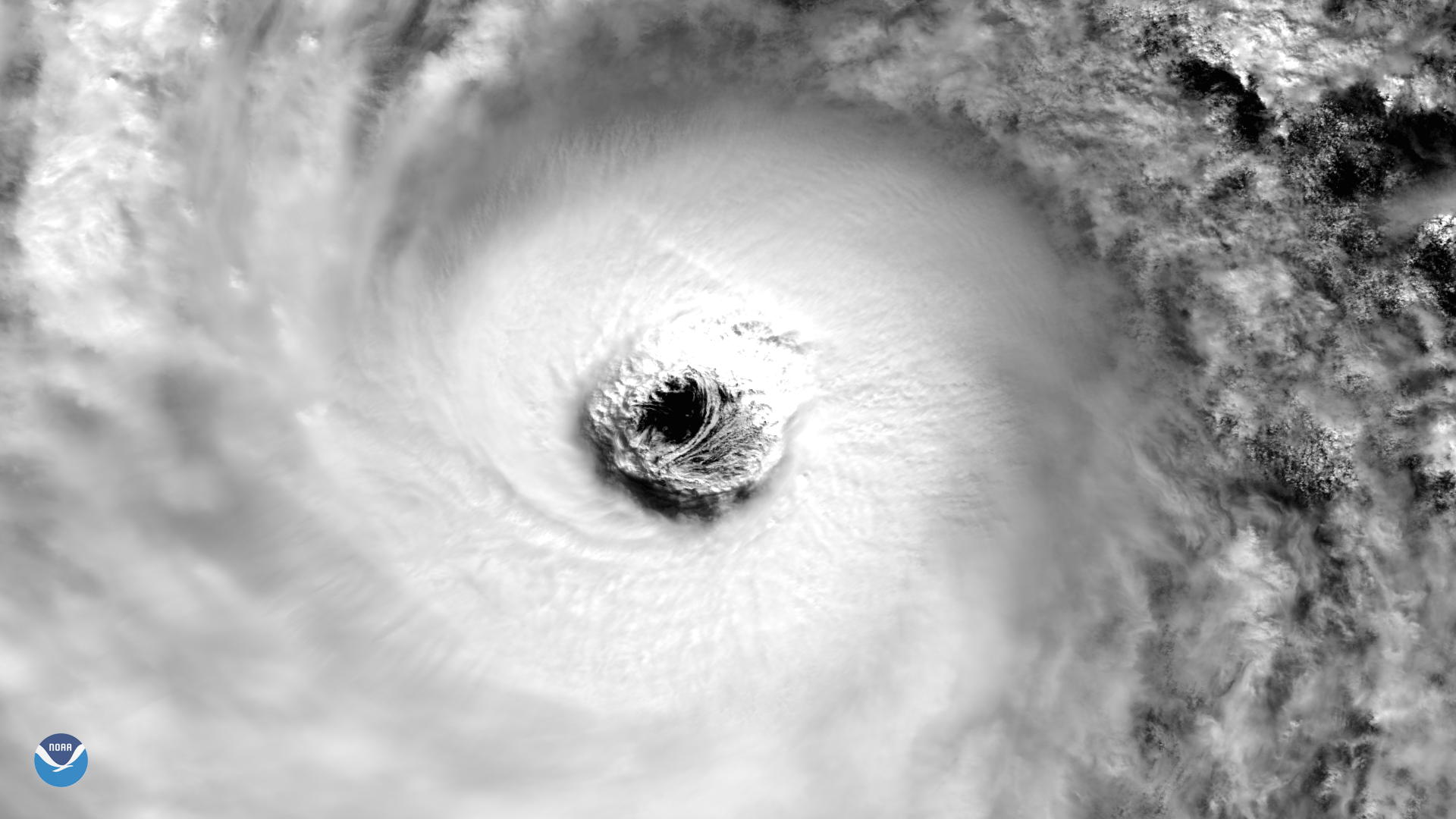
On October 21, 2017, the VIIRS instrument aboard NOAA/NASA Suomi NPP Satellite captured this image of Super Typhoon Lan's well-defined and large eye - over 100 km wide. The storm rapidly consolidated and intensified reaching peak intensity that day but had weakened to a Category 2 equivalent typhoon before making landfall on Shizuoka, Japan, 175km (110 miles) south-west of Tokyo, at about 03:00 local time on Monday (18:00 GMT Sunday) October 23rd. Gusts of up to 198km/h (123mph) hit the country, as reported by multiple news sources.