Search
News

Mid-June in Utah usually marks the tail end of the most fertile time of year for crops.
News
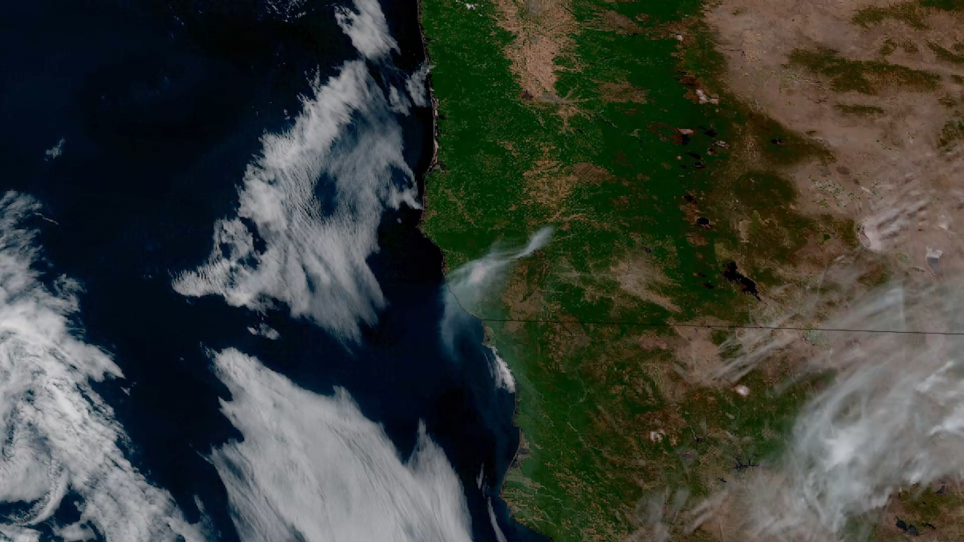
As record-breaking heat continues to scorch parts of the southwestern U.S. and Mexico, NOAA satellites are monitoring fires…
Page
Since its inception in November 2013, the River Ice and Flooding Initiative has grown, serving regions affected by ice jam…
News
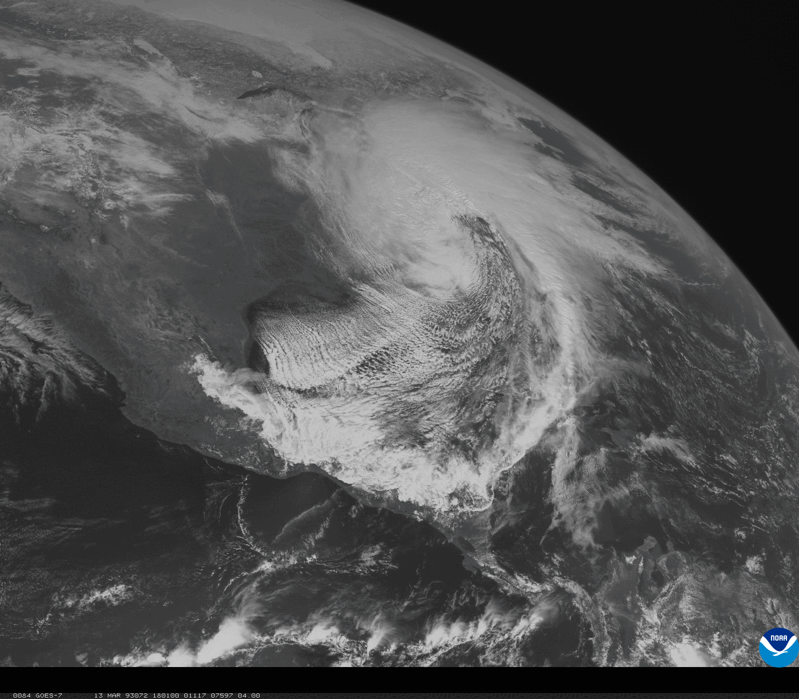
The Storm of the Century: A Look Back from NOAA Satellites
News

With their lofty view from space, NOAA satellites see the awe-inspiring beauty and the sobering destruction Mother Nature…