Search
News

Severe storms that began rolling through the southern U.S. on Friday, March 24, 2023 left a path of devastation from Texas…
News

With the change of seasons, there comes increased risk of severe weather.
News

Wildfires continue to rage in the western U.S. Some of the most intense fires have generated their own weather, with…
News

A sprawling storm system stretches from the Florida Panhandle into New England in this April 19, 2019, sunrise view from…
News

Severe storms and heavy rain continue to trigger flooding from Texas to Wisconsin. Flash flooding across Houston and parts…
News

The GOES East satellite watched a massive supercell push across south-central Texas. The storm produced damaging winds and…
News

On Thursday, Feb. 6, 2020, the GOES-East satellite is watching a large winter storm stretching roughly 2,000 miles across…
News

Every morning NOAA’s GOES-16 Satellite takes in an amazing view of Earth.
News
NOAA satellite experts and weather forecasters are working together at the Hazardous Weather Testbed (HWT) in Norman,…
News

GOES-13 has served in the GOES East position since April 2010. Ten years ago today, on May 24, 2006, GOES-13 was launched…
News

Ivan existed for 22.5 days and produced a track more than 5600 nautical miles long. This movie shows GOES East from…
News
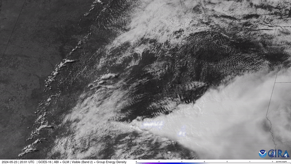
NOAA’s GOES East (GOES-16) satellite watched severe thunderstorms fire up along a dry line situated in west Texas and…
News

Your cell phone isn't the only device that relies on the radio frequency (RF) spectrum. Buoys, satellites, weather…
Bio

Deputy Director
Systems Architecture and Engineering
Dan St. Jean brings more than 28 years of NOAA experience to our team.
News

NASA Selects Ball Aerospace to Develop NOAA’s GeoXO Sounder Instrument