Search
Page

The Visible Infrared Imaging Radiometer Suite (VIIRS) instrument collects visible and infrared images and global…
News
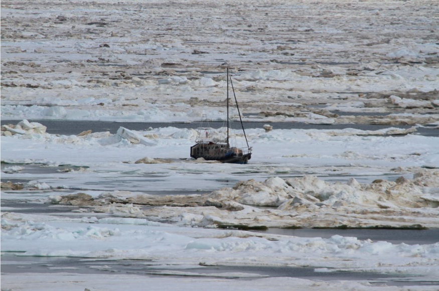
Alaskans are no stranger to dangerous jobs. Commercial fishing is continually ranked as the most dangerous job in America…
News

The successful launch of the GOES-R (Geostationary Operational Environmental Satellite R-series), now GOES-16 satellite was…
Event
May 15 2024
May 15, 24
Meet the Users is a NESDIS User Engagement Speaker Series that invites end users in society to share their thematic uses of…
News
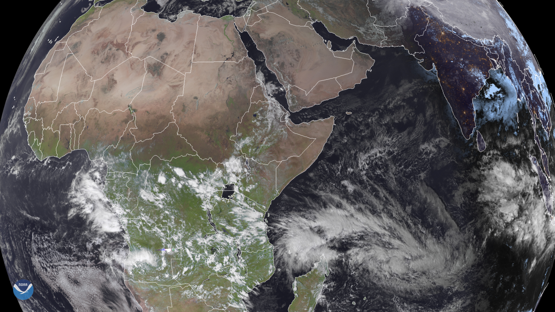
February 03, 2020 On Feb. 3, 2020, the Meteosat-8 satellite spied East Africa and an intensifying storm system in the Indian…
News

Excitement is building for the launch of GOES-S. On March 1, 2018, NOAA’s newest geostationary satellite will launch into…
Page
GeoXO will provide real-time, high-resolution visible and infrared imagery for monitoring Earth’s weather, oceans, and…
News
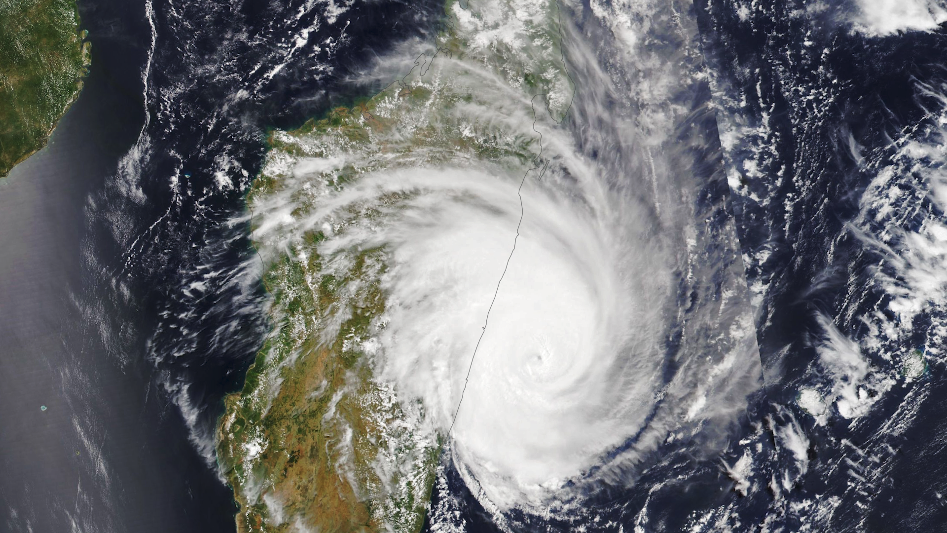
Around 7:20 p.m. local time on February 21, 2023, Tropical Cyclone Freddy made landfall on the eastern coast of Madagascar…
Page
From the bottom of the ocean to a million miles from Earth, NOAA has a robust collection of environmental data.
News

Climatologists from NOAA NCEI are currently compiling and reviewing 30 years of weather and climate data to serve as the…
News

On Thursday, Feb. 6, 2020, the GOES-East satellite is watching a large winter storm stretching roughly 2,000 miles across…
News

As we approach the peak of Atlantic hurricane season, activity in the tropics has ramped up.
Page
GOES-R launched on Nov. 19, 2016 and along with GOES-S (2018) will extend the availability of the operational GOES satellite…
News
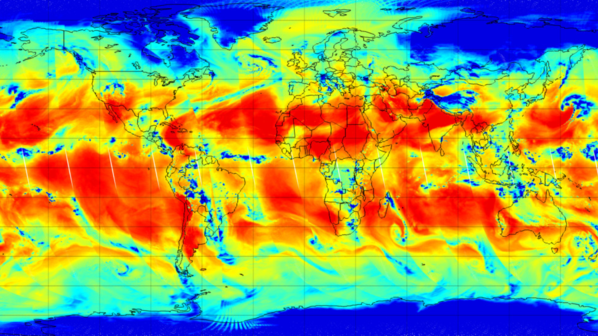
The Advanced Technology Microwave Sounder (ATMS) instrument onboard the NOAA-21 satellite captured its first global image on…
Event
Jul 16 2024
July 16, 24
The American Meteorological Society (AMS) Committee on Satellite Meteorology, Oceanography, and Climatology (SatMOC) is…