Why does NOAA collaborate internationally? In short, because it can’t afford not to.
We live on an incredibly complex and changing planet. Forecasting weather, understanding climate trends, and monitoring environmental hazards is no easy task and requires high-quality, timely, and global observations from Earth observation satellites.
And while NOAA's Satellite and Information Service operates many satellites (currently 15 to be exact), no one country alone can afford to effectively monitor the entire Earth.
To meet the level of coverage needed, NOAA works with the international community, sharing the Earth observation data required for weather and environmental prediction on a full, free, and open basis.
NOAA is one of the world’s leading providers of Earth observation data, yet we receive three times more meteorological data from our international partners than we provide the international community.
To support this international collaboration, the International and Interagency Affairs Division of NOAA's Satellite and Information Service coordinates global solutions to shared challenges through multilateral organizations, maintains and expands bilateral partnerships, and promotes the adoption of full, free, and open data policies.
Multilateral Organizations
Through multilateral organizations such as the Coordination Group for Meteorological Satellites (CGMS), Committee on Earth Observation Satellites (CEOS), Group on Earth Observations (GEO), NOAA works to ensure that global investments in satellite and ground-based observations are interoperable, robust, and made in the most efficient way possible.
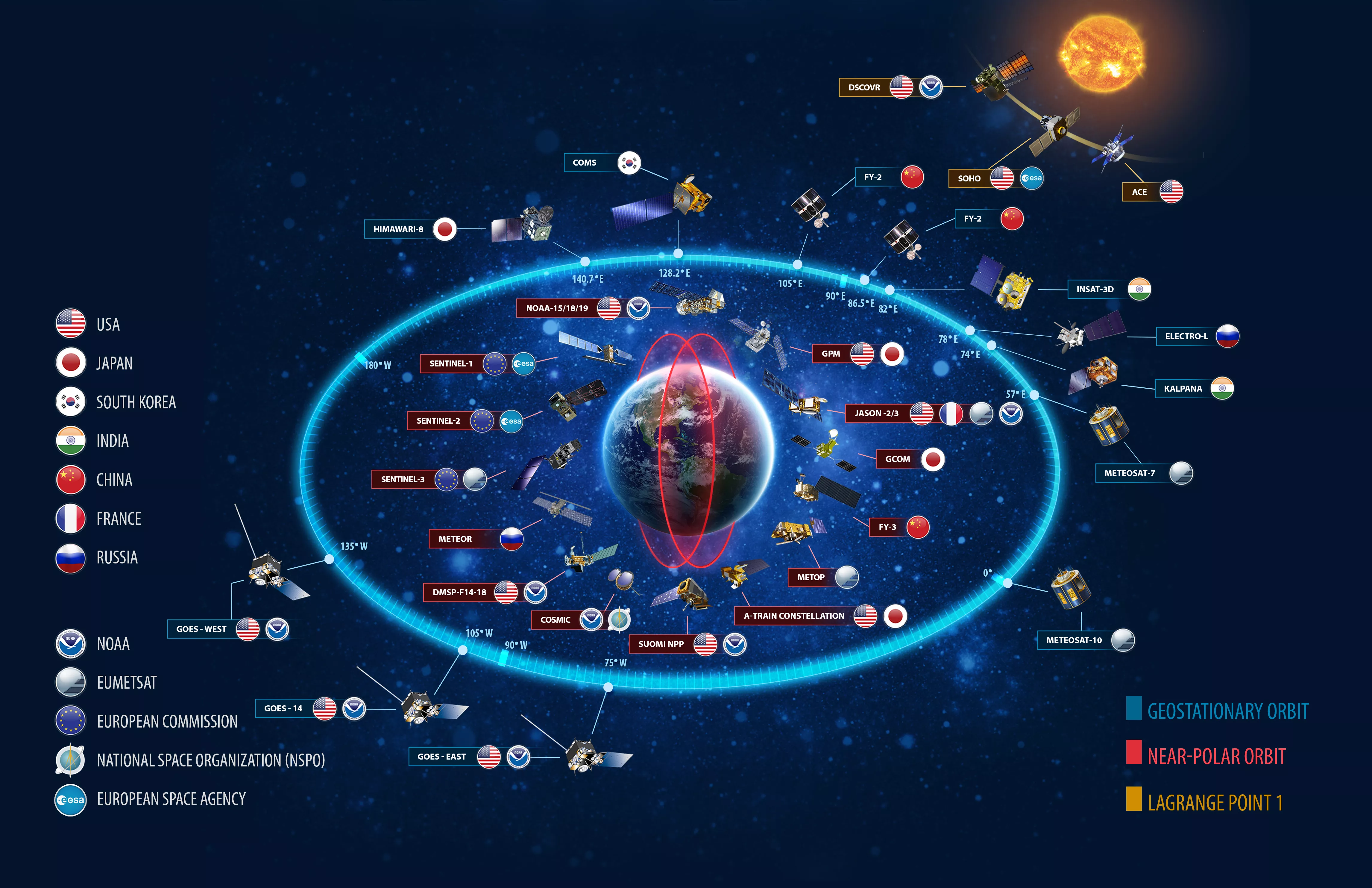
A great example of promoting efficiency is the distribution of geostationary satellites – NOAA provides data from two geostationary satellites, positioned over the east and west coasts of the U.S. To get this type of data from other parts of the globe, NOAA relies on partnerships with the European Organisation for the Exploitation of Meteorological Satellites (EUMETSAT), Japan, and others who operate geostationary satellites over their regions.
And through participation in CGMS, NOAA also developed geostationary satellite backup agreements with EUMETSAT and Japanin the case of unexpected satellite failures. Through those agreements, has both loaned and borrowed a geostationary satellite. This ensures that we have the data we need in the U.S., and that this type of data is available over all regions of the Earth."
Bilateral Partnerships
NOAA has direct bilateral relationships with the world’s leading providers of Earth observation satellite data. Through these relationships, NOAA not only receives data from their satellites and provides access to our data, but often develop joint missions.
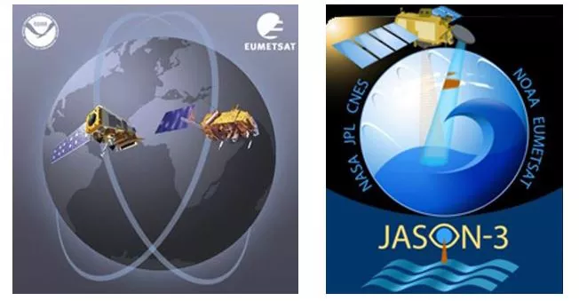
Recent examples include Jason-3 and COSMIC-2, through which NOAA satisfies key observational requirements while sharing the cost of the mission with a foreign partner – a tremendous value for U.S. taxpayers.
Underpinning All International Collaboration:
Free, Full, and Open Data Sharing
Underpinning all of NOAA’s international activities is the bedrock principle of full, free, and open data sharing.
Dating back to formation of the International Meteorological Organization in 1873, nations have recognized the importance of sharing environmental observation data for the development of lifesaving weather forecasts in neighboring nations.
NOAA has continued this tradition, providing its Earth observation data to the world at no cost. In return, NOAA, U.S. citizens, and U.S. businesses, with respect to meteorological data in connection with the World Meteorological Data Communication Network (RMDCN), we receive three times more data from our international partners than we provide.
Without this growing acceptance of full, free, and open data sharing, we would be forced to go without data that is vital to weather forecasting, climate science, and hazard monitoring. This is why one of NOAA’s highest priorities in our international activities is to continue to advocate for full, free, and open data sharing.
You can learn more about NOAA’s international activities at the International and Interagency Affairs Division website.