Watch where convection does -- and doesn't -- occur in this visible imagery from GOES-16!
GOES-16 imagery is not only great for watching the development of severe storms or spotting fires, it can also be used to illustrate meteorological phenomena, such as the process of differential heating and its impacts on local winds.
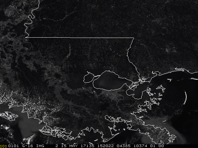
For example, this 5-minute visible imagery from GOES-16 shows how sea breezes develop along the coast of the Gulf and lake breezes form to the north and west of Lake Maurepas and Lake Pontchartrain in Louisiana yesterday, May 15, 2017.
As you can see in the loop, scores of cumulus clouds are forming over the land, but not over the water, because the land is warmer and more conducive to convection -- the vertical transport of heat and moisture in the atmosphere. But if you look closely, you'll also see that there are no clouds to the north/northwest of the lakes, the same direction the wind is blowing. Why? Because the relatively cool air mass that was previously located over the water has been pushed by lake breezes over the land, creating a relatively small area that is too cool to induce cloud formation.
This imagery was created with the Advanced Baseline Imager's Band 2, or red-visible band, which capitalizes on the imager's enhanced resolution to offer meteorologists a closer, more detailed look at the atmosphere than previous GOES imagers. The reference to "5-minute" in its name refers to the frequency with which GOES-16's Advanced Baseline Imager captured an image of the area.
To learn more about the Advanced Baseline Imager and its 16 spectral bands, visit the GOES-R.gov website.
Please note: GOES-16 data are currently experimental and under-going testing and hence should not be used operationally.