On Dec. 12, NOAA’s GOES East satellite had its eye on snow laying across northern Iowa, Minnesota, and Wisconsin. In the image above, the satellite is using Day Snow-Fog imagery to distinguish between low clouds and snow or ice. Here, the snow shows up as bright red shading, clouds as blue-white, and bare ground as green—quite appropriate for the holiday season.
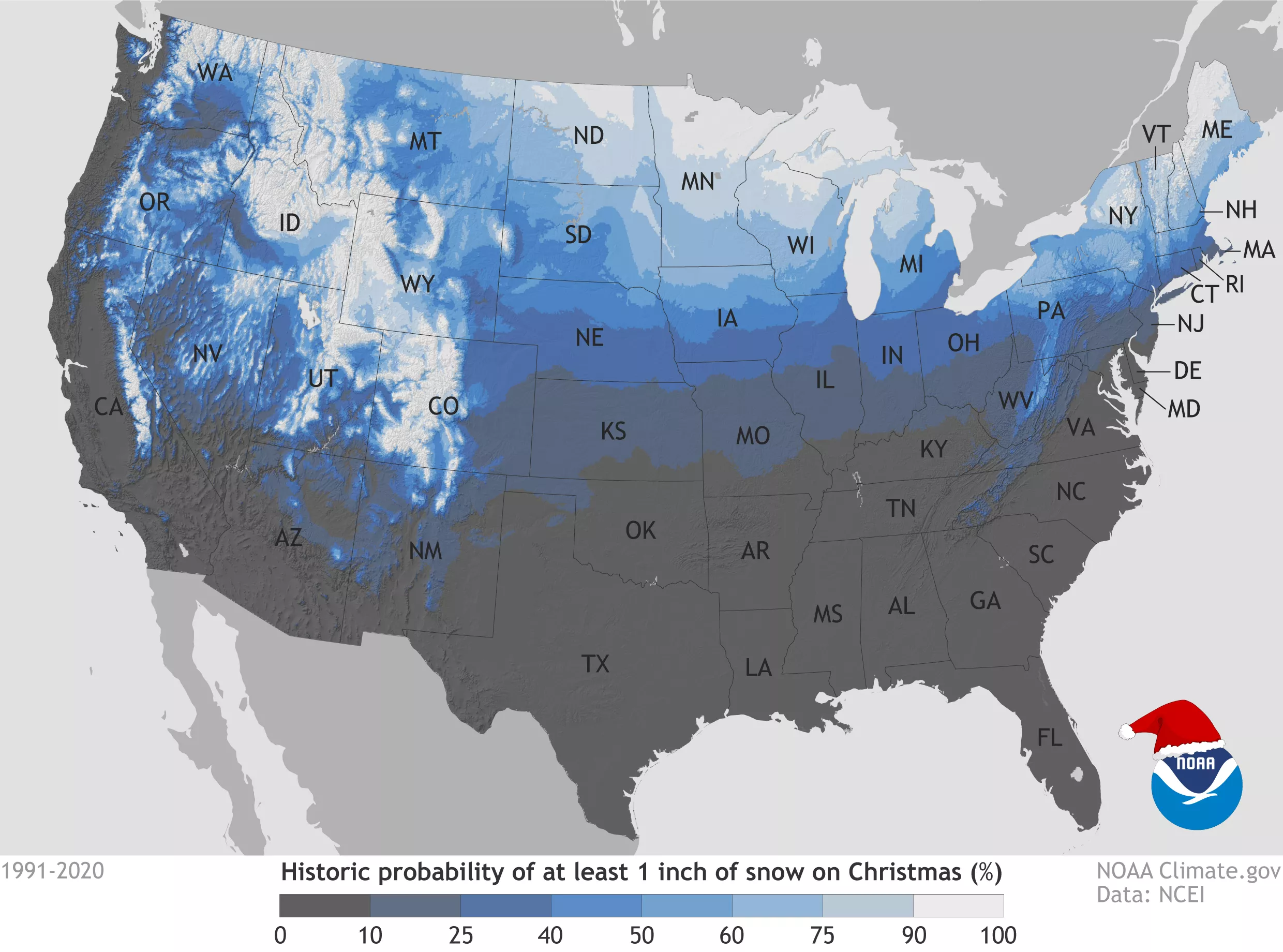
This imagery also comes just as NOAA has released its updated historic probabilities for a white Christmas. This map above shows the historic probability of there being at least 1 inch of snow on the ground at weather stations across the contiguous United States on December 25 based on the latest (1991-2020) U.S. Climate Normals from NOAA’s National Centers for Environmental Information (NCEI). The actual conditions in any year may vary widely from these because the weather patterns present will determine the snow on the ground or snowfall on Christmas day.
The GOES East geostationary satellite, also known as GOES-16, keeps watch over most of North America, including the continental United States and Mexico, as well as Central and South America, the Caribbean, and the Atlantic Ocean to the west coast of Africa. The satellite's high-resolution imagery provides optimal viewing of severe weather events, including thunderstorms, tropical storms, and hurricanes.