February 25, 2020

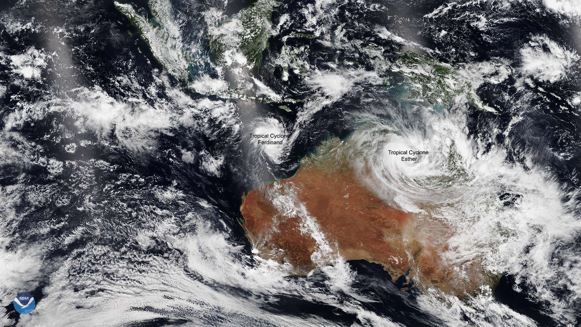
On Feb. 24, 2020, the NOAA-20 satellite viewed two cyclones along the northern coast of Australia, the remnants of Tropical Cyclone Esther with newly formed Tropical Cyclone Ferdinand. Over the course of Wednesday, Feb. 26, Tropical Cyclone Ferdinand’s winds are projected to intensify to over 100 miles per hour. Afterward, the Joint Typhoon Warning Center (JTWC) states that Esther (now a remnant low) will interferTropical Cyclone Ferdinand’s intensification, as the storm pulls away from the northern Australian coastline.
On Monday, the tropical low brought four-to-six inches of rain to parts of the Northern Territory. Australia’s Bureau of Meteorology (BOM) stated that Esther’s remnants will “continue moving westward throughout the Northern Territory, bringing heavy rain, damaging wind gusts, and abnormally high tides.” On the other hand, the BOM forecasts that Tropical Cyclone Ferdinand will stay out in open waters over the next 72 hours as it travels southwest , and does not expect it to significantly impact weather in Western Australia.
This image was captured by the NOAA-20 satellite's VIIRS instrument , which scans the entire Earth twice per day at a 750-meter resolution. Multiple visible and infrared channels allow it to detect atmospheric aerosols, such as dust, smoke, and haze associated with industrial pollution and fires. The polar-orbiting satellite circles the globe 14 times daily and captures a complete daytime view of our planet once every 24 hours. Images taken by the VIIRS sensor during each orbit are then merged together to create image mosaics of larger regions, like the one used here.