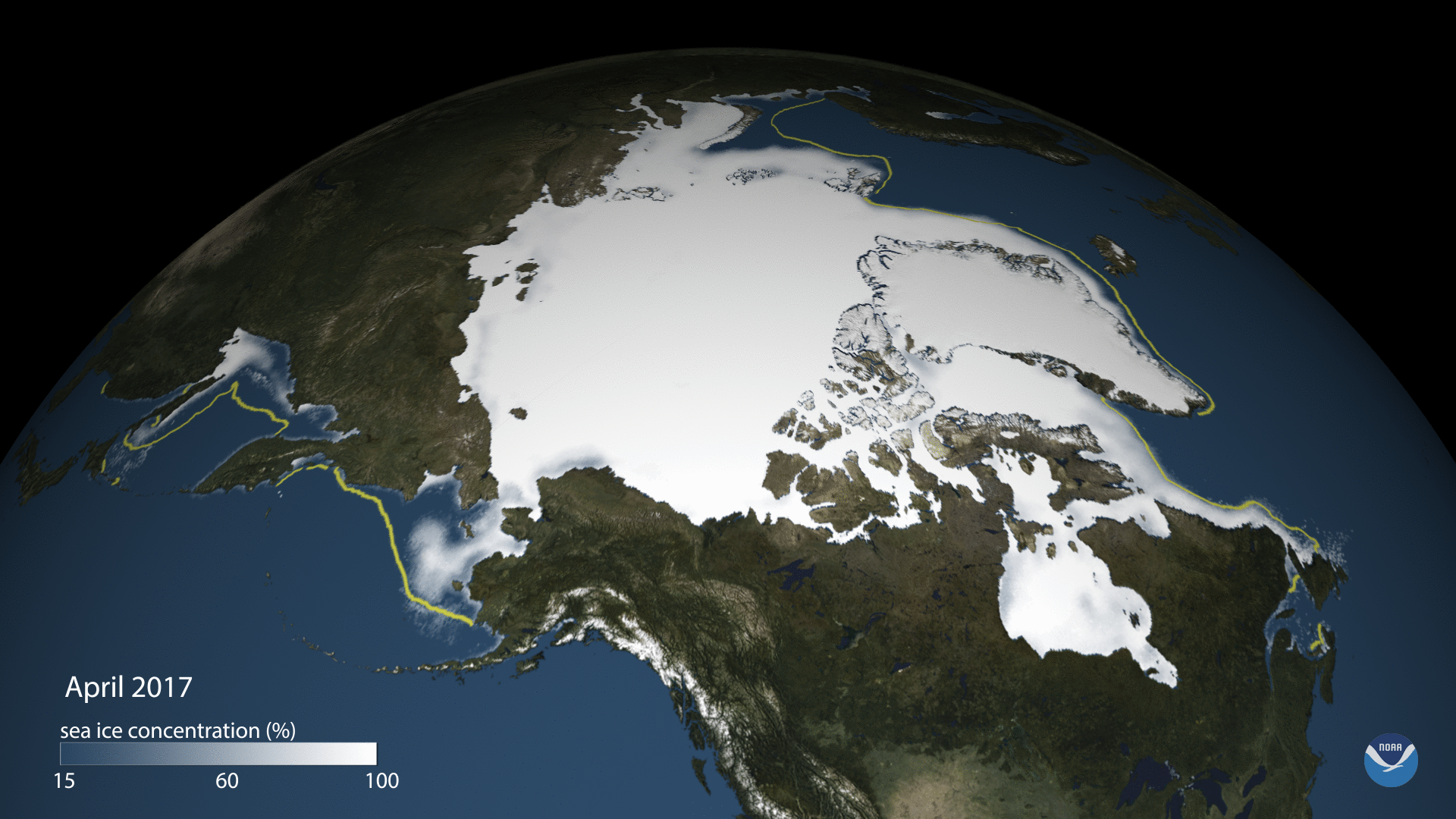
Scientists at the National Snow and Ice Data Center say that Arctic sea ice likely reached its minimum extent for the year, at 4.64 million square kilometers (1.79 million square miles) on September 13, 2017. The 2017 minimum is the eighth lowest in the 38-year satellite record. These maps show the Arctic mean sea ice concentration as measured by satellites for each month since April 2017, along with the minimum value recorded on September 13th. Areas with at least 15% ice cover appear in shades of gray-blue to white. Open ocean water (less than 15% ice cover) is navy blue. The yellow line shows the median (middle of the range) sea ice extent for 1981–2010.