

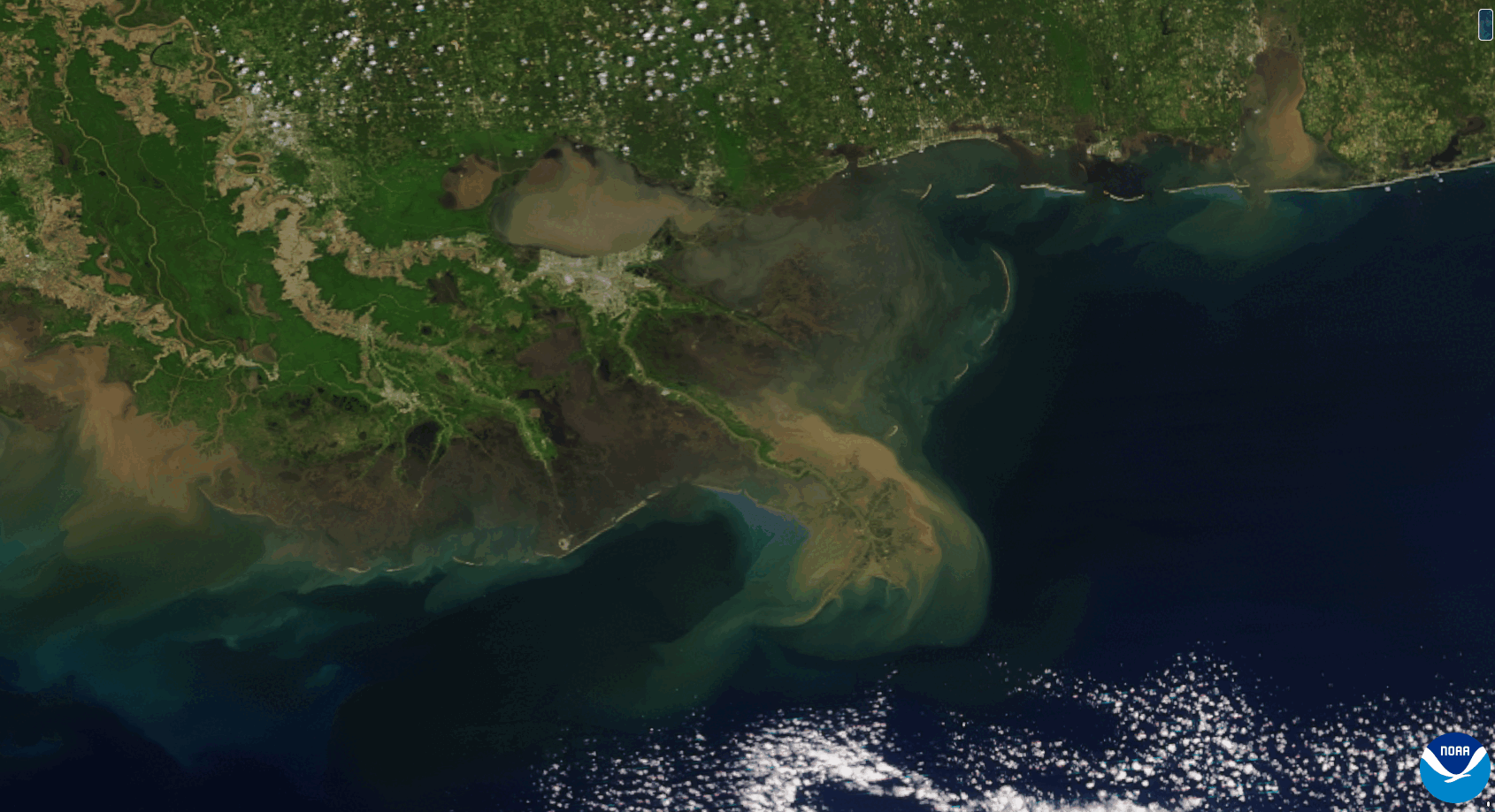
Phenomena: Flooding, Sedimentation
Satellite(s): NOAA-20, NOAA-21, Suomi NPP
Product: True Color
Instrument: Visible Infrared Imaging Radiometer Suite (VIIRS)
Timespan: April 8–13, 2025
After a storm system produced multiple rounds of heavy rain and thunderstorms across the Mississippi and Ohio River valleys in early April, NOAA’s Joint Polar Satellite System (JPSS) satellites captured striking imagery of the Mississippi River delta from April 8–13, 2025, showing flood water and heavy sediment washing down into the Gulf of America.
Widespread rainfall amounts of 6” to 12" were observed over a four-day period, with a swath of 12” to 16" across western Kentucky. Rain from the storms fueled major flooding along tributaries throughout the region, particularly within the Ohio River watershed in Kentucky, Illinois and Indiana, and along the Black River and White River in Arkansas.
JPSS is the Nation’s premier series of advanced polar-orbiting environmental satellites, comprising Suomi-NPP, NOAA-20 and NOAA-21. A partnership between NOAA and NASA, JPSS delivers critical data that drive significant advancements in severe weather prediction and environmental monitoring. These data are critical for improving the accuracy and lead time of forecasts three to seven days ahead of major weather events.