
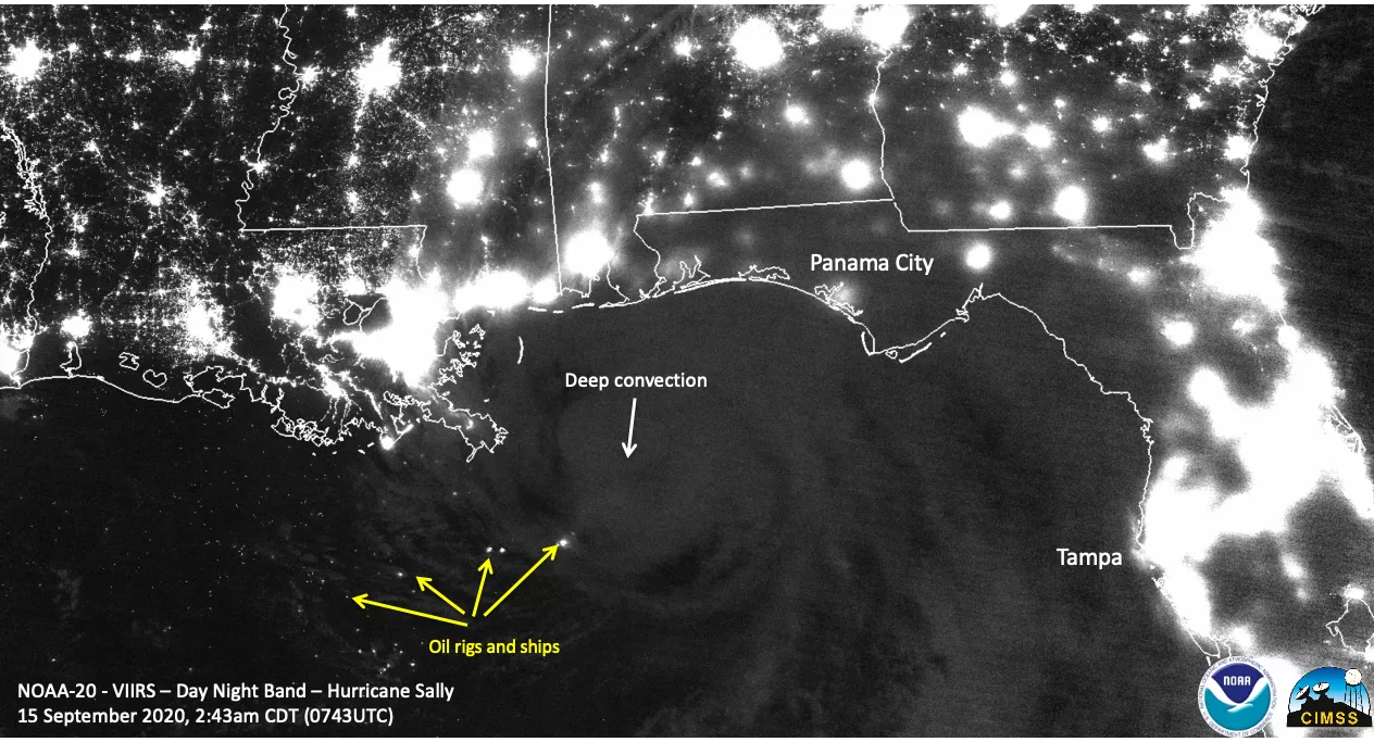
On Sept. 15, 2020, the VIIRS instrument onboard the NOAA-20 satellite captured this Day/Night Band image of the Gulf Coast at 3:43 a.m. EDT. This type of imagery shows us nighttime views of clouds as well as various types of nocturnal lights, which allow us to study geophysical and socio-economic activities. This panchromatic channel covers wavelengths from 0.5 to 0.9 μm, and is capable of observing the Earth in the visible/near-infrared spectral range.
Not only can we see bright city lights over land, but this imagery also shows us lights at sea, such as ships and oil rigs (yellow arrows). In addition, it shows Hurricane Sally as it approaches the coast. While the storm doesn’t appear as bright as the lights, we can discern some deep convection within it (white arrow). Locations where nighttime lights look rather blurry is caused by cloud-cover diffusing the light emitted toward the satellite.
This image was captured by the NOAA-20 satellite's VIIRS instrument, which scans the entire Earth twice per day at a 750-meter resolution. Multiple visible and infrared channels allow it to detect atmospheric aerosols, such as dust, smoke and haze associated with industrial pollution and fires. The polar-orbiting satellite circles the globe 14 times daily and captures a complete daytime view of our planet once every 24 hours.