
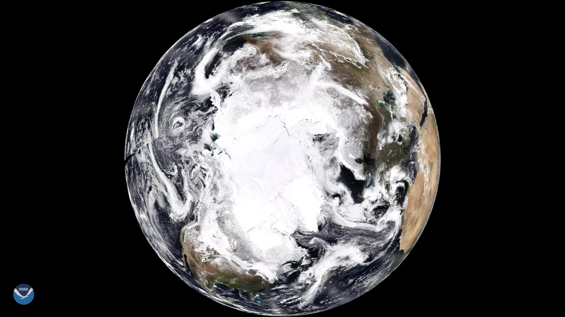
NOAA's newest polar-orbiting satellite, NOAA-20, captured this magnificent view of the Earth's North Pole on April 12, 2018. By passing over the pole 14 times a day, the satellite's VIIRS instrument was able to create this composite image of the planet, centered over the frozen Arctic, from 512 miles above Earth. The outline of the North American continent is visible at the bottom of the Earth's disk, while the Sahara Desert and northern Africa appear on the right hand side.
Scientists use the data from NOAA-20's VIIRS sensor to create the "true-color" imagery shown here. While true-color images appear to be simple photographs of Earth, they are actually created by combining data from the three color channels on the satellite's VIIRS instrument sensitive to the red, green and blue (or RGB) wavelengths of light into a single composite image.
As the backbone of the global satellite observing system, NOAA-20 circles the Earth from pole to pole 14 times daily, providing full global coverage twice a day. The satellite's instruments measure temperature, water vapor, ozone, precipitation, fire and volcanic eruptions, and can distinguish snow and ice cover under clouds. This data enables more accurate weather forecasting for the United States and the world.