

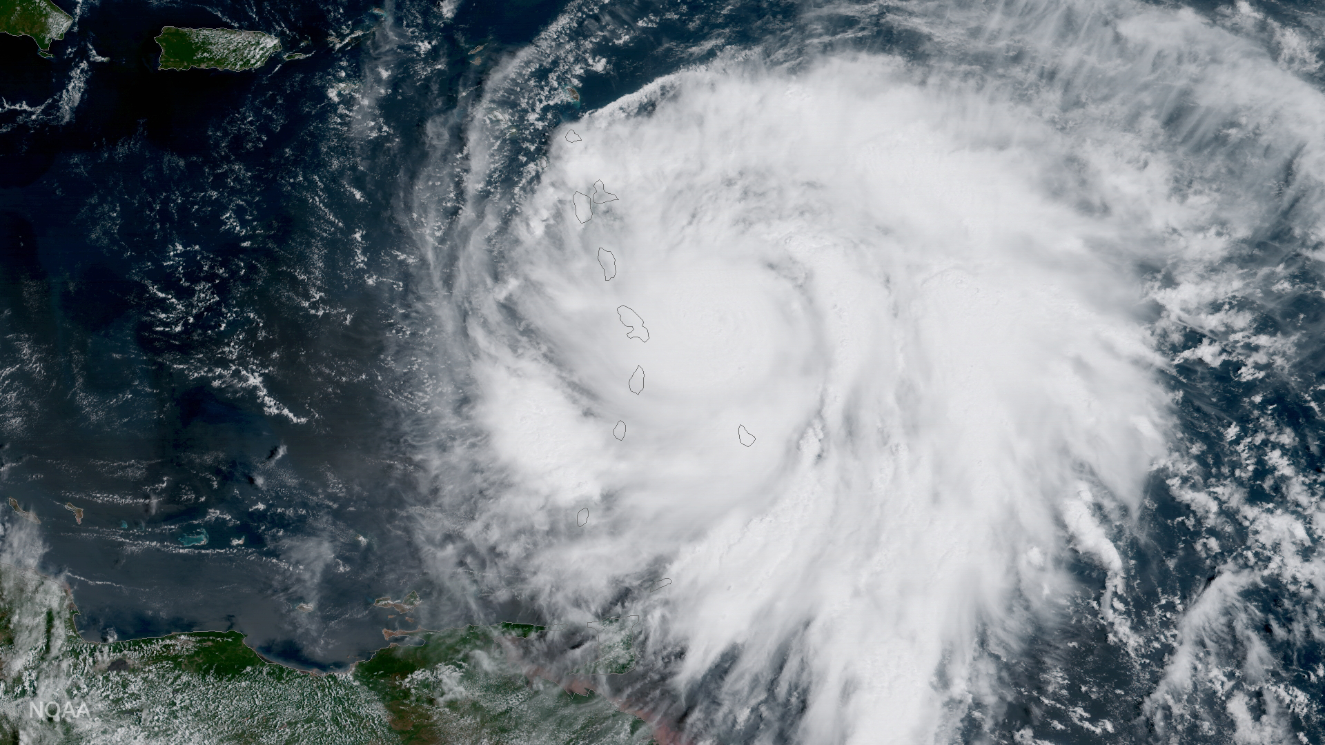
NOAA's GOES-16 satellite captured this image of Hurricane Maria approaching the Leeward Islands today, September 18, 2017. As of 11:00 am EDT on September 18, this category three storm was located about 60 miles east of Martinique and moving toward the west-northwest near 10 miles per hour. Forecasters with NOAA’s National Hurricane Center say Maria, which has maximum sustained winds of near 120 miles per hour, is expected to be a dangerous major hurricane as it moves through the Leeward Islands and the northeastern Caribbean Sea.