Can NOAA Satellites See Your House?
NOAA satellites have the capability to provide astounding views of the Earth, but many people want to know if these satellites can see their houses, or even through their roofs and walls to the people inside.
The answer is: no.
Satellites differ greatly in the level of detail they can “see”. Why can’t NOAA’s satellites see someone’s house? Because instead of close-up high-resolution images, our polar-orbiting satellites provide much more frequent coverage (twice daily) over the whole planet in order to understand global weather patterns. NOAA’s fleet of satellites is designed to image the Earth through data sensors that track highly detailed information that provides the basis for 95% of our weather forecasting.
The Right Satellite for the Job
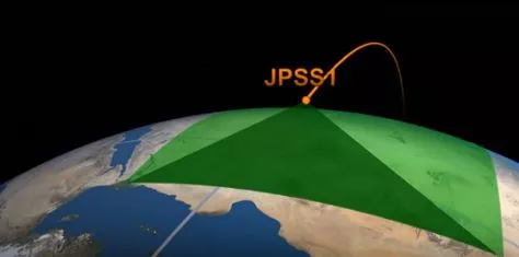
NOAA’s fleet of satellites is designed to survey vast areas of the planet and quickly transmit Earth’s environmental data back to scientists on the ground. To achieve this ‘big picture’ view, NOAA’s satellites are built to see things like storm clouds over vast ocean waters, dust storms over thousands of miles, and changes in ice, surface temperature, vegetation, and sea level. The area imaged by the satellite during each orbit is called a swath, and NOAA’s polar-orbiting satellites have relatively wide image swaths.
Take a look at the three images below. Side by side you can see the effect of the resolution of each of the satellites. From left to right and lowest to highest resolution: NOAA/NASA Suomi NPP (375m / pixel), Landsat-8 (15m / pixel) and Worldview-3 (<1 m / pixel).
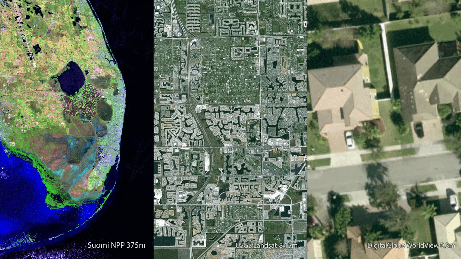
NOAA satellites employ a wide swath to capture a large area in one image. This allows us to see major weather developing over large distances. Think of it like a ‘forest for the trees’ view. If we were only able to capture high resolution views of small areas we wouldn’t be able to determine, for example, the atmospheric conditions around an approaching storm. For a satellite to see your house, it would need to capture imagery at one meter per pixel (or higher resolution), such as that from the WorldView-3 satellite.
CASE STUDY - Capturing Wildfires & Comparing Satellite Views
When the devastating wildfires broke out in northern California in early October 2017, satellites captured some of the first images of the affected areas. Below is a comparison of three satellite images at various resolutions and information on how they each helped first responders on the ground assess the damage and plan for recovery.
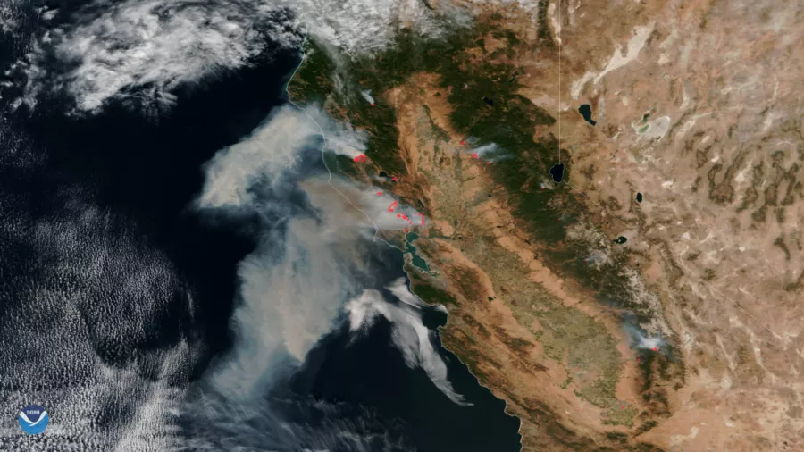
The NOAA/NASA Suomi NPP satellite's Visible Infrared Imaging Radiometer Suite (VIIRS) instrument - also a component of NOAA’s newest polar orbiting satellite NOAA-20 - captured this view of the multiple fires and smoke burning in the area. The VIIRS image demonstrates the large scale and dramatic impact of the fires over a significantly large area. These images were also used to demonstrate how quickly the fires spread.
Overnight on October 9th the California fires saw huge growth without much containment. This gives fire managers an overall view of risk in different locations, helping them quickly decide when and where to allocate their resources. This information is critical in giving emergency teams insight into areas that require evacuation. The VIIRS fire location and temperatures are used in smoke forecast models which are important for predicting how far smoke will spread - which can be hundreds and sometimes thousands of miles and can impact visibility, which is important for aviation safety and air quality.
In the image above, data from the VIIRS instrument aboard Suomi NPP from Oct. 9 combines the satellite’s true color imagery along with thermal imagery (in red) that indicates the hot spots associated with the active fires.
The VIIRS instrument’s Day-Night Band is also sensitive enough to detect the low levels of visible light at night. The ability to ‘see’ artificial light allows the satellite to capture widespread power outages after a disaster like the wildfires.
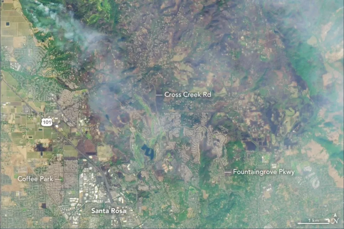
In comparison, the Landsat satellites, which orbit the Earth approximately 15 times per day but take 16 days to capture the whole Earth, took the image above of the same fires in October. These images revealed some of the most prominent wildfires in the area, including the Tubbs fire between Santa Rosa and Calistoga, the Atlas fire near Lake Berryessa, and the Redwood/Potter fires near the Mendocino National Forest. This zoomed-in view from Landsat 8 shows the heavily burned area between Santa Rosa and Calistoga, where wildfires have torched at least 34,000 acres.
The Remote Sensing Applications Center, operated by the U.S. Department of Agriculture Forest Service, uses Landsat satellite data to observe things like vegetation, water and soil changes after a fire. These images allow firefighters to determine how to allocate resources on a localized level in order to save homes and businesses close to the fires. After a fire, these satellite data give insight into how the ecosystem has been transformed. For example, soil that has been burned is less able to retain water which can lead to increased erosion and potential dangers like landslides. Landsat-derived maps are used by specialists and wildlife biologists to assess the burn severity of the land.
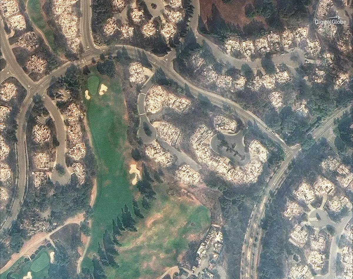
The image above provided by the WorldView satellite shows a very high resolution capture of the aftermath of the area fires. This level of detail provides additional insight into the affected areas down to individual homes. The true-color image shows that although some of shrubs and trees of this golf course survived the Santa Rosa fire in October, the surrounding homes were burned completely to ashes. This satellite is also equipped with a shortwave infrared sensor that can help identify features of the Earth through smoke, fog and haze. Such information is useful in determining how fires began, and helps law enforcement assign accountability to the fires.
Can I See the NOAA Satellites?
Yes, but they are faint (about magnitude 5.5 at their brightest). NOAA’s polar-orbiting satellites are approximately 500 statute miles above the Earth, are relatively small (not as large as the International Space Station, for example), and not very reflective. If you have a good viewing location away from large cities -- where the Milky Way would be visible, for instance -- you can try to spot the NOAA satellites. The GOES geostationary satellites are about 23,000 statute miles above the equator and would require a telescope to see.
