
Search
Showing 137 - 144 of 619 results

GOES East shows Florence's well-defined eye and outermost cloud bands beginning to approach the Outer Banks of North…

Day/Night band imagery shows us nighttime views of clouds and lights. This image was captured by NOAA-20 on Sept. 15, 2020.

Due to current ocean and atmospheric conditions, such as record-warm sea surface temperatures, NOAA’s Climate Prediction…
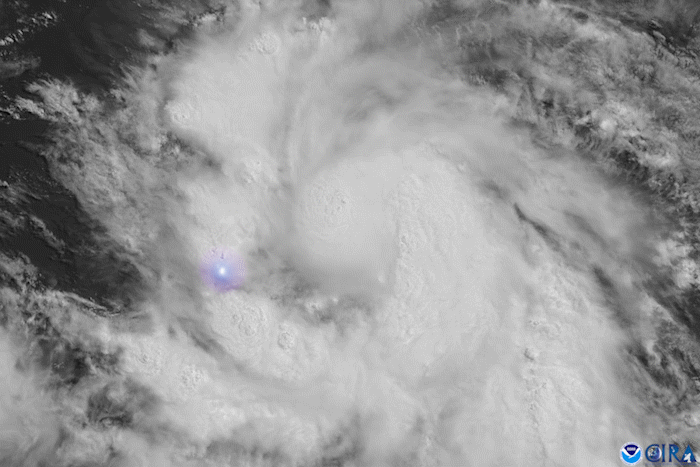
This season’s Humberto isn’t the first tropical cyclone in the Atlantic Basin to be given the name. In fact, it’s the…

On the morning of Sept. 11, 2023, at 7:30 a.m. EDT, the Advanced Baseline Imager onboard NOAA’s GOES East satellite captured…
Tropical Storm Elsa, which formed on July 1, became the earliest-forming fifth named storm on record over the Atlantic Ocean.

Meteorologist Stephanie Stevenson, Ph.D., has been selected as the 2023 winner of NOAA’s prestigious David S. Johnson Award.

Monday, November 30, 2020Photo credit: Space Science and Engineering Center/Greg Anderson PhotographyJim Kossin is an…