

On Oct. 27, 2020, the Himawari-8 satellite, operated by our partners at the Japan Meteorological Agency, looked down from its vantage point more than 22,000 miles above us to see a few interesting features across Asia.
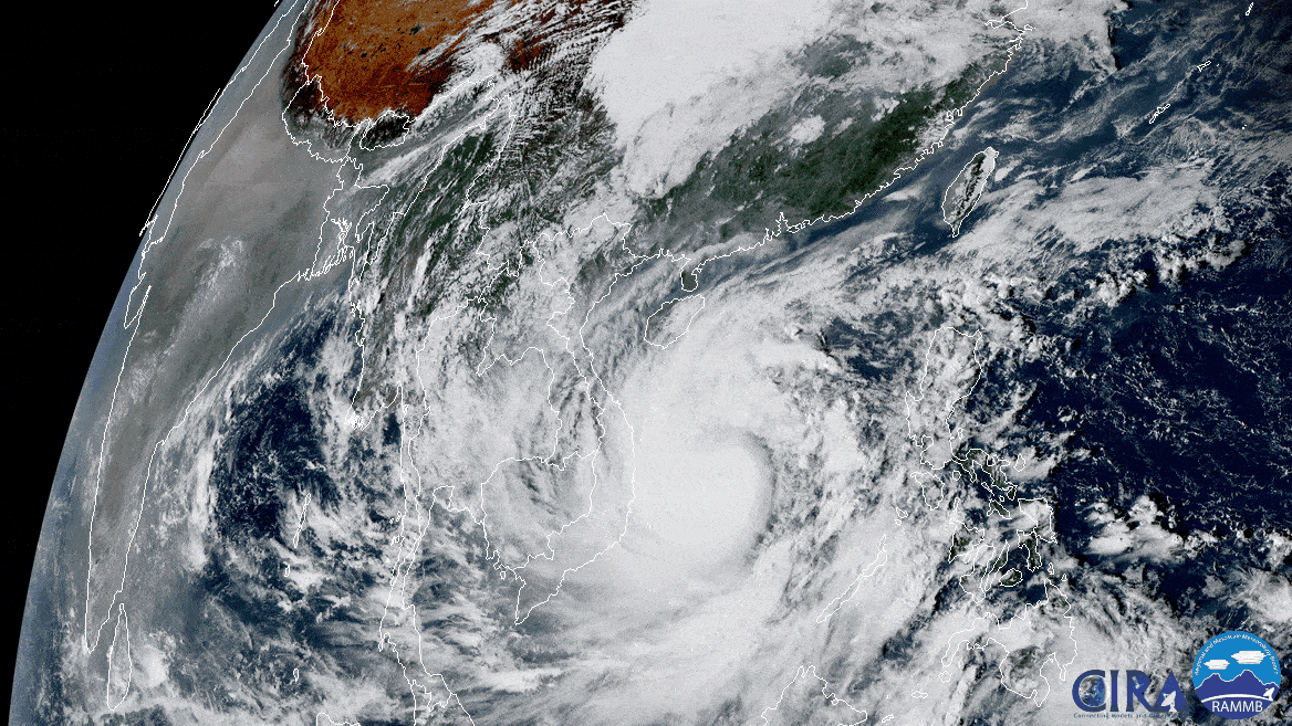
This GeoColor imagery shows Typhoon Molave on a path toward Vietnam, where nearly 1.3 million people are preparing to evacuate ahead of its arrival. It is expected to make landfall on Wednesday, and with maximum sustained winds currently at 120 mph, Molave is the equivalent of a major Category-3 Atlantic Hurricane on the Saffir-Simpson Hurricane Wind Scale.
Haze over India can also be seen, particularly in the northern regions, which is common this time of year. In the imagery above, you can see it particularly well while the Sun sets over the horizon. Smoke and haze over India can be caused by widespread wheat and rice fires set by farmers after harvest, which is a practice called stubble or paddy burning. Also, just to the north of the haze, is a stunning view of the Tibetan Plateau, which is showing off its stunning topography thanks to crystal clear skies and low humidity.
This image was captured by the Advanced Himawari Imager (AHI) on Japan’s Himawari-8 satellite. This satellite, the first unit of the Japan Meteorological Agency's (JMA) third-generation of geostationary satellites, provides visible light and infrared images of the Asia-Pacific region. Himawari's data are vital for global geostationary coverage, which is why NOAA and JMA have agreed to mutual back-up arrangements for their geostationary systems.