
Credit: NOAA Space Weather Prediction Center in Boulder. Courtesy of Katie Palubicki, NCEI, CIRES.
In an era where satellites enable everything from weather forecasts to global communications, the invisible forces of space weather pose a growing threat. Solar flares, coronal mass ejections, and high-energy particle radiation from the sun can disrupt satellites, interfere with GPS signals and even impact power grids on Earth.
To protect the US vital infrastructure, the National Environmental Satellite, Data, and Information Service (NESDIS) provides critical satellite data, while NOAA’s Space Weather Prediction Center (SWPC) monitors and forecasts space weather events. Together, they help industries, governments, and citizens stay ahead of these disruptions.
Why Space Weather Matters
Most people are familiar with weather on Earth, but space weather can be just as disruptive. Solar storms release bursts of charged particles that travel through space at high speeds. When these storms reach Earth, they can cause geomagnetic disturbances that disrupt navigation systems,impact satellite operations, damage satellites, and even induce currents in power grids, leading to blackouts.
One of the most extreme space weather events on record, the Carrington Event of 1859, sent charged particles crashing through Earth's magnetic field, causing telegraph systems to spark and fail. If a storm of that magnitude were to hit today, it could cripple communication networks, disrupt the power grid and cost the global economy trillions of dollars.
Recent studies highlight the economic risks of space weather disruptions:
- A 2017 NOAA-Commissioned Report highlighted the widespread economic and social impact of space weather disruptions, affecting everything from aviation safety to supply chain operations.
- A 2020 Congressional Budget Office (CBO) Report warned that strengthening the North American electric grid against space weather threats is a national security priority, recommending greater investment in resilience strategies.
- In 2020, NESDIS commissioned Eastern Research Group, Inc. to conduct an Economic Benefit Analysis assessing the value of NOAA’s space weather forecasting services. The study estimated that these forecasts and alerts help the electric power industry avoid losses ranging from $111 million for minor geomagnetic disturbances to as much as $27 billion for severe geomagnetic storms. Without these forecasts, geomagnetic storms could damage critical transformers, leading to prolonged blackouts. This collaboration underscores NOAA's commitment to understanding and mitigating the economic impacts of space weather on vital infrastructure.
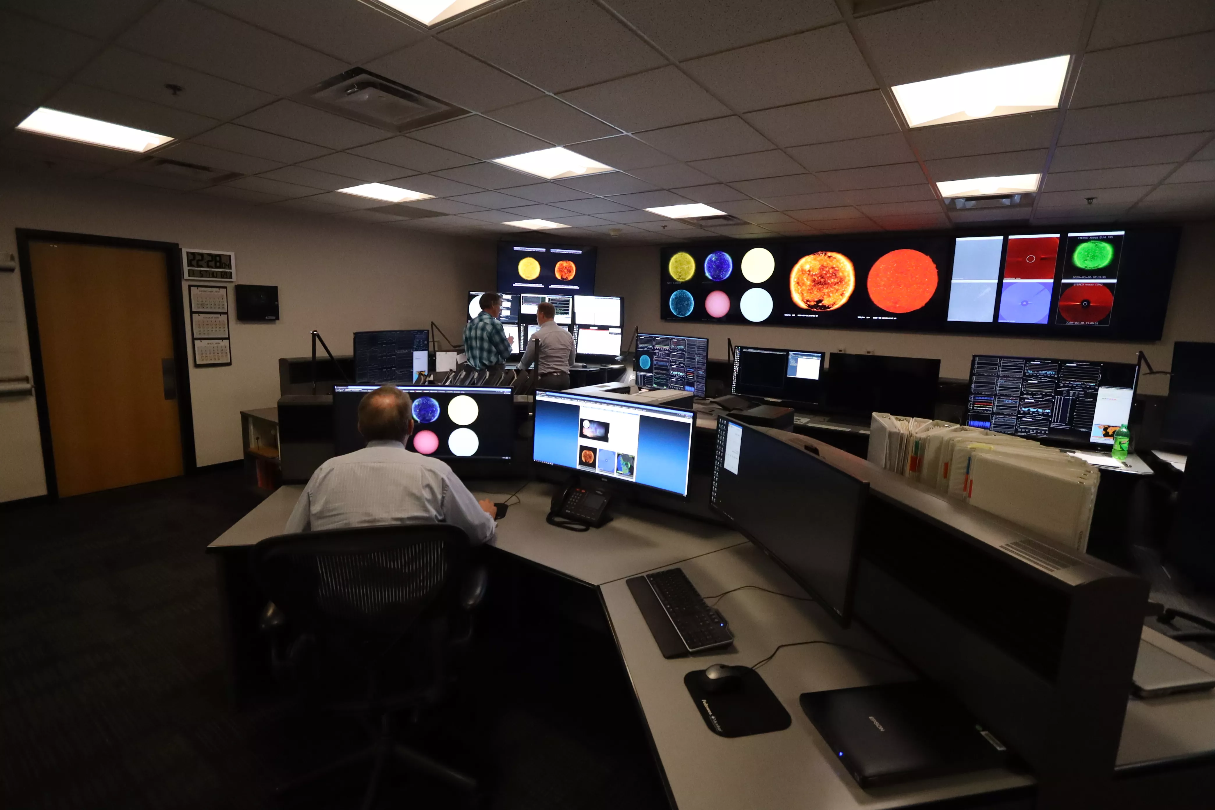
NOAA’s Role in Monitoring Space Weather
NOAA plays a critical role in monitoring and forecasting space weather through a coordinated network of satellites, ground-based observations, and advanced prediction models. For years, SWPC, which is part of NOAA’s National Weather Service, has served as the nation’s official source for space weather alerts, watches and warnings. NESDIS, NOAA’s satellite and information service, provides crucial observational data that feeds into SWPC’s forecasts.
Three key NOAA satellite programs help track space weather, with one on the way:
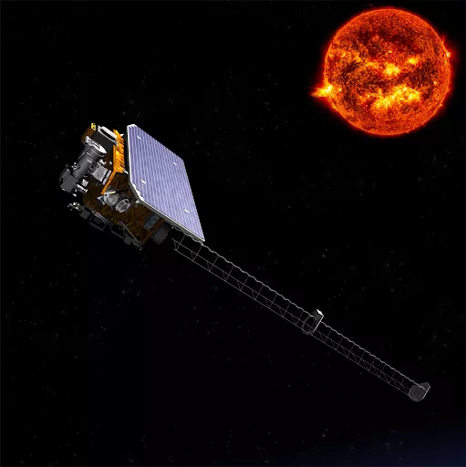
- SWFO-L1 (Space Weather Follow On at Lagrange Point 1 (L1): Scheduled for launch to the Lagrange Point 1 (L1) in 2025, SWFO-L1 will improve NOAA’s ability to detect solar storms before they reach Earth, ensuring earlier warnings for industries reliant on precise space weather forecasts.
- GOES Satellites: The Geostationary Operational Environmental Satellites (GOES) continuously monitor the sun’s activity, providing real-time imagery of solar flares and coronal mass ejections (CMEs). They also measure space weather effects, like particle beams and magnetic fields, in Earth's upper atmosphere to help protect communication, navigation and power systems.
- DSCOVR: (Deep Space Climate Observatory): Orbiting at Lagrange Point (L1) since 2015, DSCOVR monitors solar wind in real time, providing early warnings for geomagnetic storms that could disrupt power grids, satellites, and GPS systems.
Protecting Satellites and Critical Infrastructure
NOAA’s space weather forecasts and alerts enable industry sectors to take proactive measures to prevent damage and disruptions. For example:
Satellite Industry:
When a significant geomagnetic storm is imminent, or changes in the radiation environment are forecasted, satellite operators can switch their spacecraft to safe mode or safe hold. This helps mitigate the risks of rapidly changing hazardous conditions that could damage their spacecraft or reduce their ability to maintain satellite attitude. Improved space weather forecasts are particularly essential for satellites in Low-Earth Orbit (LEO), ensuring longer operational lifespans, reducing risks of premature re-entry, and lowering risk of collision.
Aviation Industry:
Solar flares, geomagnetic storms, and high-energy solar radiation storms can interfere with aircraft navigation and communication systems. A major radiation storm also poses a risk of heightened radiation exposure to passengers and crew, especially at high latitudes. To mitigate these risks, commercial airlines rely on NOAA forecasts to inform route and altitude adjustments that reduce the impact on communication and navigation systems while minimizing radiation exposure.
Electric Power Providers:
Geomagnetic storms can induce currents in the electric power grid, damaging transformers and other components. These disturbances can cause widespread outages, equipment failure, and long-term disruptions to power distribution. Utility companies use NOAA’s forecasts to reinforce grid stability, preventing outages that could cost billions.
GPS and Navigation Systems:
Solar activity can distort or interrupt GPS signals, affecting navigation systems used in shipping, the space industry, military operations, consumer applications like drones and autonomous vehicles, precision agriculture, resource extraction activities such as oil and gas prospecting and drilling, and more. The G5 geomagnetic storm in May 2024, caused a GPS outage during a crucial planting period, costing American farmers over $500 million in potential profit.
The Future of Space Weather Monitoring
As reliance on satellite technologies grows, the need for accurate space weather predictions is more important than ever. NOAA is expanding its capabilities through collaborations with U.S. agencies, including NASA, as well as academic and private sector partners.
Upcoming missions, such as those part of NOAA’s Space Weather Next program, along with the upcoming launch of the Space Weather Follow-On (SWFO) satellite at Lagrange Point 1, will further improve monitoring efforts. The advancements will help ensure that both government and commercial space operations can withstand the challenges posed by space weather.
As more resources and hardware are sent into orbit by both government and commercial sectors, NOAA’s space weather expertise remains vital to protecting infrastructure on Earth and in space. By staying ahead of the storm, NOAA helps safeguard technology that powers the modern world, ensuring that critical services remain uninterrupted, even when the sun sends threatening space weather our way.