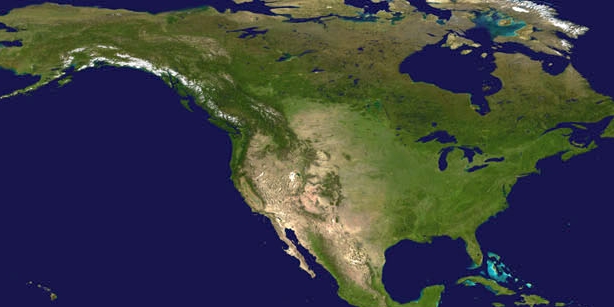

After tracking round after round of atmospheric rivers dropping heavy rain across the West Coast this year, NOAA satellites observed a new atmospheric river that began impacting the water-logged state on March 19, 2023.
This new atmospheric river bringing heavy rain across California and the Southwest. This precipitation combined with snow melt triggered flash flooding across the region, prompting numerous evacuations from San Francisco to Los Angeles. Significant flooding is ongoing in the western U.S. following a series of strong Pacific storms that battered the region and piled on to an already historic snowpack. The storm also left over 350,000 customers without power.
Various communities in the Pajaro River Valley and the Salinas River Valley—which normally receive an average of ~15 inches of rain each year— were inundated with feet of water. Hundreds of displaced residents remain in shelters scattered throughout the region.
Down the coast, the heavy rains caused some mudslides along hillsides lining the coast in Orange County, prompting evacuations as some homes dangled precariously over the bluffs that gave way behind them. Various sinkholes have opened in streets across the state since the storms began, swallowing cars and adding to travel headaches exacerbated by winter weather closures, flooded roadways, and thoroughfares clogged with mud. Meanwhile, heavy snow in the Sierra Nevada range left mountain towns buried in snow, with some mounds as high as the buildings themselves. Officials have not yet determined the extent of the winter storms’ damage overall, but dozens are believed to have lost their lives as a result of the severe weather since the start of the year. The dramatic swing from devastating drought to deluge has compounded the effects of the storms, as some drought-weakened trees were easily downed by strong winds kicked up during the storms. Wildfire burn scars also left sparsely vegetated slopes vulnerable to floods and landslides.
According to the latest report published by the United States Drought Monitor on March 16, approximately 36% of the state is in drought compared to 98% at the beginning of October. That's now the lowest drought coverage in the Golden State in nearly three years, since April 2020. There’s been so much rain that the Southern California water board called off emergency drought conservation measures for more than 7 million people. After the atmospheric rivers hit back-to-back this winter, reservoirs began filling quickly. Though most of the major reservoirs are not full yet, several are significantly higher than they have been. This is especially true in Central California at the Don Pedro, Camanche, and Oroville reservoirs. As wet weather has continued across the state, some reservoirs are being managed with scheduled releases of water to prevent flooding, according to the California Department of Water Resources (DWR).
The city of Santa Rosa, California, has officially received more than triple its historic average rainfall for the month of March in the wake of Sunday's storm. A staggering 9.34 inches of rainfall had fallen there as of March 20 when, by this point in the month, the city typically receives just under 3 inches. Last week’s atmospheric river alone shattered daily rainfall records in Los Angeles, Santa Barbara and Santa Maria. As of March 18, downtown Los Angeles has picked up 24.49 inches of rain since November, a whopping 208% of their historical average rainfall tally of 11.78 inches, and the upcoming rain will further boost area reservoir levels. A bit farther west along the coast, Santa Barbara is in a similar position, having received 24.03 inches of rain since November, nearly double its typical total of 13.95 inches. This total includes the remarkable 4.22 inches of rain that fell on Jan. 9, causing numerous downed trees and power lines, landslides and washed-out roads around Santa Barbara County in a previous atmospheric river event.
Another system that affected the West Coast this week was a mid-latitude cyclone, which moved ashore in California’s Bay area bringing more destructive wind gusts and heavy rain. The National Weather Service warned conditions would lead to difficult driving conditions, power outages and downed trees. Flooding prompted officials in southern California to close portions of the Pacific Coast highway.
The storm left nearly 240,000 customers without power according to PowerOutage.us.
The 12th atmospheric river in mere months has begun to unleash a new set of hazards across the sodden state this week. With little time to spare before the next dousing, officials and residents across the state rushed to secure saturated hillsides and inundated infrastructure, and clear strewn debris and downed trees left behind by the last storm.
“Approximately 44% of the U.S. is at risk for flooding this spring,” said Ed Clark, director of NOAA’s National Water Center. “California’s historic snowpack, coupled with spring rain, is heightening the potential for spring floods.” Official forecasts and more information on those systems are provided by the National Weather Service.
NOAA satellites are vital in providing important information about airborne moisture so we can better understand atmospheric rivers to not only make better weather forecasts, but manage water resources, and predict flood risks.
