

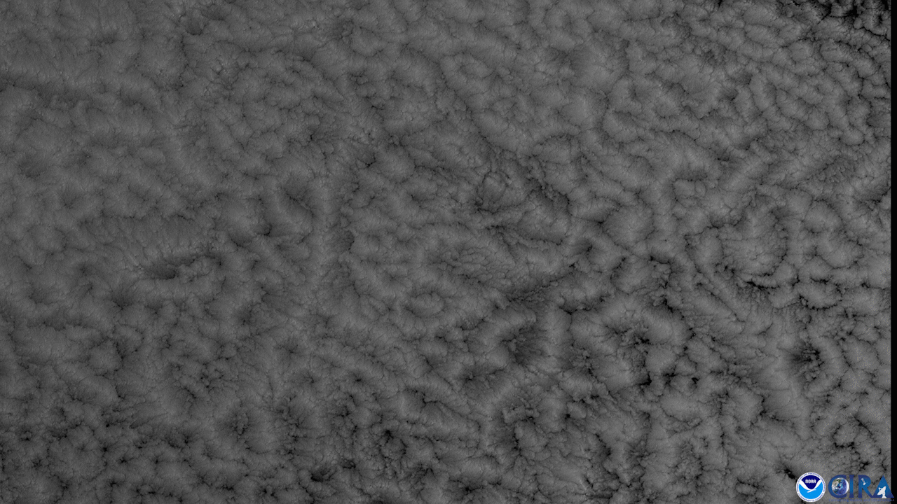
On Jan. 5, 2021, the GOES East satellite, using Band 2 of the ABI instrument , viewed percolating clouds approximately 3,000 miles off of the coast of Chile, north of Easter Island and the Pitcairn Islands. Band 2, which has the finest resolution of all of the 16 bands on the ABI, is called “red” because it picks up specific wavelengths that read out as that color on processed imagery. Due to its detail, it is also the band that is best suited to viewing clouds and the changes they undergo.
These types of clouds are called maritime (or marine) stratocumulus, and they form over open water, which is also seen here by the NOAA-2O satellite in this previous article. There are two types of these clouds: either closed- or open- celled, depending on current cloud cover. Maritime stratocumulus clouds are common in the South Pacific, but meteorologists are unsure as to why; the common overall circulation in the globe may be a factor.
The clouds seen in this GOES East imagery are closed-cell maritime stratocumulus. They cover nearly 100% of the surface underneath them, blocking sunlight and reflecting solar radiation. The clouds’ shallow convection is often confined to small cells, creating the bubbling, boiling motion. With open-celled maritime stratocumulus clouds , on the other hand, the clouds have a more scattered structure that does not block as much solar radiation, allowing for sunlight to break through more easily.
The GOES East geostationary satellite, also known as GOES-16, keeps watch over most of North America, including the continental United States and Mexico, as well as Central and South America, the Caribbean, and the Atlantic Ocean to the west coast of Africa. The satellite's high-resolution imagery provides optimal viewing of severe weather events, including thunderstorms, tropical storms, and hurricanes.