
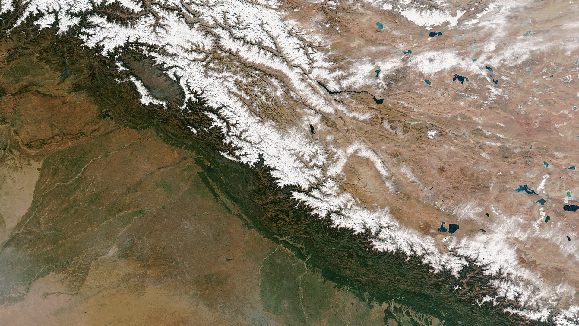
The Himalayas – with some of the highest mountain peaks on Earth – serve as a continental divide between Central and Southern Asia. The separation between cold air from the north and warm, moist air from the south is evident when looking at snow patterns along the mountain range in this true color imagery from the Suomi NPP satellite (taken November 15, 2013). The white snow cover barely extends to the southern slopes of the mountains. The differences in climate and surface features are even more apparent when looking at the near-infraredimagery instead of the true color visible imagery.