

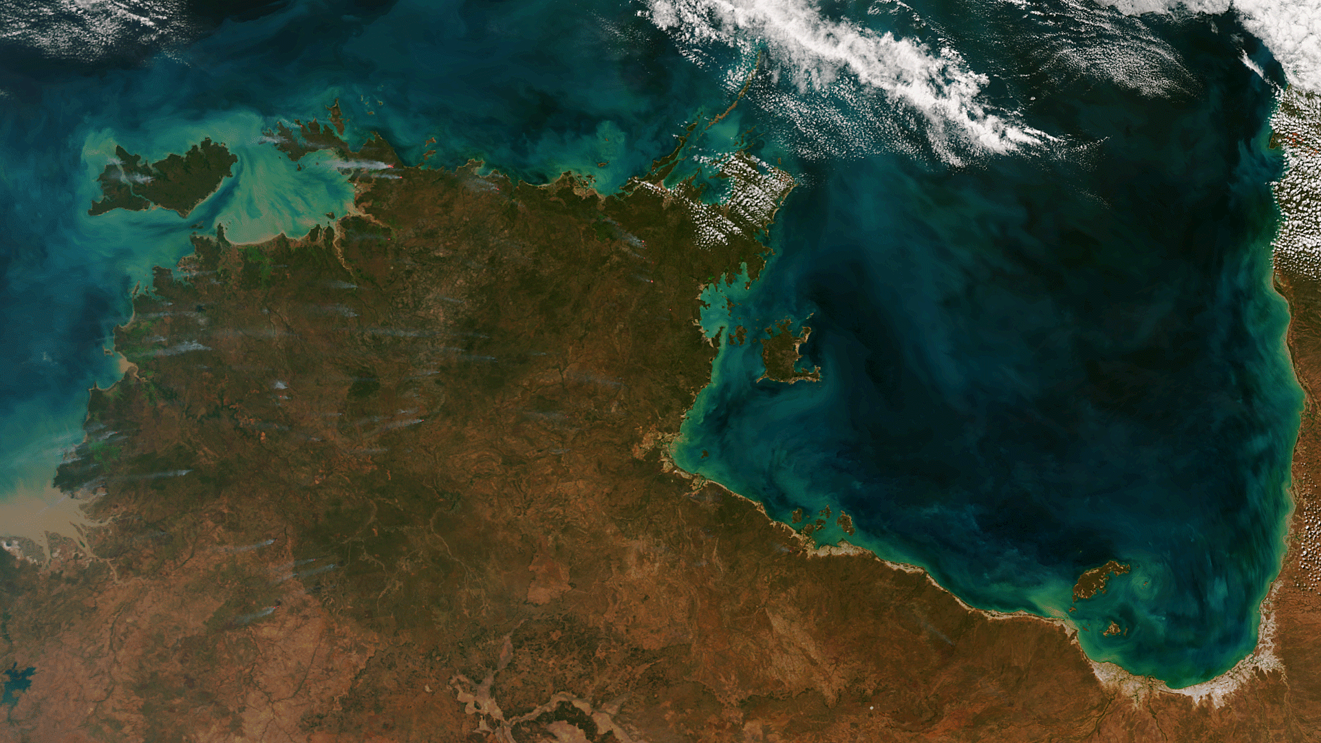
The Suomi NPP satellite captured an amazing image of northern Australia on June 25, 2013. Dozens of wildfires release wisps of smoke throughout the Northern Territory. Offshore, phytoplankton and sediment create swirls of blue, green, and beige. This image was produced by using the “true color” bands on the Visible and Infrared Imaging and Radiometer Suite (VIIRS), while the thermal signatures of the fire locations are augmented in red using the M13 “fire detection” band.