

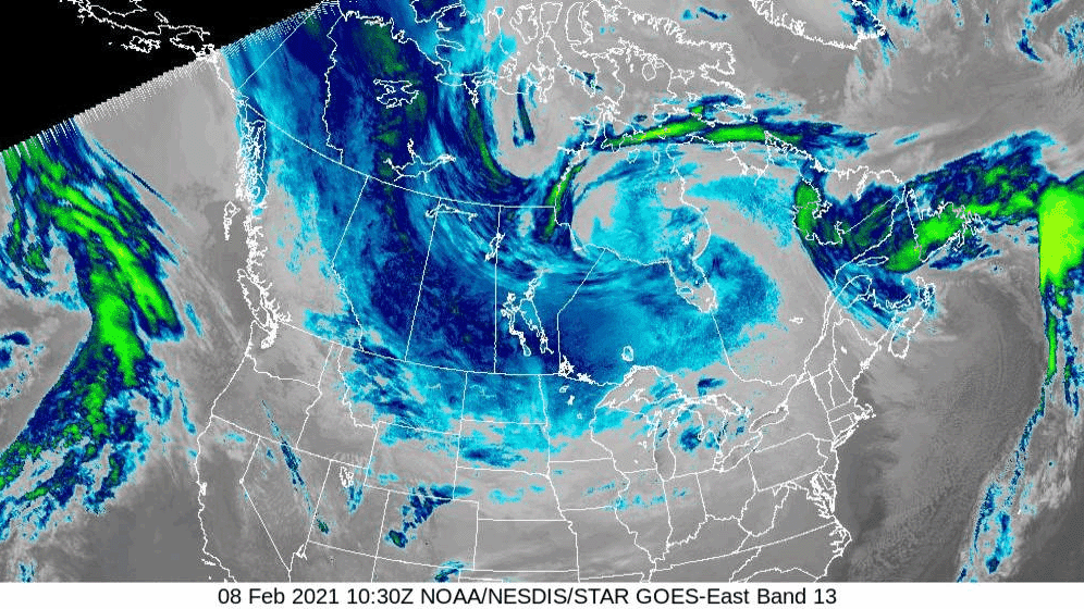
As a dip in the polar vortex continues to bring bitter temperatures to North America, the air over the northern reaches of the continent was so frigid on the morning of Monday, Feb. 8, 2021, that the GOES East satellite perceived the cold air along the ground as very cold cloud tops.
In the satellite’s “clean” infrared longwave window (band 13) imagery this morning, we can see particularly cold temperatures that appear as bluish clouds. If you look carefully, the “disappearing” cloud cover over Quebec, Ontario, and Manitoba as well as the northern U.S. is really the cold air warming slightly as the sun rises. The blue and green areas that don’t fade away are actually real clouds.
This Arctic air has brought bone-chilling temperatures to Canada and the US. According to Canada’s weather agency , the community of Wekweèti, in the Northwest Territories of Canada recorded -51.9°C (-61.4°F), which is Canada's coldest temperature since March 2017. In the U.S., low temperatures on Monday morning dropped to -36°F in International Falls, Minn., and -20°F in Fargo, N.D. WInd chills at Duluth International Airport dipped to -45°F right around sunrise.
The GOES East geostationary satellite, also known as GOES-16, keeps watch over most of North America, including the continental United States and Mexico, as well as Central and South America, the Caribbean, and the Atlantic Ocean to the west coast of Africa. The satellite's high-resolution imagery provides optimal viewing of severe weather events, including thunderstorms, tropical storms, and hurricanes.