You don't have to be a meteorologist to know that clouds have a significant impact on the Earth's climate, but what about artificial clouds, particularly jet contrails; do they affect the Earth's climate too? Penn State geography professor Andrew Carleton and his colleagues have been trying to find out, and they're using data from NOAA satellites in the process.

You don't have to be a meteorologist to know that clouds have a significant impact on the Earth's climate. They cool the planet's surface by reflecting the sun's rays, warm the atmosphere and surface by absorbing solar and longwave radiation, and even replenish surface waters through precipitation. But what about artificial clouds, particularly jet contrails; do they affect the Earth's climate too?
For several years, Penn State geography professor Andrew Carleton and his university colleagues have been trying to find out, and they're using data from NOAA satellites in the process.
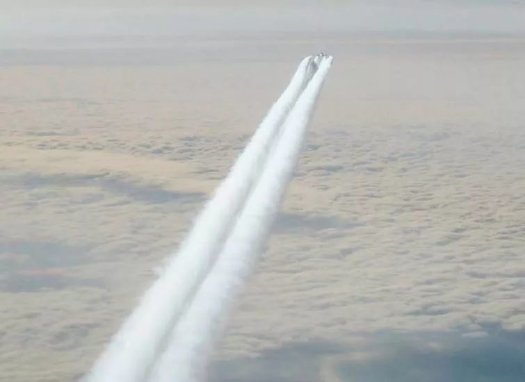
Contrails, or "condensation trails"—the line-shaped clouds often seen behind aircraft—are ice crystal clouds formed by the combination of carbon particles and water vapor emitted from the combustion of aviation fuel and atmospheric water vapor. They typically occur at about the same altitudes as natural cirrus clouds, approximately 25,000 to 35,000 feet.
Depending on the temperature and the amount of moisture in the air at this altitude, contrails either evaporate quickly or persist. If the humidity is low and the temperature is not cold enough (above -40 degrees Fahrenheit) contrails will dissipate quickly. However, if the air is moist and the temperature is -40ºF or below, then a contrail will "persist" for as long as 30 minutes to an hour. These persistent contrails are of interest to scientists because they increase the amount of clouds in the atmosphere and, as a consequence, can affect meteorological and even climatic conditions at or near the Earth's surface.
Locating Persistent Contrails

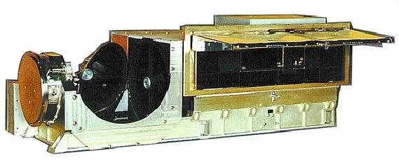
Of course, before scientists can study the effects of contrails they have to locate them. To do that, Carleton and his colleagues accessed data from the Advanced Very High Resolution Radiometer (AVHRR), an instrument aboard several of NOAA's POES (polar orbiting environmental satellites) spacecraft.
The AVHRR provides radiance data for investigation of cloud types, day and night cloud distribution, and many other meteorological parameters through passively measured visible, near-infrared and thermal-infrared spectral radiation bands. Since its first flight aboard TIROS N in 1978, data from the AVHRR instrument have been used in a wide variety of applications, including detection and analysis of cold fronts, severe weather systems, cloud movement, boundary clouds, jet streams, cloud climatology, and hurricanes. In addition, AVHRR data has been used to monitor the effects of climate change and the environmental impacts from human activities.
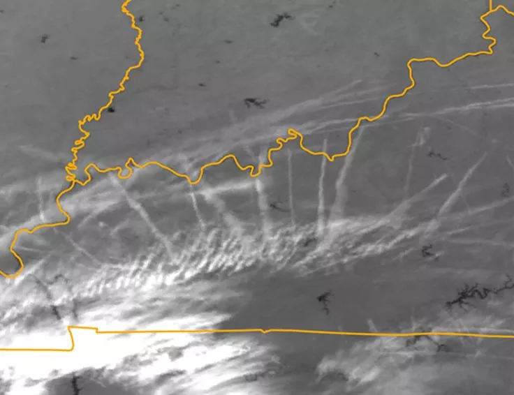
"We were mostly interested in the AVHRR's thermal-infrared [imagery], both day and night (AVHRR channels 4 and 5) because the thermal-infrared bands are where you can see the contrails clearest," he said. "We downloaded the data from the NOAA CLASS website, for multiple times per day to cover the conterminous United States. We weren't doing it for the whole year, just for the mid-season months (January, April, July, and October) as representative of the seasons for the years 2000 to 2002 and then for the period 2007 to 2009."

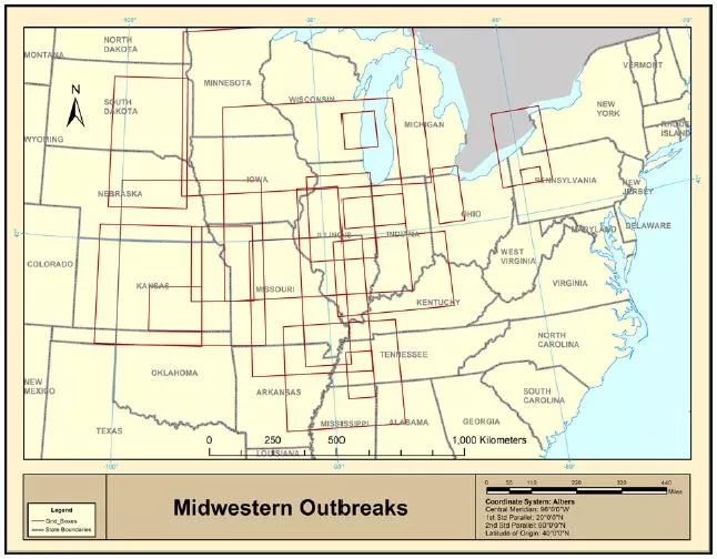
The Advanced Very High Resolution Radiometer (AVHRR) instrument aboard NOAA’s polar-orbiting (NOAA-series) satellites provides radiance data for the investigation of cloud types, day and night cloud distribution, and many other meteorological parameters through passively measured visible, near infrared and thermal infrared spectral radiation bands. The researchers then imported the AVHRR images into ERDAS (software that allows users to prepare, display and enhance digital images for mapping) to determine when and where contrails occurred, derived their latitude and longitude, and then mapped them. The resulting "heat maps," as they are called, not only show where the greatest frequencies of contrails exist, but also their seasonal variability.
"Essentially, the Midwest—Illinois, Indiana, into Ohio also including Kentucky – the Southeast, and the Northeast are the primary areas where the satellite shows the contrails as being most persistent," said Carleton.
Linking Contrails and Climate
After mapping the areas in which contrails were most likely to occur, the researchers then investigated the proposed link between increased aviation and the increase of contrails (also referred to as non-opaque, cirrus-like clouds) by comparing climate records on clouds from ground-based weather stations beneath and further away from well-traveled flightpaths.
"What we found was that, from the 1960s to the late 1990s (which is when the station data on opaque and non-opaque clouds ends), there has been an increase in the non-opaque or the cirrus-level clouds in the areas [beneath flight paths] as compared to stations that don’t have many flights over them," Carleton said. "This suggests that the high-cloud increases are at least partly related to the presence of aviation and contrails."
Later, in a paper published in the International Journal of Climatology in 2015, Carleton and Ph.D. student Jase Bernhardt looked at the relationship between persistent contrails and temperature conditions, particularly in regard to what’s known as the diurnal temperature range (i.e., the difference between the daytime high temperature and the nighttime low temperature). Again, the researchers compared data records from ground-based weather stations beneath and further away from areas of frequent contrails, namely the Midwest and the Southeast, to see if the diurnal temperature ranges in these areas differed.
“Particularly for the South and Southeast [Bernhardt] showed that, yes, stations underneath the contrails had a suppressed diurnal temperature range versus stations a bit further away,” Carleton said. “The same was basically true for the Midwest, but it was not quite as statistically significant as it was for the South.”

In a second 2015 paper appearing in the Journal of Applied Meteorology and Climatology, the researchers again used AVHRR data to investigate the feasibility of developing a statistical model to predict where clusters of contrails were likely to occur based on meteorological data, such as the temperature of the upper troposphere, humidity, wind shear and so on.
According to Carleton, such a model could be used to re-route planes to prevent the formation of contrails, thereby limiting their impact on surface temperatures.
“The temperature increases related to global warming could be made worse in areas where you have a lot of contrails,” said Carleton. “When you’re increasing the temperature, then that means there is more potential for evaporation of water, which can put more water vapor into the atmosphere and increase temperatures further by increasing the greenhouse effect.”
Beyond temperature, Carleton also said that contrails could have an effect on wind patterns.
“If you have variations at the earth’s surface in that diurnal temperature range, or just in the daytime high or the nighttime low, those differences could change local-scale wind patterns, which could have impacts for pollution dispersal near the Earth’s surface.”
