
Search
Showing 169 - 176 of 608 results
News
This data visualization shows the maximum wind gusts from Hurricane Irma from September 7 to September 10, 2017. Note how…
Page
Severe weather is classified as a series of events that can cause destructive or deadly effects on the ground. It…
News
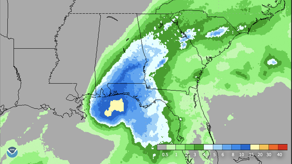
CMORPH (NOAA Climate Prediction Center MORPHing technique) showed total rainfall produced by Hurricane Sally over several…
News

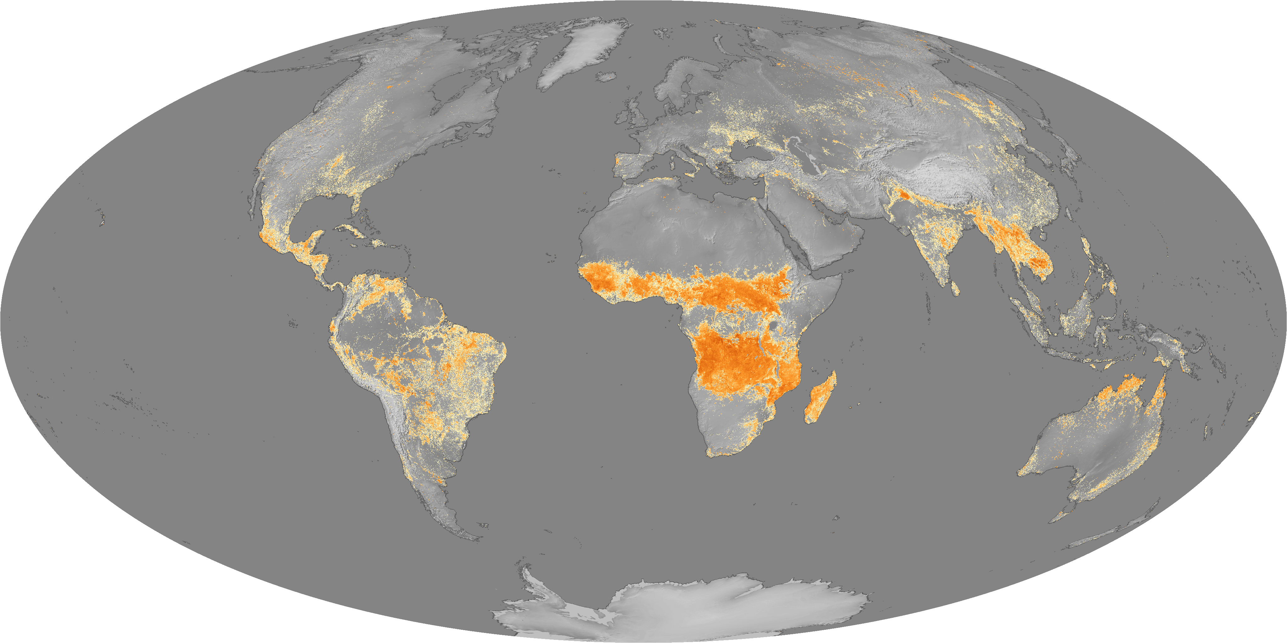
Tropical cyclones form in most ocean basins – some more frequently than others. Before the advent of the satellite era,…
News
This data visualization shows the maximum wind gusts from Hurricane Irma from September 7 to September 10, 2017. Note how…
News
STAR published their 2021 Annual Report this week. This report highlights the variety of our work - hurricane predictions,…
News

Satellite images of Hurricane Florence captured early Tuesday showed the storm developing a second, outer eyewall. By midday…
News

At approximately 11:04 am (EDT) on April 18, an excavator involved in an effort to remove a tower toppled by Hurricane Maria…