
Search
Showing 113 - 120 of 607 results
News
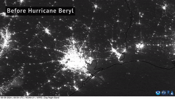
NOAA-21 captured imagery of the devastating power loss across East Texas following Hurricane Beryl’s landfall.
News
Seven years ago, on August 25, 2017, Hurricane Harvey made landfall in Texas—marking the beginning of one of the most…
News

Sept. 10 marked the peak of the Atlantic hurricane season, which officially runs from June 1 through Nov. 30.
News

At least nine people died from torrential rains in New York and New Jersey as Hurricane Ida moved North.
News

The ability to use satellites to locate a storm that could evolve into a severe storm, or hurricane,.
News
October 08, 2020 Between October 1 and October 3, 2020, Hurricane Marie was tracked by Canada’s RADARSAT-2 satellite in the…
News

The 2021 Atlantic Hurricane Season officially came to a close on Nov. 30, and was the third-busiest Atlantic season on…
News

This before-and-after imagery from GOES East shows a changed landscape and flooding after Hurricane Florence affected…