
Search
Showing 33 - 40 of 100 results
News

JPSS satellites will dramatically improve volcano monitoring worldwide, both in terms of monitoring volcano hot spots and…
Bio

Heather Holmes is an Associate Professor in the Department of Chemical Engineering at the University of Utah.
News

The satellites of the JPSS constellation host state-of-the-art instruments, including the Advanced Technology Microwave…
News

The David Johnson Award is presented by the National Space Club in honor of the first Administrator of what was to become…
News

The NOAA-20 polar-orbiting satellite instrument captured Thursday's eruption of Hawaii's Kilauea volcano in this…
News
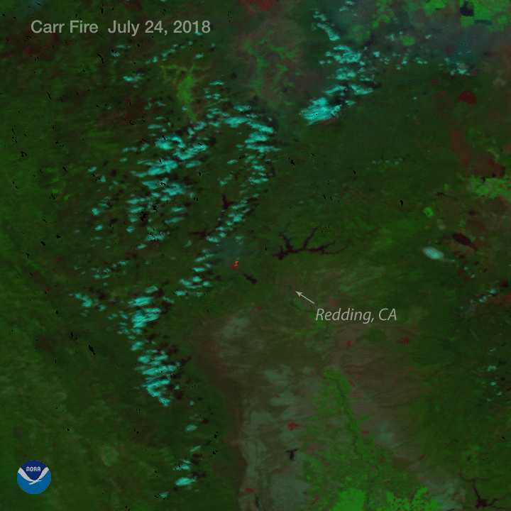
With raging wildfires torching the Western landscape, and six billion dollar weather-related disasters already experienced…
Event
Jun 30 2022
June 30, 22
October 28, 2021 marked the successful 10th anniversary of the Suomi NPP (SNPP) satellite, a critical risk reduction and…
News

The Suomi NPP satellite's VIIRS instrument captured this detailed thermal imagery showing the eruption of Hawaii's…