In satellite meteorology, a rope cloud is a very long narrow, rope-like band of cumulus cloud formations. These clouds are sometimes visible in satellite imagery along a changing weather pattern or other boundaries. For this reason, they can be used to diagnose the location of the leading edge of a weather system.
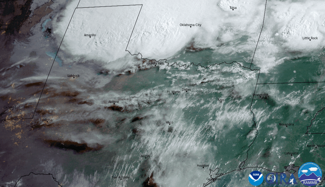
A rope cloud can be seen forming at the end of this GeoColor loop from GOES East. Morning storms near the Red River in Texas left a strong remnant outflow boundary that pushed southward with 40+ mph wind gusts.
Rope clouds are generally associated with a cold front or a land-sea breeze front. The term is sometimes used synonymously with rope or rope funnel.
An exceptional example of a rope cloud is these images from the GOES West satellite of a well-defined rope cloud that stretched for nearly 1000 miles in the East Pacific Ocean on January 16, 2019. The cloud marked the cold front position at the time of the image, which was associated with a Hurricane Force low.
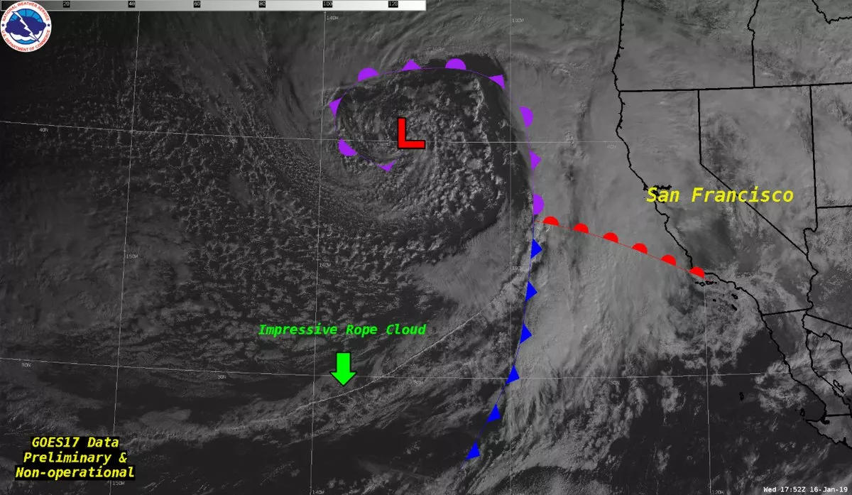
GOES-17 captured a massive rope cloud over the eastern Pacific Ocean on January 16, 2019. A rope cloud is a very narrow, long, sometimes meandering, cumulus cloud formation that is frequently visible in satellite imagery that is associated with a cold front or a land-sea breeze front.
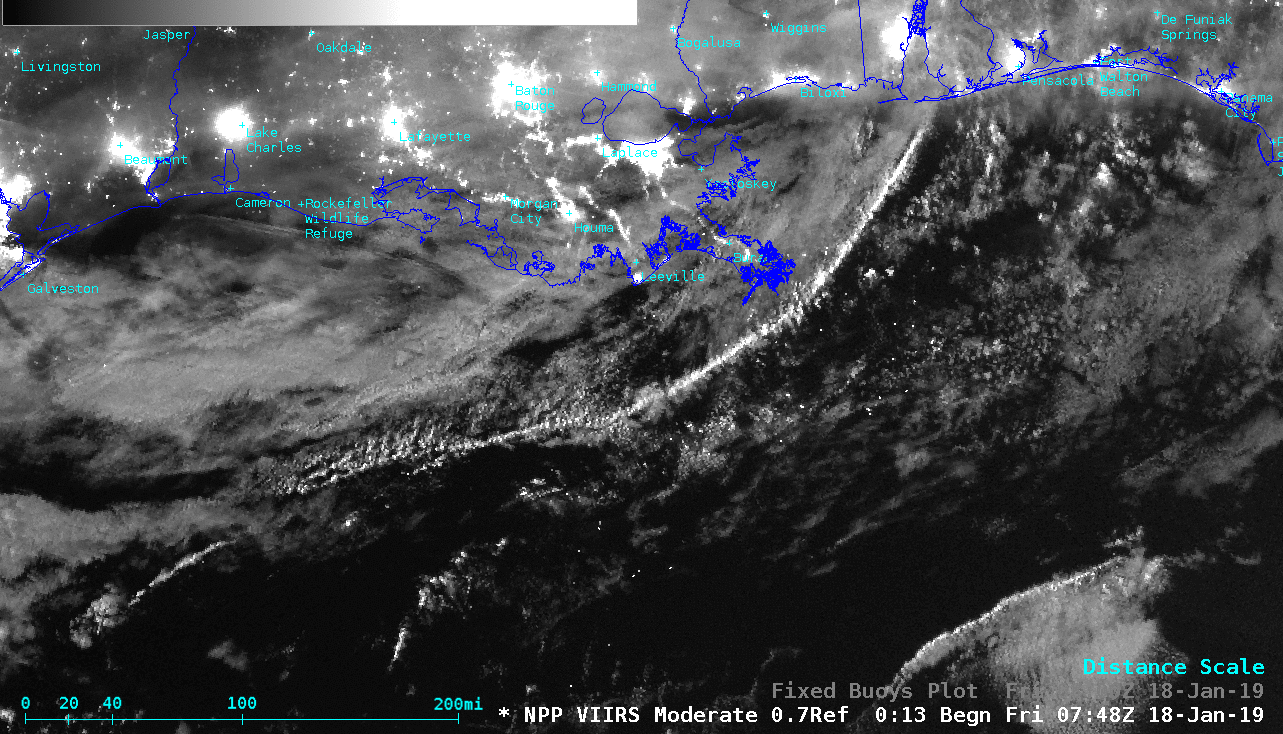
Suomi NPP VIIRS Day/Night Band (0.7 µm) image, with and without buoy observations
Not all rope clouds are associated with cold fronts. An example of a rope cloud caused by a land-sea breeze front was spotted in the northern Gulf of America. With ample illumination from the Moon — in the Waxing Gibbous phase, at 90% of Full — a Suomi NPP VIIRS Day/Night Band image provided a “visible image at night.”
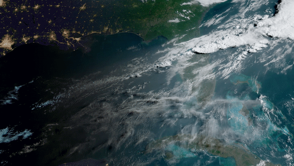
Another example is the long, narrow rope cloud below that the GOES East satellite watched pushing across the Gulf of America and Florida on April 26, 2021.