
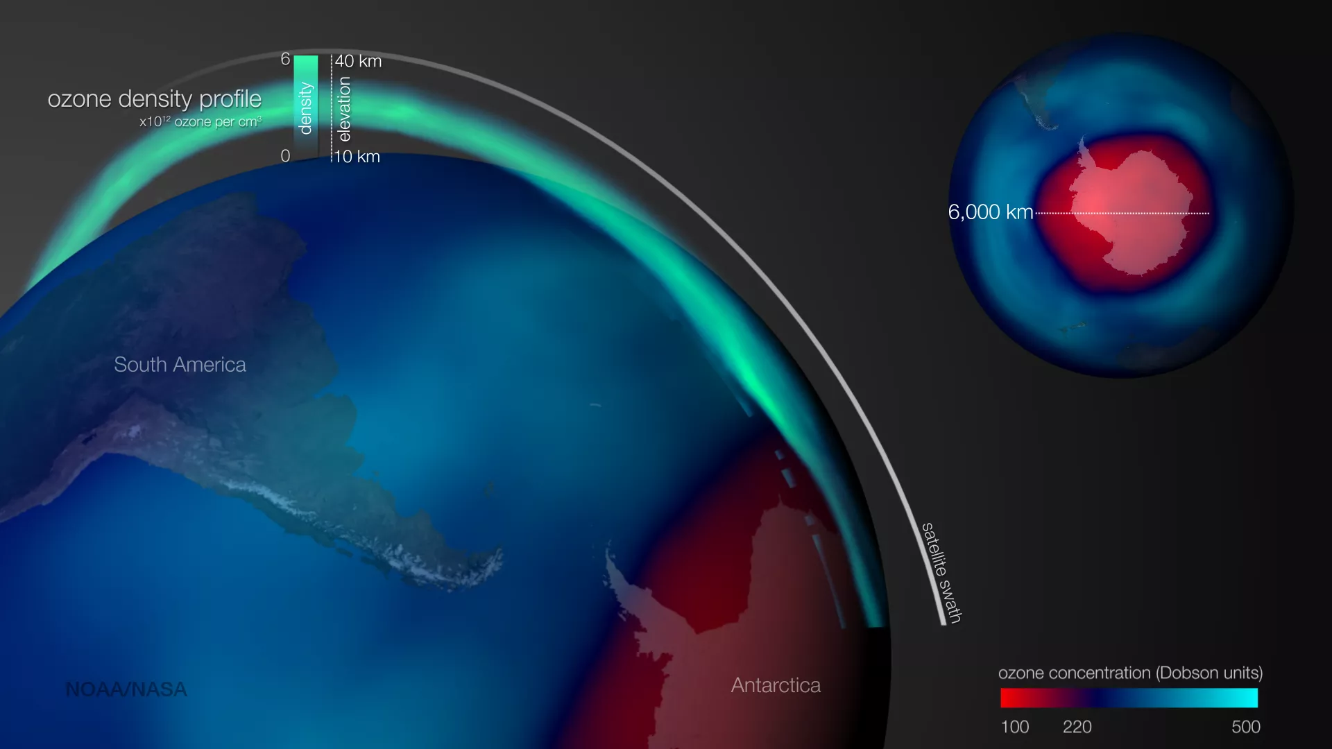
The 2015 Antarctic ozone hole area was larger and formed later than recent years, according to scientists from NOAA and NASA. On October 2, 2015, the ozone hole expanded to its peak of 28.2 million square kilometers (10.9 million square miles), an area larger than the continent of North America. This image, using data from NOAA and NASA satellites, shows the ozone layer from two perspectives.
In the global map, blue colors indicate normal levels of ozone and red colors indicate the area associated with the ozone hole. The vertical profile in green colors shows how the actual thickness of the ozone layer changes, as measured by the OMPS Limb sensor on the Suomi NPP satellite. On October 2nd, as the satellite orbit passed over Antarctica, very low levels and thicknesses of ozone were measured. This depletion can be seen in the vertical profile as a much thinner band of green, and was consistent with balloon sonde measurements from the same time. Such low levels of ozone allow dangerous ultraviolet radiation to reach the Earth’s surface.