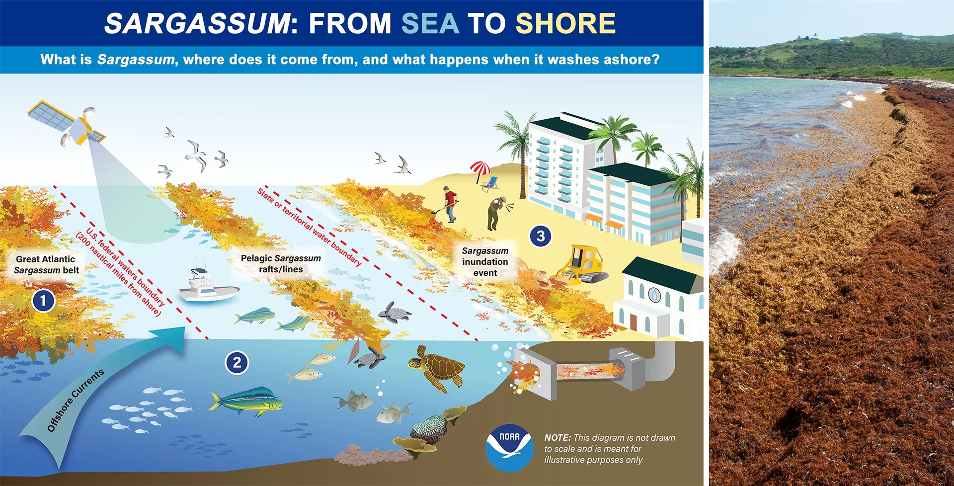
In the vastness of the open ocean, Sargassum seaweed, a floating brown macroalgae, forms large mats that serve as crucial habitats for various marine species. While providing refuge and nourishment in the sea, Sargassum becomes problematic when it reaches coastal areas in excessive amounts, leading to significant environmental, economic, and public health issues.
When Sargassum builds up along coastlines, its decomposition depletes oxygen levels, leading to dead zones that threaten marine life, including key fish species crucial for the economy. This accumulation also hinders sunlight penetration, adversely affecting vital underwater habitats such as coral reefs and seagrass beds. Tourism also suffers greatly from Sargassum inundation events, with the unsightly accumulation and foul smell of decaying seaweed on beaches driving away visitors, leading to considerable economic impacts on coastal communities. Moreover, rotting Sargassum emits hydrogen sulfide gas, posing serious health risks like respiratory problems and other ailments.

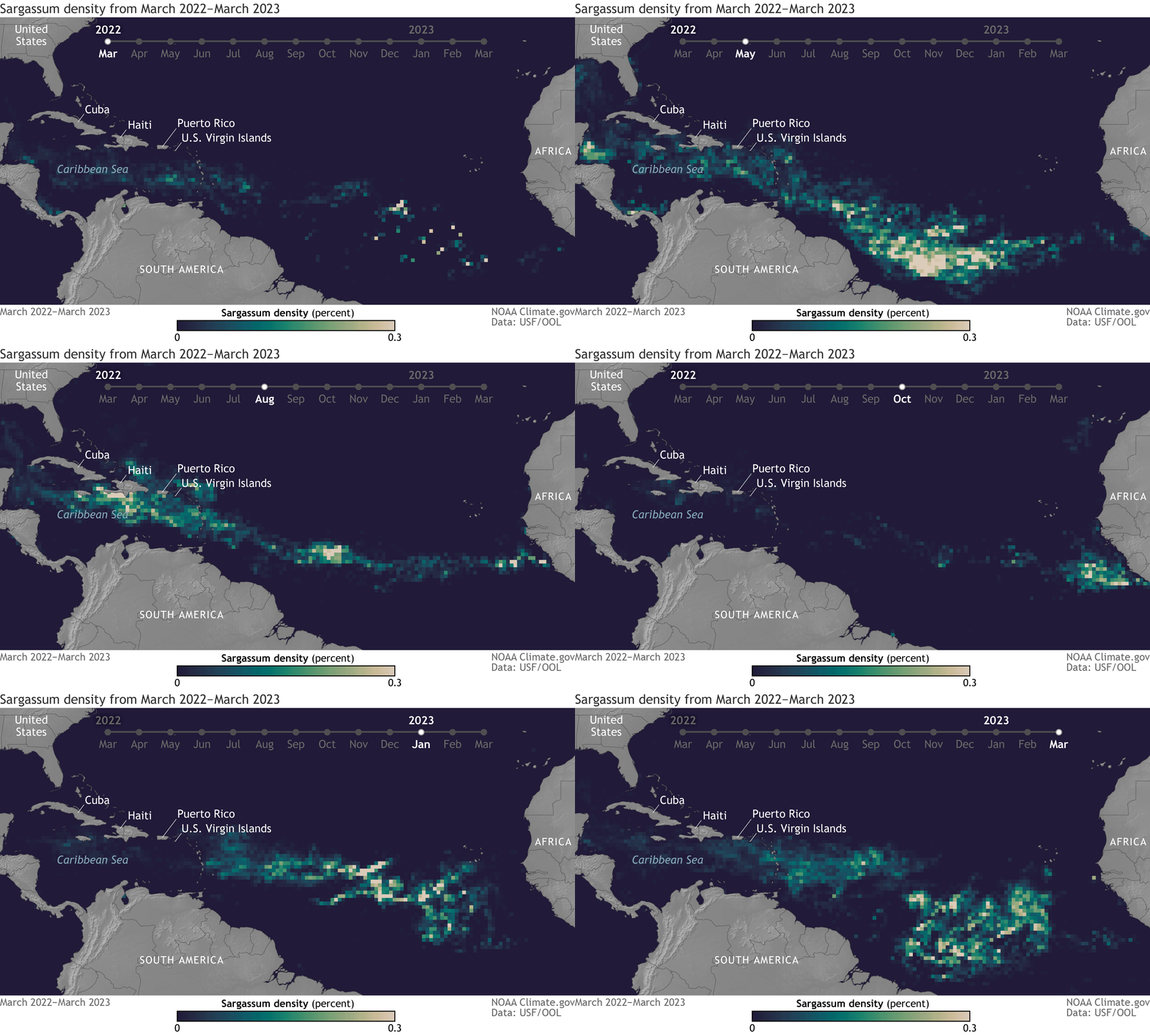
The Great Atlantic Sargassum Belt (GASB), a massive Sargassum bloom stretching from West Africa to the Gulf of Mexico, has been causing problems along the coastlines of the tropical Atlantic, Caribbean, and Gulf of Mexico nearly every year since 2011. Predicting the movement and impact of the GASB is complex due to the dynamic nature of oceanic and atmospheric factors that influence Sargassum distribution. The animation below shows the density and movement of Sargassum in the GASB as it moves across the Atlantic between March 2022 and March 2023, where lighter colors denote higher density.

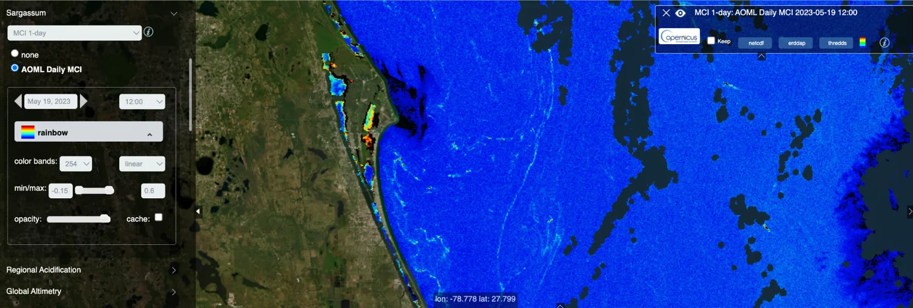
To manage these challenges, researchers have turned to low Earth orbit (LEO) observations. LEO satellites offer extensive and repeated coverage, crucial for monitoring the vast expanses of the GASB. Instruments such as the JPSS Visible Infrared Imaging Radiometer Suite (VIIRS) provide daily global coverage useful for tracking large Sargassum mats in the open ocean, while Copernicus Sentinel-2 satellites offer detailed imagery for smaller blooms closer to shore. Data like these are vital for predicting Sargassum inundation events and aiding in effective proactive action and response strategies.

Scientists at NOAA CoastWatch, NOAA Atlantic Oceanographic and Meteorological Laboratory (AOML), the National Autonomous University of Mexico (UNAM), among others, are developing Sargassum detection and prediction models that combine data from various satellite sensors. These models, integrating advanced techniques like machine learning, are essential for creating effective Sargassum monitoring systems. This research is crucial for understanding Sargassum dynamics and supporting decision-making processes in affected coastal communities.


To dive deeper into how these innovations are shaping our response to the Sargassum challenge, the upcoming 2023 JPSS Annual Science Digest, published later this month, offers an in-depth analysis. For more information, visit www.nesdis.noaa.gov/jpss-digest.
