
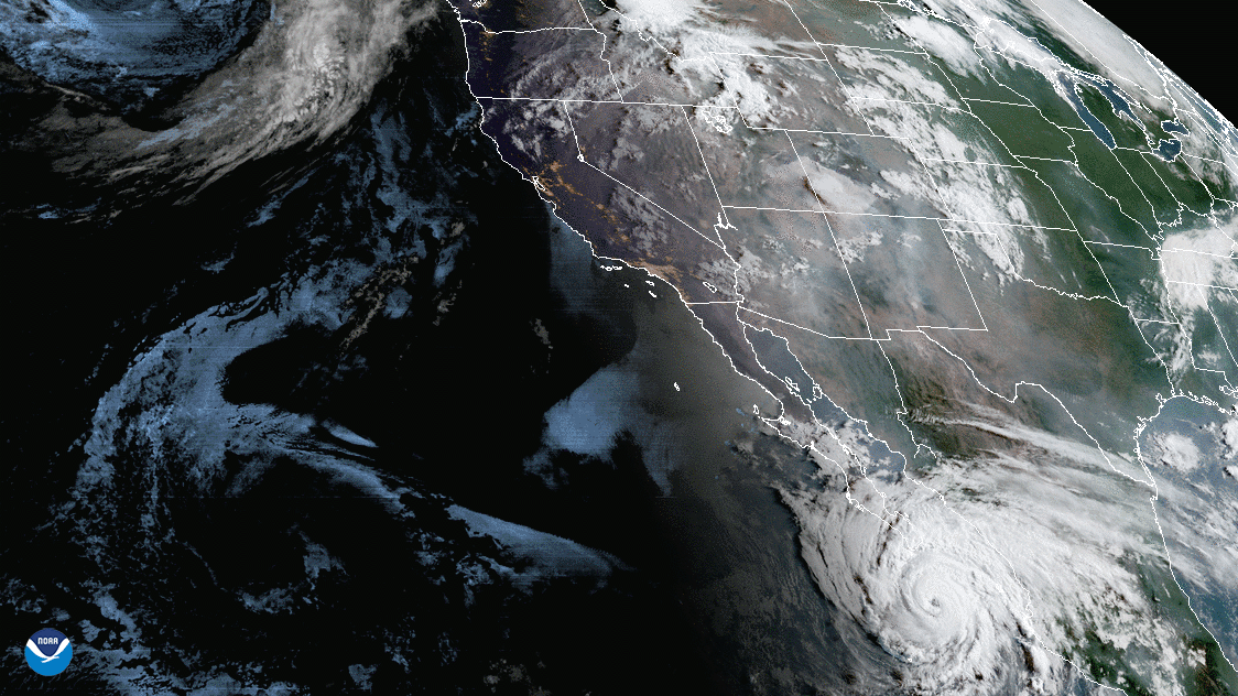
On Aug. 19, 2020, NOAA’s GOES-West satellite captured the above GeoColor image loop of massive wildfire smoke plumes billowing from California and areas of the Rocky Mountains. To the north, a mid-latitude cyclone spins over the Gulf of Alaska while Hurricane Genevieve continues its path toward Baja California.
As the southwestern United States endures a record heat wave, the state of California saw intense lightning this week that, over the course of 72 hours, produced nearly 11,000 cloud-to-ground lightning strikes and ignited hundreds of additional fires.

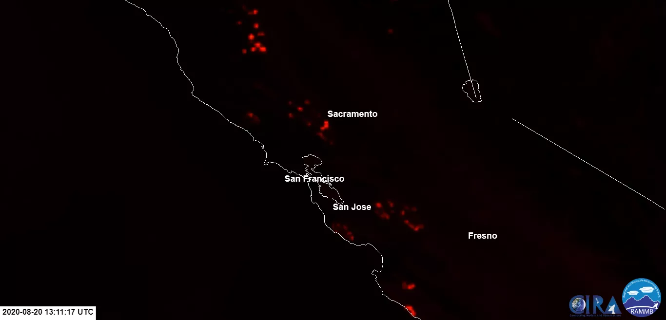
The VIIRS sensor onboard the NOAA-20 satellite captured this imagery of the smoke as it passed by the region on Aug. 19. The reddish points show the heat signature intensity of the fires. Red points are the hottest fires, followed by orange and yellow.
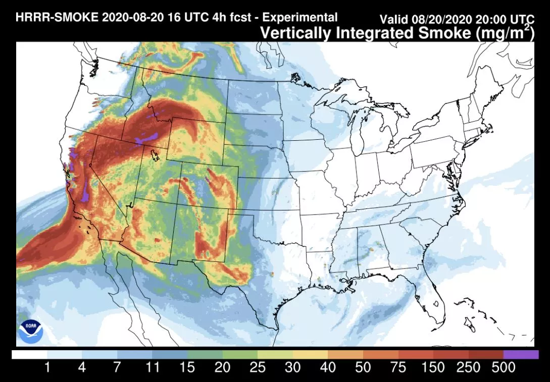
Vertically integrated smoke plot showing HRRR-Smoke forecast on August 20, 2020 valid at 20:00 UTC. The High Resolution Rapid Refresh Smoke model uses a suite of fire products from JPSS satellites.
At the last report, California’s Governor, Gavin Newsom, said there are 367 active fires across the state, 26 of which are considered major blazes. He declared a statewide emergency on Tuesday to deploy resources to "combat fires burning across the state which have been exacerbated by the effects of the historic West Coast heat wave and sustained high winds." He has requested 375 fire engines from out of state to assist in the effort while current crews are continuously working to save communities which lie in the path of the flames.
This Fire Temperature RGB imagery from GOES-West also shows where the fires are and the intensity of heat.
To the south, the center of Hurricane Genevieve is expected to pass just west of Baja California. Tropical storm conditions in the area will continue over southern Baja California Sur, which may lead to dangerous flash flooding and mudslides in some areas, according to the National Hurricane Center.
Read more about Hurricane Genevieve , and get the latest information about the storm.
The above GeoColor and Fire Temperature RGB enhanced imagery was created by NOAA's partners at the Cooperative Institute for Research in the Atmosphere. The GOES-West satellite, also known as GOES-17, provides geostationary satellite coverage of the Western Hemisphere, including the United States, the Pacific Ocean, Alaska and Hawaii. First launched in March 2018, the satellite became fully operational in February 2019.
The NOAA-20 satellite's VIIRS instrument scans the entire Earth twice per day at a 750-meter resolution. Multiple visible and infrared channels allow it to detect atmospheric aerosols, such as dust, smoke and haze associated with industrial pollution and fires. The polar-orbiting satellite circles the globe 14 times daily and captures a complete daytime view of our planet once every 24 hours.