

Phenomena: Lakes, Coasts, Ice
Satellites: Joint Polar Satellite System (Suomi NPP, NOAA-20, NOAA-21)
Product: Day/Night Near-Constant Contrast
Instrument: Visible Infrared Imaging Radiometer Suite (VIIRS)
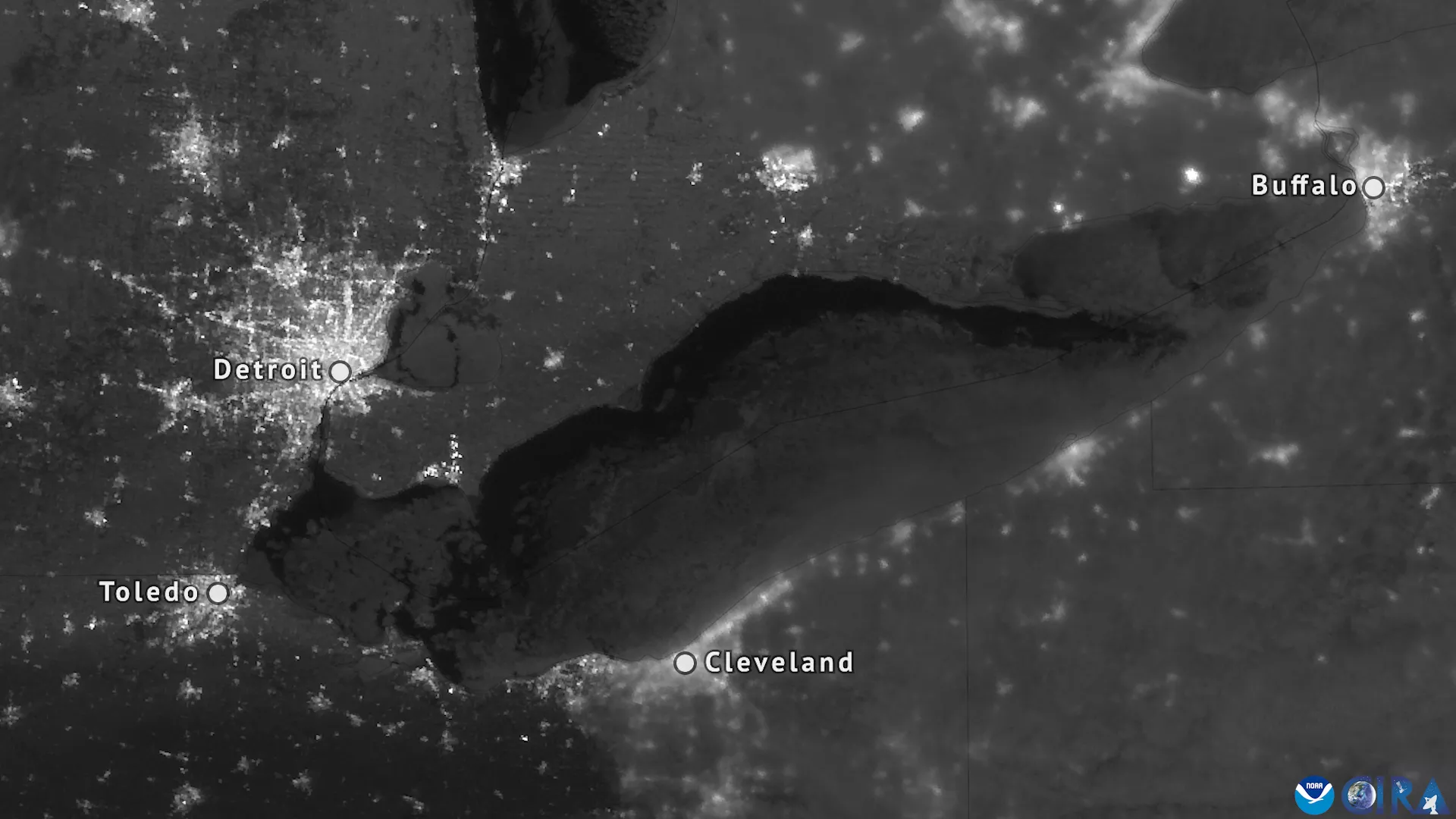
Date: Feb. 10, 2025
As NOAA’s Joint Polar Satellite System (JPSS) satellites passed over Lake Erie on the night of Feb. 10, 2025, they detected moonlight reflecting off its icy surface. Can you see the difference between the dark water along the northern shore of Lake Erie compared to the lighter ice covering most of the lake?
The Near-Constant Contrast (NCC) product creates nighttime images using data derived from the VIIRS Day/Night Band (DNB) imagery, which is sensitive to very low levels of light. This sensitivity allows it to detect a wide range of light sources such as city lights, gas flares, fires, lightning, reflected moonlight and auroras. Notice how brightly the nighttime lights of Detroit, Toledo, Cleveland and Buffalo shine in this imagery taken from more than 500 miles up.
NOAA’s Joint Polar Satellite System is the Nation’s advanced series of polar-orbiting environmental satellites, currently comprising Suomi NPP, NOAA-20 and NOAA-21. JPSS represents significant technological and scientific advancements in observations used for severe weather prediction and environmental monitoring. These data are critical to the timeliness and accuracy of forecasts three to seven days in advance of a severe weather event. JPSS is a collaborative effort between NOAA and NASA.