NOAA's GOES-U satellite, the last of four in the GOES-R series of geostationary operational environmental satellites, launched on June 25, 2024. However, unlike its sibling satellites, GOES-U, which was renamed GOES-19 once in orbit, is carrying a new instrument—the nation’s first operational coronagraph.
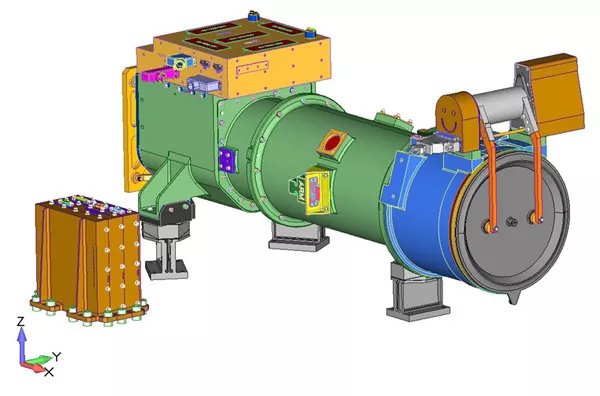
A digital rendering of the CCOR-1 instrument. (Credit: U.S. Naval Research Laboratory)
GOES-U/-19 will accommodate the NOAA Space Weather Follow On (SWFO) program’s Compact Coronagraph-1 (CCOR-1), which will reside on the satellite’s Sun-Pointing Platform, along with the Solar Ultraviolet Imager (SUVI) and Extreme Ultraviolet and X-ray Irradiance Sensors (EXIS). As part of NOAA’s Space Weather Follow On program, CCOR-1 was developed at the Naval Research Laboratory and is a collaboration between the Office of Space Weather Observations (SWO) and the Office of Geostationary Observations (GEO) within NOAA's National Environmental Satellite, Data, and Information Service (NESDIS).
CCOR-1 is designed to observe the solar corona, or outermost layer of the sun’s atmosphere, in order to detect and characterize coronal mass ejections (CMEs) for space weather forecasting. It does this by essentially mimicking the effects of a total solar eclipse.
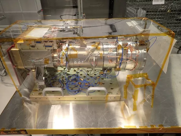
CCOR-1 is shown after being prepped for shock testing. During shock testing, the instrument is moved to a specially fabricated ‘shock’ plate and accelerometers (blue cables in image) are attached to various points. Shock testing simulates the shocks CCOR will experience on orbit when the GOES-U satellite’s solar arrays are deployed. Accelerometers measure the shock seen at various points on the instrument and determine if anything moves. (Credit: NASA Goddard Space Flight Center)
What are coronal mass ejections?
CMEs are large expulsions of energetic, magnetized plasma from the solar corona, which can affect us on Earth by causing space weather-induced geomagnetic storms if we happen to be in the way. These storms, primarily caused by CMEs, tend to be the costliest type of space weather events. They can cause widespread damage to power grids, satellites, and communication and navigation systems. They also pose a threat to astronauts in space.
Sequences of CME images help determine a storm’s size, velocity and density, serving as the primary source for information on impending geomagnetic storm conditions at least one day ahead of time.
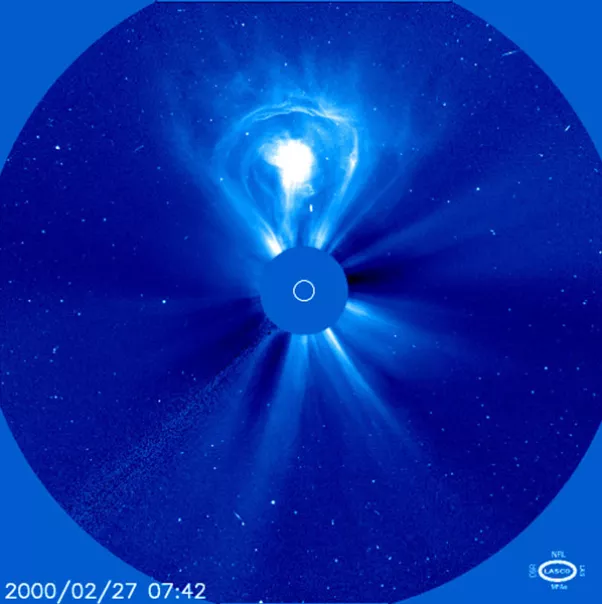
An example of a coronal mass ejection seen via the LASCO coronagraph. (Credit: NASA, U.S. Naval Research Laboratory).
A new CCOR instrument in space is vital because currently, CME imagery at the Earth-sun line is provided by the Large Angle and Spectrometric Coronagraph (LASCO) instrument onboard the European Space Agency (ESA)/NASA Solar and Heliospheric Observatory (SOHO) satellite, launched in 1995. This instrument, however, is for research purposes only, and is not operational. Additionally, the aging satellite’s mission was scheduled to run until only 1998. Thus, SOHO has been functioning well past its projected lifespan, and it is unknown how much longer it will be able to do so.
The new CCOR-1 will deliver CME imagery within 30 minutes of acquisition, compared to LASCO's imaging that can take up to 8 hours. CCOR-1 will also capture at least three images of each Earth-directed CME and operate during intense solar storms, enhancing NOAA’s space weather observational capabilities and improving forecasts.
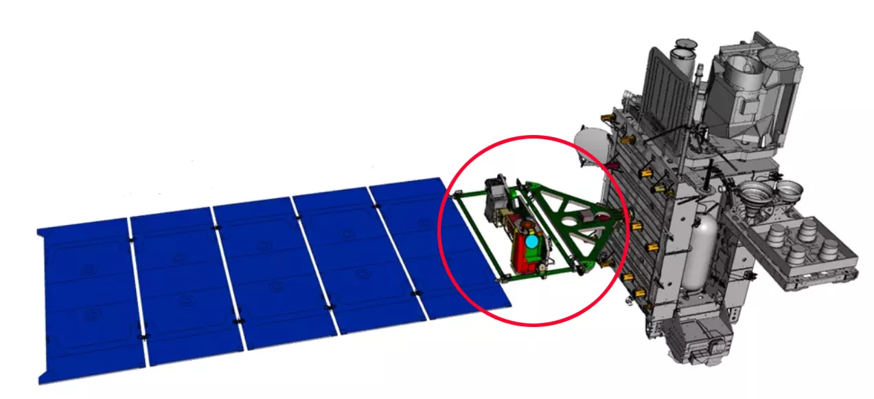
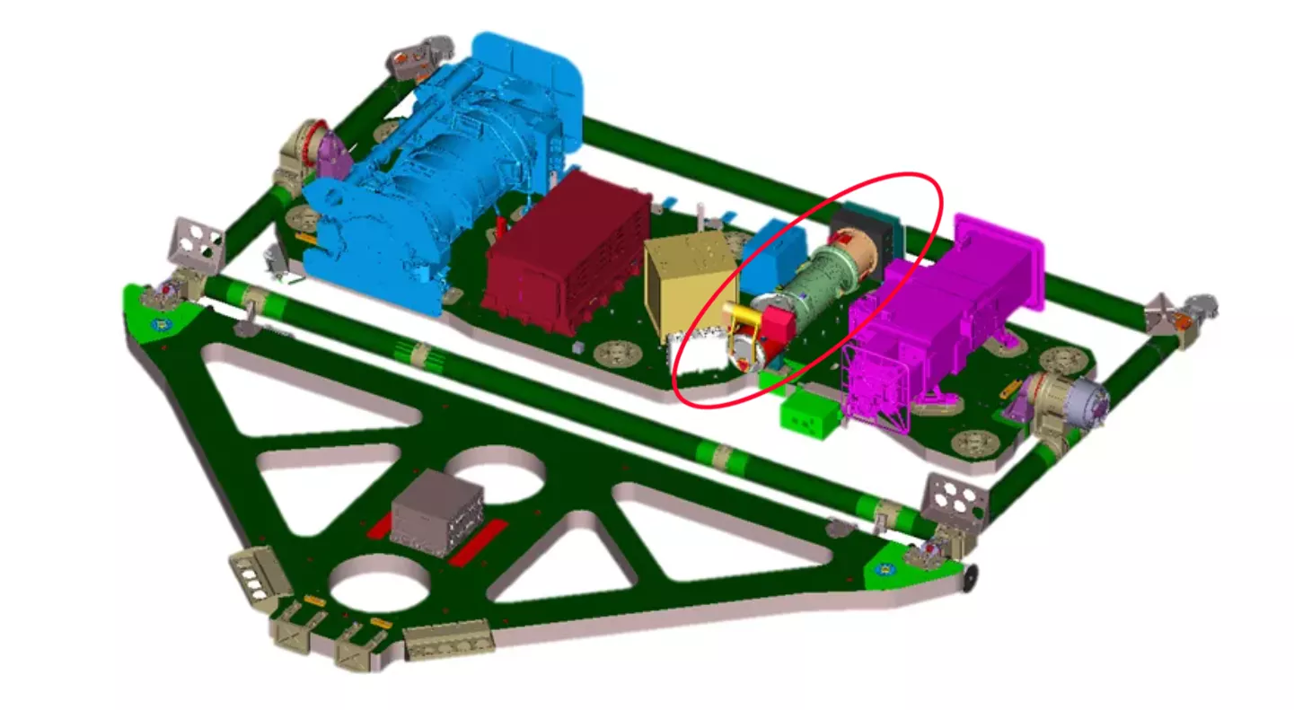
A digital rendering of the CCOR-1 instrument's placement on the GOES-U Sun-Pointing Platform. (Credit: U.S. Naval Research Laboratory/Lockheed Martin)
CCOR-1 is optimized for NOAA's needs, being smaller and lighter than traditional coronagraphs, making it adaptable to various spacecraft platforms. The critical space weather information collected by CCOR-1 will ensure continuity of CME imagery to enable the National Weather Service’s Space Weather Prediction Center to issue warnings one to four days prior to damaging geomagnetic storm conditions.
While the CCOR-1 instrument on GOES-U/-19 is NOAA’s first operational coronagraph, it won’t be the last. GOES-U/-19 is a geostationary satellite, meaning its view of the sun will occasionally be obstructed by Earth. That is why another CCOR instrument (CCOR-2) will be mounted on the SWFO-L1 satellite, which is currently in development.
SWFO-L1 will be located at Lagrange point 1 (L1), roughly one million miles from Earth, between the Earth and the sun. This orbit allows for continuous unobstructed observation of the corona without interference from the Earth. From here, the satellite will collect data and measurements via a suite of instruments, including CCOR-2, to gather real-time measurements of the solar wind, thermal plasma, and the magnetic field. It is expected to launch in 2025.
View more photos of CCOR-1.
