
COSMIC/FORMOSAT-3, a partnership satellite mission, credited with improving NOAA's weather prediction, climate monitoring and space-weather forecasting, was officially decommissioned today, after 14 years of operation.
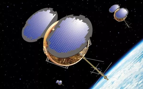
Artist's rendering of COSMIC-1 satellites.
When it launched in 2006, COSMIC/FORMOSAT-3 was historic — both for its mission and the breakthrough technology it used. Its fleet of six small, low-orbiting satellites was the first constellation to provide real-time atmospheric data of its type over thousands of points across the planet for research and operational forecasts. They did this by measuring the bending of radio signals from the U.S. Global Positioning System (GPS) as the satellites passed through Earth's atmosphere — a technique called radio occultation.
Called COSMIC (Constellation Observing System for Meteorology, Ionosphere and Climate) in the United States and FORMOSAT-3 (Formosa Satellite #3) in Taiwan, the mission resulted from an agreement between the American Institute in Taiwan (AIT) and the Taipei Economic and Cultural Representative Office in the United States (TECRO). The satellite array was based on a system design provided by the University Corporation for Atmospheric Research (UCAR), based in Boulder, CO.
Throughout its mission lifetime NOAA, NASA, the National Science Foundation, the U.S. Air Force, and the U.S. Navy funded UCAR to execute the COSMIC mission science data processing and ground station downlink operations.
Since April 2008, NOAA has provided uplink and downlink services at Fairbanks Command and Data Acquisition Station and Wallops Command and Data Acquisition Station and downlink only via the Kongsberg Satellite Services Tromsø station through NOAA agreements with the Norwegian Space Agency.
"COSMIC opened the door for smart uses of radio occultation data, where today, this type of information is a mainstream source flowing into NOAA's weather prediction models," said Steve Volz, Ph.D., assistant NOAA administrator for its Satellite and Information Service.
The success of the initial COSMIC was a springboard for the launch of COSMIC-2/FORMOSAT-7 in 2019. This new mission, also under an AIT-TECRO agreement with the National Space Organization as TECRO’s designated representative, as with the first COSMIC, and with NOAA as AIT’s designated representative, includes participation by the U.S. Air Force, NASA and UCAR. In Taiwan, COSMIC-2 is known as FORMOSAT-7 and the satellites are owned and operated by the Taiwan authorities. COSMIC-2 is the largest science and technology cooperative activity between the United States and the Taiwan authorities.
Unlike the first COSMIC mission, where the satellites orbited the Earth in nearly polar orbits, the COSMIC-2 satellites are orbiting the planet near the equator, taking measurements of the tropics and subtropics and monitoring the ionosphere for the effects of solar storms.
And similar to the first mission, COSMIC-2 data are flowing into NOAA’s numerical weather prediction models that forecast weather and climate, and monitor dynamic changes in Earth's ionosphere which improves space weather forecasts.