

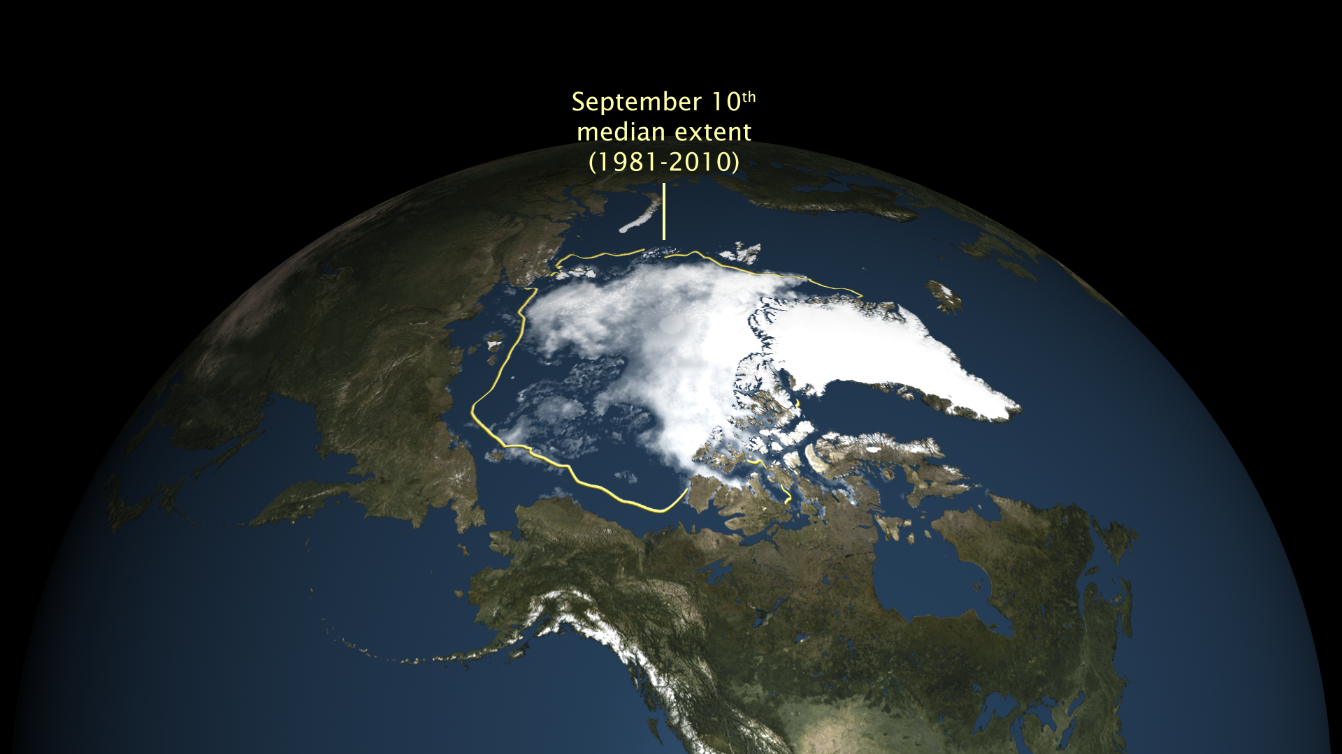
On September 10, 2016, Arctic sea ice extent shrank to 4.14 million square kilometers (1.60 million square miles). The National Snow and Ice Data Center (NSIDC) announced that this summer low was statistically tied with the minimum of 2007 for second-lowest in the satellite record, both behind the 2012 record low. The map shows Arctic sea ice concentration as measured by satellites on September 10, 2016. Areas with at least 15% ice cover appear in shades of gray-blue to white. Open ocean water (less than 15% ice cover) is navy blue. The yellow line shows the median (middle of the range) sea ice extent for 1981–2010.