
Proving Grounds: Fire & Smoke Initiative
Where There’s Smoke...
In 2018, wildfires in California caused more death and destruction than any previously recorded year. By the end of the calendar year, the fires in British Columbia had burned more area than in any prior recorded year; and California experienced the single largest (by area) fire on record.
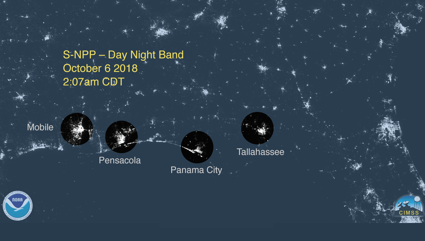
Hurricanes are a type of tropical cyclone that form over tropical waters in the Atlantic Ocean. When a cyclone's winds exceed 74 miles per hour, it is officially designated a hurricane and given a name.
Hurricanes are a type of tropical cyclone that form over tropical waters in the Atlantic Ocean. When a cyclone's winds exceed 74 miles per hour, it is officially designated a hurricane and given a name.

The Hurricanes & Tropical Storms Initiative connects scientists and meteorologists with data products derived from JPSS satellites pertinent to tropical cyclones.
In turn, weather experts share their predictions and expertise with the public, ensuring that individuals and communities on the coast can make informed decisions when facing severe weather events.
NOAA-20 captured this image of a series of tropical cyclones across the Atlantic in early September 2019.

This initiative relies on insights provided by the JPSS sounders, which take measurements of atmospheric moisture, and visible observations that show the structure and breadth of hurricanes.
By combining data from JPSS satellite instruments with ground-based observations and weather models, meteorologists can better predict the strength and path of these storms.
Access Hurricanes and Tropical Storms Initiative Data Products
JPSS Imagery is available through the NOAA View website, an interactive software portal to visualize NOAA’s weather and environmental satellite data.