“It is a capital mistake to theorize before one has data,” said the great detective Sherlock Holmes in Sir Arthur Conan Doyle’s short story entitled “A Scandal in Bohemia.” We at NOAA couldn’t agree more and are highlighting the amazing things we can learn from data throughout the month of September during a celebration known as NOAA DataFest. After all, NOAA data are freely available to all who want to learn about the world and its many mysteries.
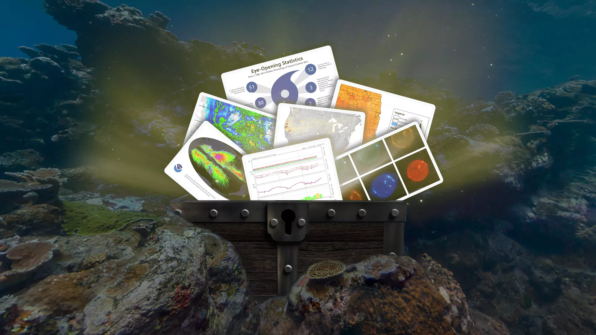
NOAA DataFest also aims to educate the public and inspire our colleagues at NOAA to learn more about the robust collection of scientific Earth and environmental observations that NOAA provides while celebrating its value, reliability, and accessibility.
One NOAA DataFest event is #Datapalooza — a Twitter chat/relay that invites scientists from all over the world, as well as our external partners and the public, to discuss the many ways they use NOAA data or ask questions about it.
This year we will be hosting conversations on three different topics throughout Thursday, Sept. 26.
- Tropical Weather (9 a.m. – 12 p.m. EDT)
- Space Weather (12 – 3 p.m. EDT)
- Fire Weather (3 – 6 p.m. EDT)
In preparation for these conversations, we have compiled a couple of examples of datasets that pertain to these topics.
We hope you join us and ask our experts any questions you have!
TROPICAL WEATHER
Inventory of Tropical Cyclone Tracks
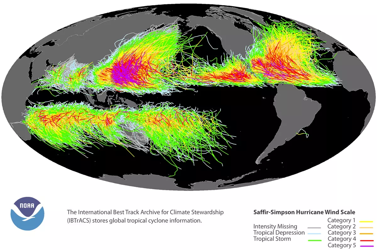
From 1980 to 2019, landfalling tropical cyclones have been the most costly natural disasters in the United States, with an average of $22.3 billion in damages per event, according to a recent report from the National Centers for Environmental Information (NCEI). Given the significant financial toll these disasters can have on individuals, businesses and communities, NCEI works in collaboration with international tropical cyclone forecast agencies and scientific institutes to maintain the International Best Track Archive for Climate Stewardship (IBTrACS). This provides the location, intensity and other information on tropical cyclones (e.g. hurricanes, typhoons, etc.) worldwide from as far back as 1848. Everyone from community planners to reinsurers uses this database to analyze past cyclones to predict future risk.
Climatology of Tropical Cyclone Eyes
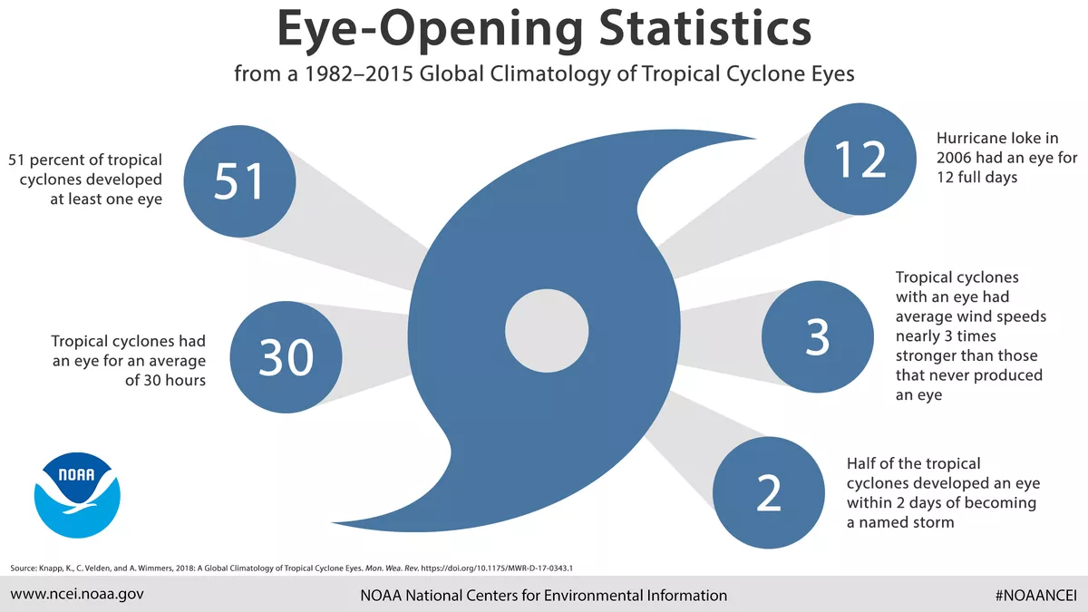
Researchers studying how tropical cyclones change over time are interested in the eyes of storms. The eye is a calm region at the center of a storm surrounded by the eyewall, which is made up of towering clouds and the storm’s strongest winds. Essentially, the more intense a cyclone is, the more defined its eye and eyewall can be.
Researchers who studied 34 years of tropical cyclone eye location data learned many things. Some of which included that more than half of the tropical cyclones occurring between 1982 and 2015 developed at least one eye, and storms with eyes had average wind speeds nearly three times stronger than storms with no eyes.
Using Radar to Track Weather

You’ve probably seen a colorful radar map like this on the news when severe weather hits—the brightest colors show where the heaviest rain is falling. Radar (radiodetectionandranging) uses radio waves to detect the height, movement, and speed of objects – including rain and other precipitation. Pulses of radio waves or microwaves, transmitted via antenna, bounce off the precipitation in its path and are detected via a receiver. We can use this data to measure the intensity of water falling from the sky.
NCEI’s Radar Archive lets you download historical radar data and maps from the Next Generation Weather Radar system (NEXRAD), which are available as a public dataset in the Google Cloud. Radar data help us estimate the location and intensity of rainfall, hail, tornadoes, snowfall and even wind speeds. This information is useful for air traffic control, agriculture, and water management.
SPACE WEATHER
GOES SUVI Data Helps Us Learn About the Sun
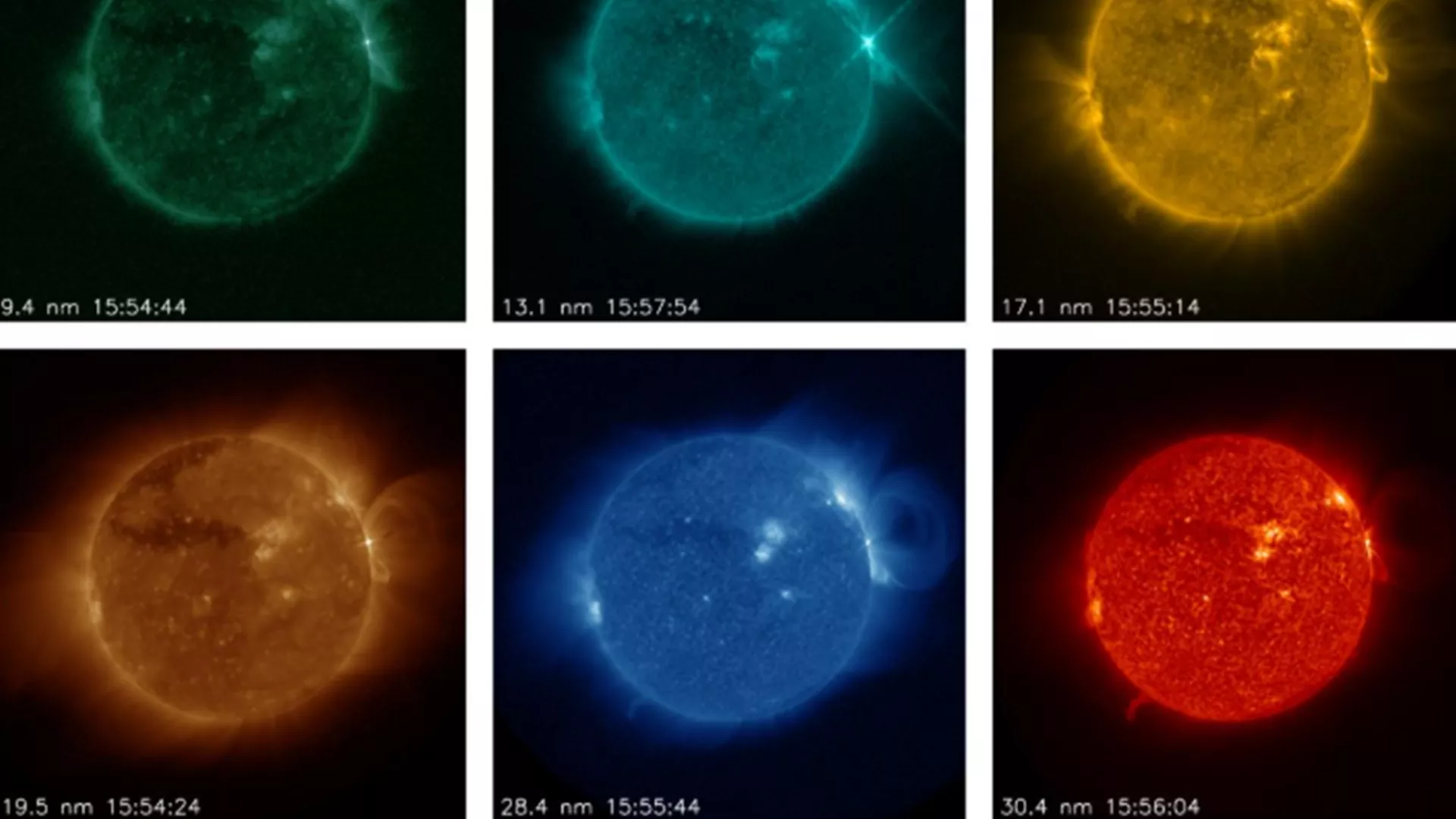
Here on Earth, the effects of weather are pretty obvious. You can immediately tell when it’s raining or snowing or if it’s windy or sunny. However, space weather is a bit more mysterious and difficult to study.Space weather is a result of activity on the sun’s surface. The sun constantly releases particles charged with electricity into space at millions of miles per hour; this constant stream is known as solar wind. Luckily, a combination of our planet’s magnetic field and atmosphere help protect us, though violent eruptions called coronal mass ejections can cause geomagnetic storms. These storms can threaten electrical grids, disrupt communication and navigation satellites, and more.
Scientists from NCEI and the Cooperative Institute for Research in Environmental Sciences (CIRES) are working to collect imagery from GOES East’s Solar Ultraviolet Imager (SUVI) instrument, a telescope used to monitor solar flares and solar eruptions. These observations can help NOAA’s Space Weather Prediction Center improve space weather forecasts and provide early warnings if there are potential impacts to Earth.
The Satellite Environment Plot Depicts Space Weather Information

The GOES satellites also collect other types of information, such as magnetic field measurements and energetic particle measurements. These allow scientists to learn about conditions in space as a result of space weather and help let us know whether any warnings or alerts should be made.
The graph above is the Satellite Environment Plot, which includes this information as well as an estimated K index (Kp), which indicates disturbances in the earth’s magnetic field, derived from fluctuations of certain readings on a magnetometer.
Additional GOES data also drive a spacecraft environment model called SEAESRT and remotely sensed X-ray flux data are used to trigger flare alerts and summaries.
FIRE WEATHER

When wildfires break out, those in the nearby areas aren’t the only ones who feel the effects. Smoke emitted by wildfires can travel across the country, potentially affecting air quality, visibility and ultimately human health. The experimental High-Resolution Rapid Refresh Smoke model uses fire radiative power data collected by the Suomi-NPP and NOAA-20 satellites to detect the location and intensity of wildfires. By mapping the location and intensity of a fire, and coupling that data with weather simulations, this model can show where smoke is going. This is information is used to alert communities before air quality reaches unhealthy levels, and help state and local emergency management offices when they’re making fire management and aviation decisions.
Fire Risk Estimation Tool
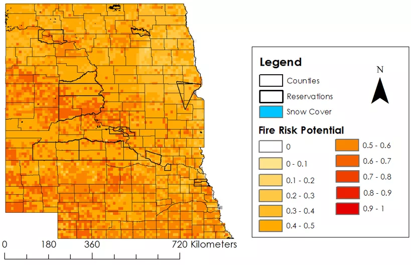
The Fire Risk Estimation (FIRE) Tool was developed to automatically process satellite and weather station data to calculate the overall wildfire risk potential in the Great Plains, specifically North Dakota, South Dakota, and Nebraska. Scientists developed a list of initial indicators — such as wind speeds, temperature, relative humidity, drought conditions, vegetation health and precipitation — that are used to assess wildfire risk. From there, scientists assessed the thresholds for each of these initial indicators by looking at a decades-worth of data on large, complex wildfires. The FIRE Tool, which was a collaborative project with NCEI, NASA's DEVELOP program, the Bureau of Indian Affairs, and the South Dakota State Fire Meteorologist, uses that data to create an interactive map that indicates where the highest overall wildfire risk potential is in a given area. Using this tool, emergency managers can quickly make decisions about where to allocate resources.
Probability of Wildfire Map
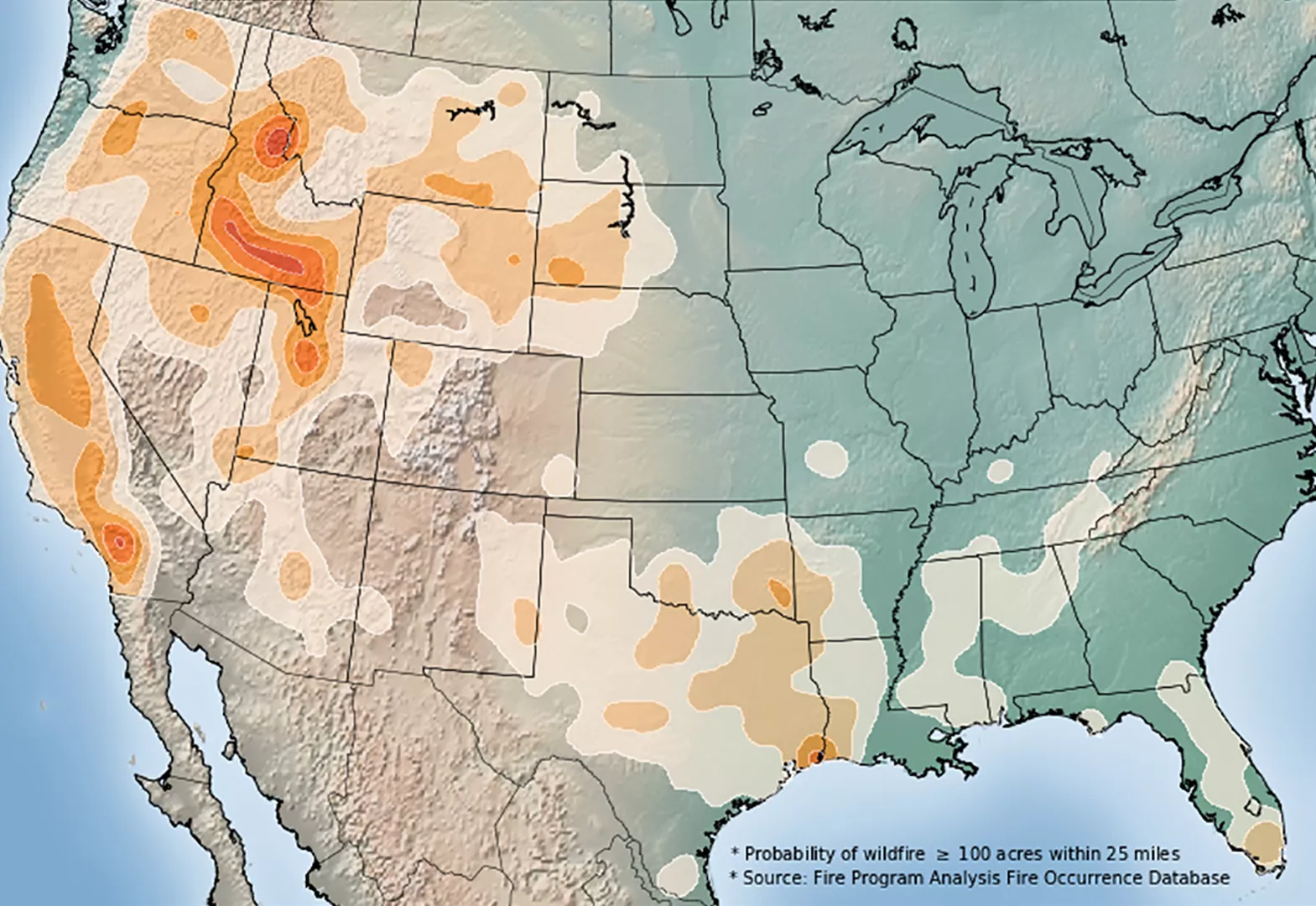
Knowing when and where wildfires are most likely to occur throughout the year based on historical probability can help the public be more prepared for a natural disaster, according to Climate.gov. To show the historical wildfire probability on a given day across the United States, fire weather experts used daily records from the U.S. Forest Service Fire Program Analysis Fire-Occurrence Database to account for fires 100 acres or larger from 1992 to 2015. The map uses shading to indicate where fires of this size or larger occurred within a given area during a 24-year period. Darker shading indicates that the highlighted areas experienced a higher number of fires on or around the given date. This type of information is valuable for both firefighting agencies and people who live in more wildfire-prone regions.
